This year’s Photo Competition judging panel did a fantastic job of narrowing down the outstanding photo submissions to the EGU’s Photo Competition to just 10 finalists! The finalist photos are listed below and on the Imaggeo website where you can vote for them from Sunday 23 April until Thursday, 27 April 2023 – voting closes at 18:00 CEST.
The three photos with the most votes will be announced online at midday on Friday 28 April!
Our Top 10 Finalists:
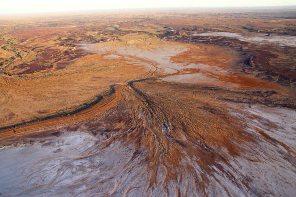
Ancient Shorelines and Extreme Rainstorms at Kati Thanda-Lake Eyre by Moshe Armon
The beat of the Australian desert water cycle is echoed in the shorelines of Kati Thanda–Lake Eyre. This normally dry lake is occasionally flooded by flows entering the lake from ephemeral desert streams, after heavy upstream rainstorms. Levels of earlier lake floods are recorded by ancient shoreline landforms and reflect past episodes of extreme rainstorms. To unravel the mystery behind the relationship between current desert rainfall characteristics and the stunning geomorphic features captured in this photo, we embarked on a journey to the dry lake margins. This field campaign and its following research aim to uncover valuable information about past extreme events and deepen our understanding of possible future scenarios.
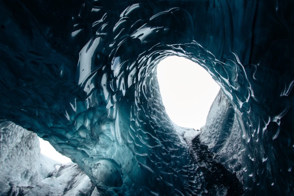
Going inside a glacier by Alexandra von der Esch
Experiencing the inside of a glacier. Amazing light going through the crystal clear ice and amazing pitch black ash layers come to show.
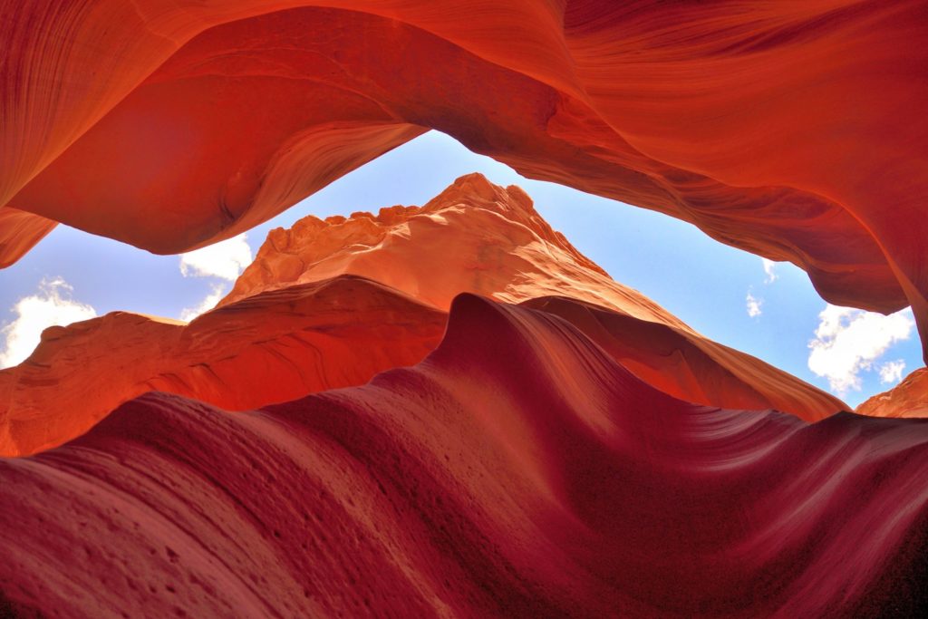
Color contrast at Upper Antelope Canyon by Aude Lavayssière
Known as “The place where water runs through rocks” by the Navajo Nation, Antelope Canyon is almost invisible from the surface. This slot canyon was formed by the erosion of the Navajo red sandstone due to intense flash flooding over the course of millions of years. And when it’s not water carving the narrow walls, the windblown sand polishes them into this incredible striated, swirling finish.
Climbing on the moon – Postojna, Slovenia by Cyril Mayaud
This picture shows the silhouette of two of my friends aligned with the moon in full climbing equipment, as they would be ready to ascend it. We planned this shot using an application able to predict the position of the moon depending on your own position. Logistically, it also implied to be at the place at 4 AM in the morning, and to be in permanent contact with our phones to make the nicest possible composition. I was standing at a distance of 800 m when I took this shot.
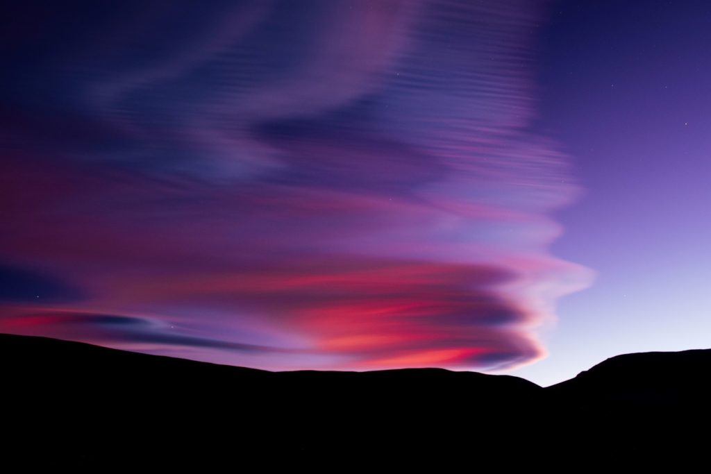
Stacked Lenticular Clouds at Twilight by Stephen Paul Michalchuk
Stacked lenticular clouds at twilight in the high Atacama Desert along the border of Chile and Argentina.
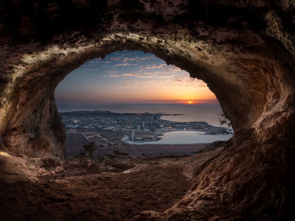
Humans in Harmony with Nature by Anastasios Rovithakis
Stavros village, located in the island of Crete, Greece, is a community that has developed a unique relationship with the surrounding natural environment. The village has a long history of sustainable living, with the residents relying on traditional farming and fishing practices that are in harmony with the natural ecosystem. This cave named Lera provides an excellent view of the entire village, which is surrounded by olive groves, vineyards and orchards.
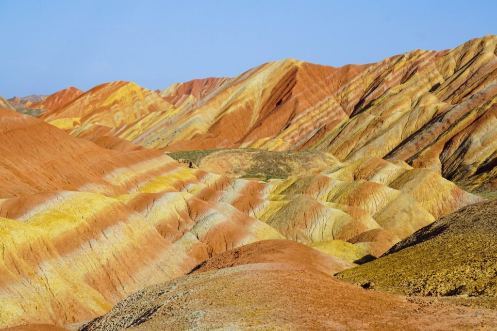
A world of flowing colors by Raul-David Serban
Rainbow Mountain, Zhangye National Geopark, Gansu Province, China
Over 24 million years ago occurred these deposits of sandstones and minerals that were tilted by the collision of the Eurasian and Indo-Australian tectonic plates. Wind, rain, and time sculptured outstanding landforms with various colors, patterns, and sizes. These colorful, smooth, and sharp ridges resemble flowing shades of reds, yellows, and oranges.
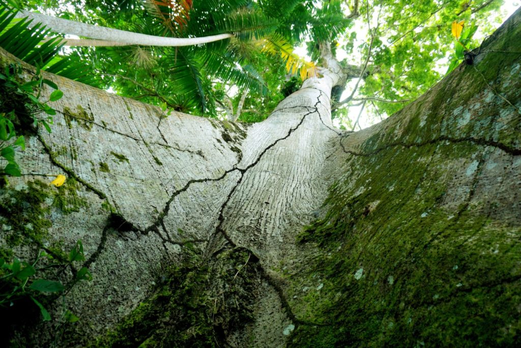
The Mother Tree of the Amazon by Simone Silva
The samaumeira, one of the treasures of the Amazon rainforest, is typical of the várzea environment (periods of flooding of the forest floor, due to the tidal regime). The record was made on Ilha do Combu, located near the city of Belém in the State of Pará. The wooded structure is a habitat for several species of animals and plants. For the indigenous communities of the Amazon, this tree is considered sacred. Their presence indicates the existence of watercourses. The roots serve as communication to guide those who walk through the forest. It can reach about 60 meters in height.
The Power of the Atlantic by Glenn Strypsteen
During a fierce storm that hit Reykjanes Peninsula in Iceland, with winds gusting over 130 km/h, huge waves and swell pounded the coast. The storm was caused by a low-pressure system that moved over the area, bringing with it strong winds and heavy rain.
The Reykjanes Peninsula is a region located in southwestern Iceland that is well-known for its geothermal activity, volcanic landscapes, and unique geological features. The peninsula is situated on the Mid-Atlantic Ridge, which is the boundary between the North American and Eurasian tectonic plates. As a result, the Reykjanes Peninsula is a hotbed of geological activity and an ideal location for studying various earth sciences.
I had this image on my mind for a long time, and it finally happened right before I had to leave the country. Capturing the image was challenging, as the conditions were harsh and the waves were powerful, but the resulting photograph is a testament to the beauty and power of nature.
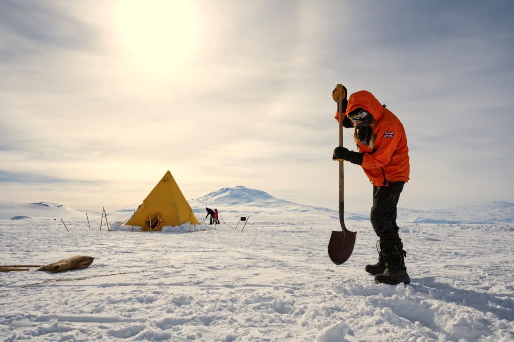
Field-Shakedown at McMurdo Ice Shelf by Ole Zeising
Preparation is everything when going on an expedition to Antarctica. Arriving in Antarctica via McMurdo Station, the final training is called shakedown. The aim of the shakedown is to spend a night on the McMurdo Ice Shelf for equipment testing and crevasse rescue training. In mid-November the temperatures were still quite cold and so was the night with -25°C – but no problem thanks to sleeping bags that keep you warm.
The photo shows Rebecca who is preparing the ground to set up a new Scott pyramid tent like the yellow one on the middle ground. In the background you can see the southernmost active volcano Mt Erebus (3794 m) and a halo around the sun.

