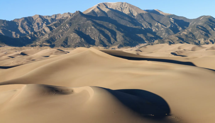
Driving eastwards through the San Luis Valley in south central Colorado, United States, the Great Sand Dunes emerge at the foot of the Sangre de Cristo Range in the northeast of the region’s upland plain.
The origin story of these great dunes begins during a time of glacial melt, five to three million years ago, when the rivers of the surrounding mountains filled the basin with water and sediments, forming a lake covering large parts of the valley. This lake kept growing until the water pressure broke through volcanic deposits situated at the southern end of the valley. The water from the lake subsequently receded, draining into the Rio Grande River.
The predominant winds from the southwest then blew the exposed sand towards the Sangre de Cristo Range, eventually forming the dune field. Opposing winds from the mountains allowed the dunes to grow vertically. Many questions about the exact formation of the dunes remain today, and scientists are still studying how these dunes took shape and evolve.
Today the highest sand dunes of North America reach up to 229 m (as high as the Golden Gate bridge reaches from the sea surface), covering an area of 78 km2. The dunes and the surrounding mountains are now protected by the Great Sand Dunes National Park and Preserve.
Visiting this breathtaking landscape at the end of my vacation through Utah and Colorado was really fascinating. As a geoscientist even on holidays I am always wondering about the processes that shaped these beautiful landscapes.


