This week’s Imaggeo on Mondays image is brought to you by Florian Heinlein, a meteorologist by training now working on his PhD modelling water transport in agricultural plants. This image was taken even before he started his bachelor’s degree and studying the Earth’s atmosphere and climate change was still a pipeline dream.
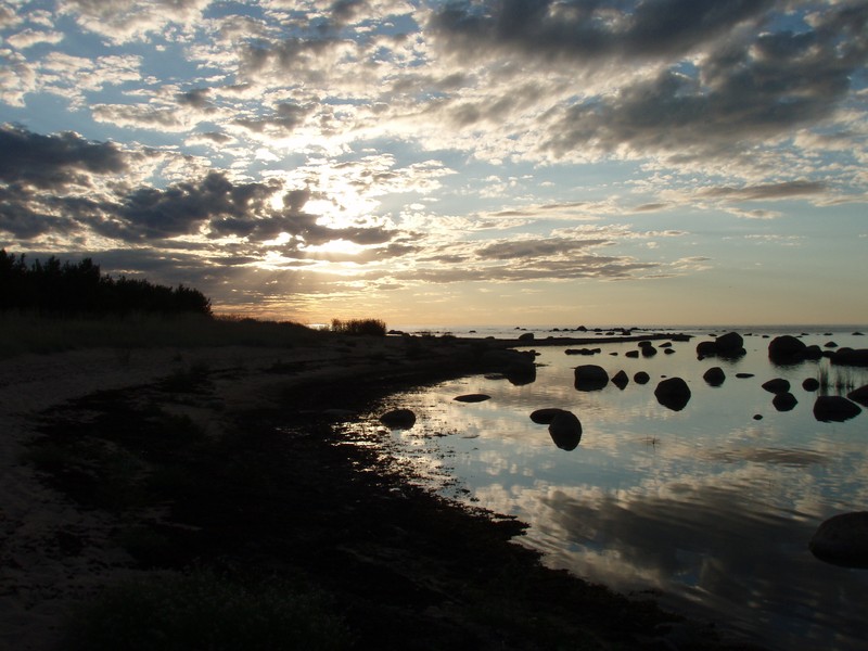
Credit: Glacial erratics in the evening sun by Florian Heinlein (distributed via imaggeo.egu.eu)
This picture was taken during a holiday trip through the Baltics in July 2006 during the search of Purekkari, the northernmost point of Estonia which lies in Lahemaa National Park, about 70km East of Tallinn. Two principal elements are noticeable in this picture: the sky with the evening sun and the randomly distributed stones which seem to rise up from the Gulf of Finland.
Even if the sun was starting to set when the picture was taken at 8pm a month after the summer solstice, the sun could still be observed all night long due to the high geographic latitude. Nevertheless, the picture is characterized by subtle red and yellow colors near the horizon. The physical reason for these colors lies in the scattering of the solar radiation on its way through the Earth’s atmosphere. When we look into the sky, but not directly into the bright and white sun, we only see scattered sunlight. Blue light, which has a low wavelength of around 450nm, is stronger scattered by air molecules, aerosols and water vapor than yellow, orange and red light (wavelengths between 560 and 780nm). Since the pathway of the solar radiation through the atmosphere is short when the sun is high, a blue sky dominates during daytime while a longer pathway of the sunlight during sunset (and sunrise) removes the blue and green component of the solar radiation, and is thus, responsible for the reddening of the sky.
The stones in the sea are glacial erratics. In general, they can be found all over the world in regions where glaciers formed the landscapes. Glaciers can transport material of very different sizes, from soil particle size to large stones with volumes of over 6500m³ and weights of around 15000t. They can either gather already loosened stones by passing over, or quarry out parts of boulders due to freezing. When glaciers retreat, they leave the erratics often at locations where these rock types would otherwise not be found. In Northern Middle Europe erratics are mostly igneous rock, granite or metamorphic rock. Sedimentary rocks rarely occur as erratics in this region because of their low resistance.
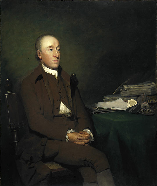
James Hutton, (1726 – 1797 ) by Sir Henry Raeburn. (Source: Wikimedia Commons).
Explaining the origin of glacial erratics or stones with different characteristics compared to other surrounding (country) rock was a huge problem in the scientific community of the 18th century as geology was considered to be static since the Creation of the world. Different theories, such as giants throwing stones or the transport of stones during the Deluge evolved to explain their occurence. In 1787, the Swiss politician Bernhard Friedrich Kuhn and the Scottish geologist James Hutton assumed glaciers to be responsible for the transport of erratics, but this theory contradicted the actual world view. During this time the name “erratic” was assigned which comes from the Latin world “errare” (to stray, to ramble). In 1835 the German natural scientist Karl Friedrich Schimper invented the term “Ice Age”. This theory was later refined together with Jean de Charpentier, director of Bex saline (Switzerland), and Louis Agassiz, a Swiss natural scientist. Thus, glacier research was promoted and advanced, meaning the problem of the slowly transported stones was solved. However, it should be noted that the Ice Age theory was not commonly accepted before the 1870s.
Finally, I want to thank my dear friend, Bernhard Kahle, for having taken this picture with his digital camera while I was only able to take a similar picture with my film camera.
Florian Heinlein, Institute of Soil Ecology, Helmholtz Zentrum München
Imaggeo is the EGU’s online open access geosciences image repository. All geoscientists (and others) can submit their photographs and videos to this repository and, since it is open access, these images can be used for free by scientists for their presentations or publications, by educators and the general public, and some images can even be used freely for commercial purposes. Photographers also retain full rights of use, as Imaggeo images are licensed and distributed by the EGU under a Creative Commons licence. Submit your photos at http://imaggeo.egu.eu/upload/.