“There is no geology here – just dirt!” or “It’s only a large sandbox.” are two common narratives told about the geology of the Berlin region. But is that true? Is there really nothing interesting to find and see for a geologist in the German capital? Let’s start digging!
The hard rock
One narrative is definitely true, Brandenburg, the state surrounding Berlin, like entire northern Germany, is a large sandbox. So if you are looking for structural exciting, hard rock geology in the outdoors, Berlin is not the place to go. The closest outcrops of hard rock to Berlin city centre are the Sperenberger gypsum quarries ~40 km south of Berlin, where you can find outcropping gypsum, and a limestone quarry in Rüdersdorf ~30 km east of Berlin. Both a very singular features in the region attributed to the upwelling of underlying salt domes, partly caused by glacial isostatic adjustment.
A glacial landscape
Generally the region around Berlin is strongly influenced by the northern ice ages, which repeatedly covered the area with kilometre thick ice sheets over the last 400.000 years. The glaciers partly carved deep channels into the previously deposited sediments, just for the channels to be filled up again with sand and other sediments by the next advance of the glacial ice. So when the ice finally melted for good at the beginning of the Holocene (~12.000 years ago), anything older than 2.6 Mio years was covered by a layer of 20 – 250 m thick sediments and the landscape was completely altered.
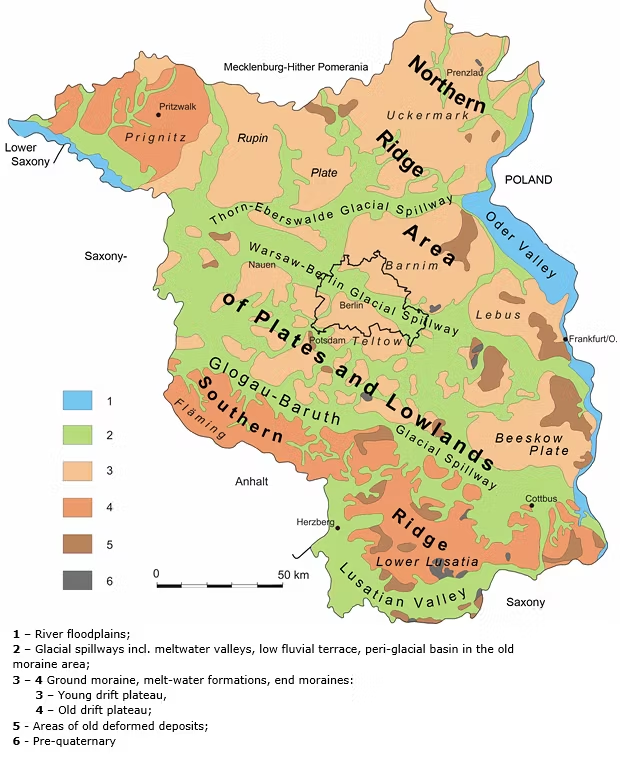
Geomorphologic landscapes of Berlin & Brandenburg (Credits: Berliner Umweltatlas, modified after Sonntag 1995)
So today Berlin and its surroundings are located in a Young Drift moraine landscape characterised by flat glacial meltwater valleys and only slight topography by terminal moraines and other deposits pushed together by the ice. Indeed, Berlin’s location in a glacial valley is the reason why the city is so flat and has so much water. (Did you know that Berlin has more bridges than Venice?) Which is why the city is so good for cycling (at least topography wise), why you can enjoy the entire city centre from E-W while having a stroll along the Spree river, go swimming in the Havel river or one of the many lakes in summer or ice-skating – should we ever get a real winter again.
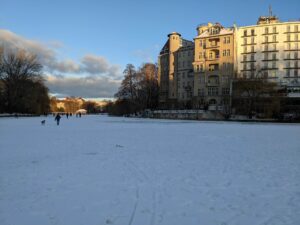
Lietzensee in Berlin centre. Perfect for a nice walk or ice skating – if the ice is thick enough (Credits: Lauretta Kaerger)
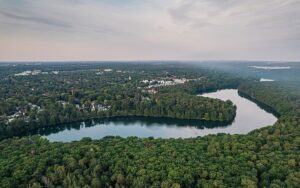
Schlachtensee & Krumme Lanke (in the Background) – two of the many lakes formed after the ice age in the Berlin region (Credits: A. Savin, Wikipedia)
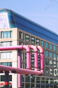
Pink Pipes can be seen all over the Berlin city centre (Credits: Morgane Le Breton via unsplash)
But the water also poses challenges and surprisingly not through river flooding. As Berlin was basically build on a swamp, the groundwater table is very high. Apparently in the centre you only have to dig two or three meters deep to reach it. This high standing ground water table causes special problems for construction sites – and in Berlin there are always some construction sites somewhere. So in case you ever walk through the city and wonder, what are these big pink & purple pipes along the street – its not modern art. These pipes are transporting pumped out ground water from construction sites to the nearest water way; surely a more unusual way how geology is influencing a cityscape.
The anthropogenic landscape
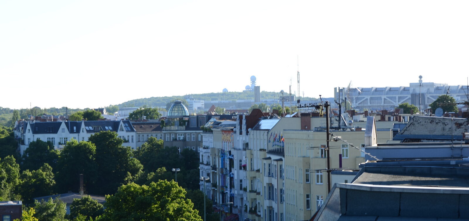
The Berlin region is not only flat, it does have some topography. However, even though you can mostly not tell the difference from the outside, not all the hills you see there are from the ice age. Some “mountains” are even younger – like less than 80 years young and originate from the recent history. After the second world war Berlin was completely destroyed and the first hurdle which needed to be overcome on the path to rebuilding was the rubble. But how do you get rid of millions cubic meters of rubble? Especially in western Berlin, which had no access to the surrounding country side, due to its special political isolation (which eventually led to the building of the Berlin Wall), this was a major problem.
So the solution people came up with was simply to pile up the rubble at different locations in the city creating “Trümmerberge” (rubble mountains). These hills eventually transformed into quite a few parks in the city, which now show no more obvious indication to their peculiar origin. The largest of these Trümmerberge even grew high enough to become the highest mountain in Berlin – the Teufelsberg (120 m). A height of 120 m might not sound like much, however if you consider it was made over 22 years out of 26 Mio m³ rubble it might change your notion about it. So this is surely a more interesting example on inverse “city-geology”.
Teufelsberg – the second-highest mountain of Berlin created between 1950 and 1972 from 26 Mio m³ second world war rubble (Credits: Lauretta Kaerger).
And just as a side note, since 2015 the Teufelsberg is not the highest mountain in Berlin anymore as it was overtaken by 1 m by the Arkenberg – a construction waste side.
The science city
So how do you rate Berlin’s geology so far? Can you be triggered by the idea of bathing in ice-age old lakes and climb modern mountains? Or are you more of a hard rock enthusiast who wrinkles one’s nose at any lose sediments? If the latter is the case the Berlin region does still have an ace up its sleeve to convince you about itself; and that is the science. Because for a region with “no geology here” it is the home of a remarkable number of geologic institutions: FU Berlin, TU Berlin, University of Potsdam, GFZ Potsdam (which is indeed located on a natural hill – for a change)… just to name a few. But also the Natural Historic Museum Berlin has an excellent geologic exhibition of minerals and dinosaurs. So if sandy grounds and mountains of rubble do not excite you, Berlin might be more a destination for this time of the year: when it is cold, rainy, and dark outside and field days are limited – so perfect for a nice visit at the museum to say hello to Tristan Otto – the T-Rex skeleton – or if you prefer a more talkative company, to grab a coffee with one of your colleagues at the many geologic institutes in the area.
References
Umweltatlas Berlin, Geologische Skizze 2007, https://www.berlin.de/umweltatlas/boden/geologische-skizze/2007/einleitung/, Senatsverwaltung für Stadtentwicklung, Bauen und Wohnen, Land Berlin, Last visited: 16.12.2025
Loy, T., 2015, Teufelsberg oder Arkenberge: Zum Wettstreit um den höchsten Gipfel Berlins, https://www.tagesspiegel.de/berlin/zum-wettstreit-um-den-hochsten-gipfel-berlins-8156497.html, Tagesspiegel, Berlin, Last visited: 16.12.2025
Teufelsberg, https://www.berlin.de/ba-charlottenburg-wilmersdorf/ueber-den-bezirk/freiflaechen/berge/artikel.177406.php, Bezirksamt Charlottenburg-Wilmersdorf von Berlin, Land Berlin, Last visited: 16.12.2025
Entdecke die Geschichte des Teufelsbergs, https://www.teufelsberg-berlin.de/geschichte/geschichtlicher-ueberblick/, IGTB GmbH & Co. Investorengemeinschaft Teufelsberg KG, Last visited: 16.12.2025
Atlas zur Geologie von Brandenburg, 2010, https://lbgr.brandenburg.de/sixcms/media.php/9/4_Geoatlas_1-69.pdf, Landesamt für Bergbau, Geologie und Rohstoffe Brandenburg,