Walking through an ancient and fascinating city like Rome, there are signs of history everywhere. The whole city forms an open-air museum, full of remnants of many different times the city has known, from the Imperial to the Medieval times, the Renaissance, the Fascist period, and finally the present day version of Rome. For historians and archaeologists, unravelling the exact history of the city proves to be a major challenge, since things are only partly preserved or have been renovated or moved to serve a different purpose. This might sound familiar to geologists, since they deal with the same type of problems, just on much larger scales, both spatially and temporally.
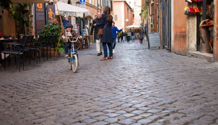
Although you might expect to find the keys to the geological history of Rome and its surroundings outside the city, there’s actually a great deal of hints within the city itself. Let’s start with the roads you would walk on, during a visit to Rome. If you’ve ever been to Rome, you might remember the black cobblestones, which form the pavement for many streets in the historical centre of Rome. The Italians call them ‘sanpietrini’, cubic-shaped blocks made from volcanic rocks coming from the surrounding volcanic regions.
Volcanic activity
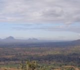
Two of these volcanic regions are the Alban Hills, southeast of Rome, and the Sabatini volcanic complex, northwest of Rome. They are part of a line of volcanic fields along the edge of the Italian peninsula, stretching from Naples, all the way to Tuscany. Eruptions in these areas were mainly explosive and created large volcanic plateaus and craters. One of those plateaus was formed by an eruption of the Alban Hills volcanic field and consists of volcanic tuff stone. Over time, erosion has altered this plateau and created a topography of valleys and hills, including the seven hills that Rome was built on. These hills are still remarkable features in the city today, for example when you climb the stairs to the Capitoline Hill and have a gorgeous view of the Imperial Forum or when standing on the Aventine hill in the south, looking down on Circus Maximus in the valley below you, and seeing the ruins of the imperial palaces on the Palatine hill in front of you.
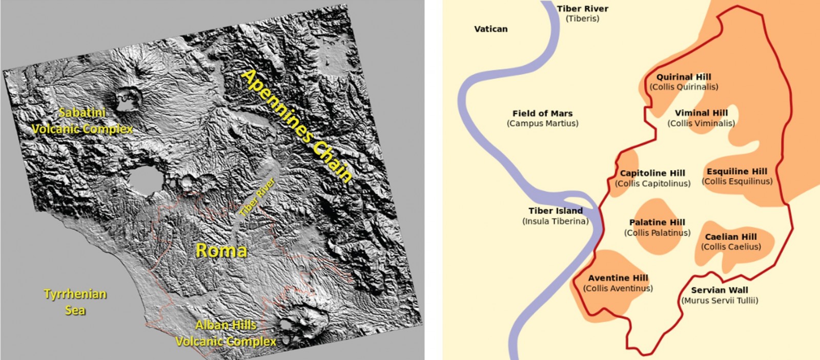
Left: Map showing the regional relief and the two volcanic complexes north and south of Rome. Credit: modified from Funiciello et al., 2003 by Francesca Cifelli. Right: The seven hills of Rome. Credit: theculturetrip.com.
The volcanic rocks in the Roman area did not only shape the landscape, they also served (and still do!) as an important water supply to the city. Springs in the areas, but also freshwater lakes formed in the volcanic craters are important sources for the city’s water budget. In fact, last summer Rome was in a state of panic, since severe drought and extremely hot temperatures had a big impact on the water level of volcanic lakes providing water to Rome and city officials were considering rationing drinking water for the Roman citizens.
The Apennines
Another important water supply to Rome are the springs in the Apennines, a NW-SE trending mountain chain, also called ‘the backbone of the Italian peninsula’. This mountain chain is the result of a collision between the African and Eurasian plates, which was part of a series of complex collisions and extensions of the Earth’s crust in the Mediterranean region, lasting from roughly 100 million years to 2 million years ago. During the last 20 million years, the Italian Peninsula rotated counter-clockwise, resulting in the formation of what we now call the Tyrrhenian sea. This period of extension also formed the onset of volcanic activity in the region.
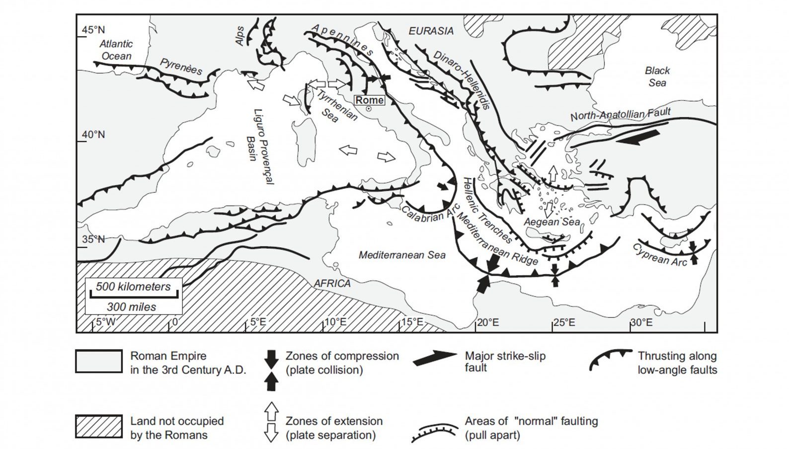
Map of the Mediterranean highlighting the main tectonic processes. Credit: Introduction to the Geology of Rome.
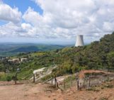
The rocks in the Apennine mountain range are limestone, deposited in ancient shallow seas as long as 300 million years ago. These rocks became very important to Rome, since they formed major rock reservoirs, which have been used for water supply for many centuries. Many remains of ancient aqueducts carrying water to Rome can still be found nowadays, and some of them are still being used, like the Vergine aqueduct, bringing water to the Trevi fountain. Also the ‘fontanelle,’ little fountains on the streets everywhere in Rome, are part of this water supply system and always provide clear, cool, and drinkable water. And if you’ve ever spend a day in Rome during summer, you know how valuable these fontanelle are!
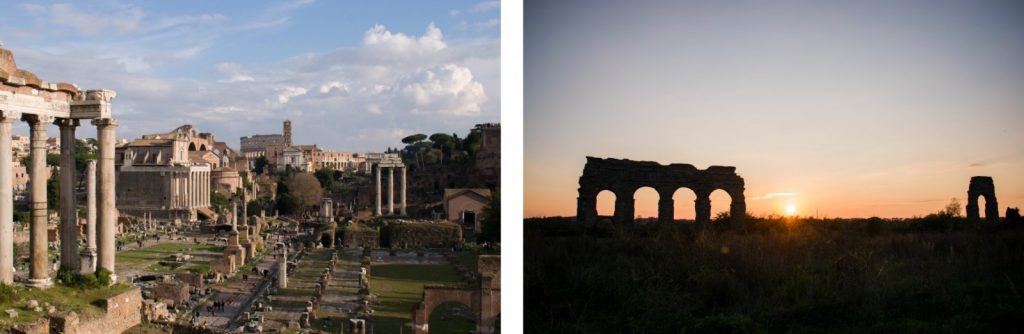
Left: view on the Imperial Forum from the Capitoline Hill. Many of the buildings at the Forum have been built with travertine. Right: remants of the Aqua Claudia, one of Romes many acqueducts bringing water from the surrounding regions to the city. Credit: Elenora van Rijsingen
The limestone that ended up in the Apennines often were converted into marble due to the high pressures and temperatures during collision. This marble can be found everywhere in Rome, since they have been used as building blocks for various structures like the Pantheon and Trajan’s column. Another rock which has been used a lot for Roman buildings is travertine, which forms by the evaporation of river and spring waters. Many temples, aqueducts, amphitheatres, and monuments have been built with travertine, but the most famous one is the Colosseum, which is the largest building in the world constructed mainly of travertine blocks.
Have you ever wondered why part of the outer ring of the Colosseum is missing? It is actually also linked to geology, since the southern part of the Colosseum collapsed during a historical earthquake. The tectonic processes which formed the Apennines still produce irregular movement along all kinds of faults on the Italian Peninsula, generating frequent earthquakes. The reason why only the southern half of the Colosseum collapsed (fortunately!) is because it had been partly built on unconsolidated alluvial deposits. When shaken by an earthquake, these loose sediments amplified the shaking and therefore caused severe damage to the southern part of the amphitheatre.
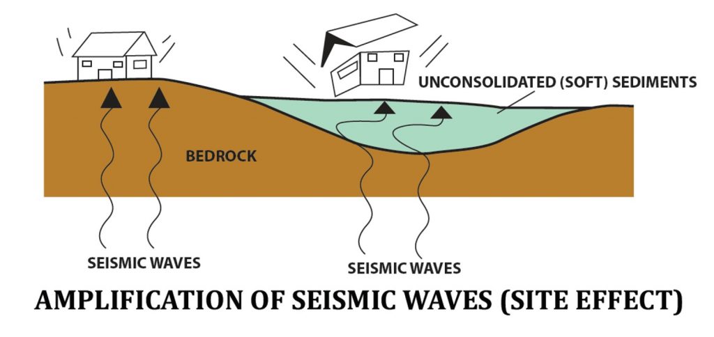
The site effect: amplification of seismic waves due to the properties of the subsurface. Credit: Ciaccio and Cultrera (2014) Terremoto e rischio sismico.
The Tiber
These type of alluvial deposits can also be found at the floodplains of the Tiber, the river which passes through Rome and played an important role in the city’s development. Romans in the imperial times did not build any houses on the floodplains of the Tiber, because they knew the river would flood every once in a while. Instead, they built theatres, temples, and army training facilities which could easily be restored and would not harm the societies too much.
Another reason not to build along these floodplains is the same reason which damaged the Colosseum: the increased risk of earthquake damage due to amplification of the shaking. Unfortunately, nowadays, many areas close to the river are covered with residential areas and even though the risk of flooding has decreased due to the 12 meter high walls surrounding the Tiber today, the risk of increased earthquake damage still exists.
And now I think of it, I am living in one of those areas myself, in Testaccio, a neighbourhood just south of the Aventine hill. I guess this amplification of the shaking due to the alluvial deposits below my feet is the reason why I feel a slight shaking (even when living on the fourth floor!) every time a large truck passes by. Roughly 2000 years ago, Testaccio was not a residential area, but was used as the location for an olive oil warehouse along the Tiber. We even have an ancient garbage dump in our neighbourhood, which is now part of the local landscape and is referred to as ‘Monte Testaccio,’ literally meaning ‘Testaccio mountain’. Romans would pile up discarded amphorae, which were used to store the olive oil, leaving a hill composed of fragments of roughly 53 million amphorae.
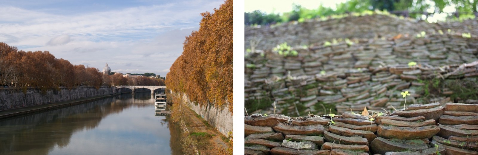
Left: the Tiber river bounded by its 12 meter high walls, which should prevent the city from future floods. Credit: Elenora van Rijsingen. Right: millions of amphorae fragments piled up in an organized way and together forming the Monte Testaccio. Credit: Flickr.
Clearly, in Rome not only geological processes shaped the landscape, but also deposits called human debris played a role. Digging an imaginary hole below your feet anywhere in Rome might reveal more ancient houses, businesses, or roads, all buried during the continuous evolution of the Eternal City. And that’s one of the reasons why, for example, the work on the new metro line here in Rome is taking so long! Every ten meters, they stumble upon a new archaeological site, all revealing new hints about what the city was like hundreds to thousands of years ago.
nganga
Have seen for the first time that volcanic rocks can make blocks
Victor Capelli
Fascinating article!
Agen Bola Terpercaya
Nice blog, a good quality article, a like it. Thanks to allow to me to comments to your blog
Rome Shopping Guide
Very revealing bless you, I do think your current audience might want a whole lot more content such as this continue the excellent work.
Alessia Pica
Anyone interested in deepen this topic? Have a look to my researchgate account (Alessia Pica), Rome’s geoheritage and urban geomorphology are my research topics and amazing results are waiting to be read!
Roy
I was driving to Rome from osti and passed some beautiful white cliffs. Can you tell me what kind of rock this is.
Thanks
Elenora van Rijsingen
Hi Roy, that sounds like limestone, but there is no way to tell for sure without looking at them in person or consulting a geological map. I do not know which location you are precisely talking about, but if you’d like to know more, you might want to contact Alessia Pica, who posted a comment here as well and might know more.