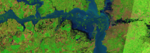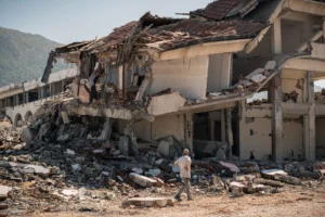
Floods in one region. Droughts in another. Wildfires intensifying across already dry landscapes, while elsewhere intense rainfall triggers landslides and infrastructure disruption. At first glance, these hazard events may seem entirely unrelated. After all, what could a flood on one side of the world possibly have to do with a drought on the other? Yet many of these seemingly disconnected events can be traced back to the same climate phenomenon developing thousands of kilometres away in the tropical Pacific Ocean: El Niño.
Chances are you have heard of El Niño and its adverse impacts in news reports from around the world. At the time of writing, El Niño is once again developing in the tropical Pacific. As it builds over the coming months, it is expected to add further warmth to an already warming planet while increasing the likelihood of weather extremes across many regions of the world.
While most people are familiar with hazards such as floods, droughts and wildfires, relatively few outside the scientific community are aware of the global climate pattern that can influence them all. This blog aims to explain what El Niño is, how it develops, why it can influence weather across the globe, and which regions are typically most affected. At the end of the blog, I will touch on the question that first inspired me to write it: whether El Niño can be considered a natural hazard. The main sources of information for this blog are the World Meteorological Organization (WMO), National Oceanic and Atmospheric Administration’s (NOAA) Climate Prediction Center (CPC), and recent news reports. All sources have been carefully cited throughout.
What is El Niño and why “El Niño”?
Hundreds of years ago, every few years around Christmas, Peruvian fishermen noticed that unusually warm waters would replace the normally cold, nutrient-rich waters along their coast. As these warm waters often arrived during the Christmas season, they are said to have named the phenomenon El Niño, Spanish for “the little boy/child”. For many years, it was believed to be a local event affecting only the Peruvian coast. It was not until the 1960s that scientists recognised it as part of a much larger ocean-atmosphere system spanning the tropical Pacific, capable of influencing weather patterns triggering natural hazard events in many parts of the world [2; 7]. But what exactly were these fishermen observing?
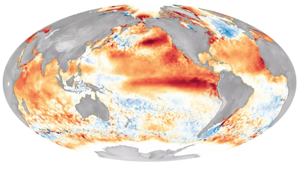
El Niño happens when the ocean surface temperatures across the central and eastern equatorial Pacific Ocean become warmer than usual (Fig 1) (for more on the mechanisms behind El Niño, see the further reading at the end of this post). This also changes the jet streams, which lead to changes in wind directions fuelling more severe storms in some parts of the world, while drying out others [10]. During El Niño, trade winds weaken and this pushes back warm water east, toward the west coast of the Americas. Once initiated, such events can last for 12 to 18 months (sometimes even go up to 24 months). El Niño occurs irregularly every 2 to 10 years, with an average recurrence interval – the average time between successive events – of around 4.5 years, typically increasing global temperatures and driving more extreme weather and rainfall patterns [2; 10]. NOAA declares El Niño conditions when sea-surface temperatures in the central-eastern equatorial Pacific are at least 0.5°C above average and the warming is expected to persist for at least three consecutive months, and characteristic changes are also observed in the atmosphere [6; 7].
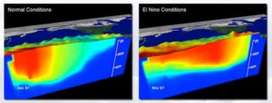
Figure 1. Schematic showing normal Pacific conditions compared with El Niño conditions in 1997. Image credit: NOAA Ocean Exploration
A brief look at El Niño events past and present
In NOAA’s El Niño-Southern Oscillation (ENSO) record, which begins in 1950, several prominent El Niño events stand out, including those of 1972-73, 1982-83, 1997-98 and 2015-16. ENSO combines changes in tropical Pacific Ocean temperatures with related shifts in atmospheric pressure [6].
More recently, the 2023-24 El Niño was classified by the World Meteorological Organization (WMO) as one of the five strongest events on record [6; 8].
And now we are experiencing another major El Niño. NOAA formally declared El Niño conditions in June 2026, and the event has continued to strengthen. Current forecasts indicate a greater than 90% chance that it will become a very strong El Niño during autumn and winter 2026-27. Forecasts also suggest that its eventual strength could rival some of the strongest El Niño events in the modern observational record [3].
The geography of El Niño’s impacts
Not all regions of the world are affected by El Niño, and even within a region, impacts can be different both spatially and seasonally. Each El Niño event is unique, with its effects depending on factors such as its intensity, duration, timing and interaction with other climate drivers [10;11]. However, generally speaking, the cycle tends to create drought and heat across Australia, around southern and central Africa, in India and in parts of South America, including in the Amazon rainforest. Heavy precipitation, meanwhile, could hit the southern tier of the US / southern South America, parts of the Middle East and south-central Asia [11].
Zooming in on the geography of El Niño in the US provides a good example of how these effects can vary from one place to another. During El Niño, warmer waters in the tropical Pacific can shift the Pacific jet stream south of its neutral position. This tends to bring warmer and drier conditions to parts of the northern United States and Canada, while the Gulf Coast and southeastern United States generally experience wetter-than-normal conditions and an increased risk of flooding [7]
Looking at India, El Niño can disrupt the monsoon, potentially reducing or altering seasonal rainfall, with important consequences for agriculture and water resources. However, the relationship is not always straightforward, as the strength of the monsoon is also influenced by other atmospheric and oceanic factors. Therefore, an El Niño event does not necessarily mean drought across India [4]. For a map of typical global El Niño impacts, check out NOAA Climate.gov website.
Is El Niño a natural hazard?
As Kamal Kishore of the UN Office for Disaster Risk Reduction puts it, “An El Niño is not, in itself, a disaster. Nor is it necessarily even a hazard” [2]. Rather, it is a large-scale climate phenomenon capable of influencing hazards ranging from droughts and floods to wildfires and tropical cyclones in different parts of the world. From a disaster risk reduction perspective, this makes the question particularly interesting. Perhaps the most useful way to think about El Niño is not simply to ask whether it is a hazard itself, but to ask what hazard scenarios it could generate, intensify or make more likely, and where.
Earlier in 2026, forecasters were already warning that El Niño was likely to develop. Since then, some of its anticipated influences have begun to appear. In Indonesia, El Niño-related drying has intensified drought conditions and increased wildfire risk, while in India it has contributed to below-average monsoon rainfall. El Niño conditions have also been linked to aspects of Typhoon Dolphin’s unusual behaviour: the storm formed exceptionally far east in the Pacific and travelled over warm ocean waters for much longer than a typical western Pacific typhoon [8].
At the same time, other major extremes and disasters have occurred, including severe heatwaves and wildfires in France throughout the summer of 2026 and the devastating glacier-triggered flash flood along the Nepal-Tibet border on 26 August 2026. Their occurrence during an El Niño year does not mean that El Niño caused them. This is precisely why attribution matters: which hazards can reasonably be linked to El Niño, and which are driven mainly by other climatic or environmental processes?
From a multi-hazard perspective, this distinction is exactly why I think it is useful to perceive El Niño not as a catch-all explanation for extreme events, but as a large-scale climate driver capable of creating or amplifying hazardous conditions across different regions. By changing rainfall, temperature and atmospheric circulation, it can favour drought in one place, flooding in another, and conditions conducive to heatwaves or wildfires elsewhere.
Why should we care?
El Niño should not only concern scientists and disaster managers. A basic public understanding of the phenomenon can help people make sense of changing hazard conditions, recognise why certain risks may be increasing, and interpret warnings more critically. El Niño is one of the most closely monitored climate phenomena in the world, yet, as WMO Secretary-General Celeste Saulo has emphasised, forecasts alone do not prevent disasters – people and preparedness do. Forecasts are only useful when we understand what they mean and know how to act on them. Knowing what El Niño is makes it easier to understand why forecasters anticipate floods in some regions, droughts in others, and how communities can prepare accordingly.
At a more everyday level, knowing that we are in an El Niño phase can encourage people to pay closer attention to local forecasts and official warnings, particularly when travelling or planning activities in areas where certain hazards may become more likely.
As a final word, if El Niño can act as a driver of different hazard scenarios across different parts of the world, understanding that connection becomes part of preparedness itself. Be aware that El Niño can influence many hazards – but do not blame El Niño for everything.
Please read more:
https://www.preventionweb.net/hubs/el-nino
https://oceanservice.noaa.gov/facts/ninonina.html
https://education.nationalgeographic.org/resource/el-nino/
References
[1] Bureau of Meteorology . Tropical Climate Update. Australian Government Bureau of Meteorology, issued 25 August 2026, available at: https://www.bom.gov.au/climate/tropical-note/ (last access: 2 September 2026).
[2] Glantz, M. H. (Ed.): Once Burned, Twice Shy? Lessons Learned from the 1997-98 El Niño, United Nations University Press, Tokyo, Japan, 294 pp., available at: https://www.preventionweb.net/files/1864_VL102131.pdf (last access: 22 July 2026), 2001.
[3] Kishore, K.: A “Super El Niño” would be a test for our disaster risk governance systems, United Nations Office for Disaster Risk Reduction (UNDRR), available at: https://www.undrr.org/news/kamal-kishore-super-el-nino-would-be-test-our-disaster-risk-governance-systems (last access: 22 July 2026), 2023.
[4] Met Office: El Niño declared for 2026 as Pacific warms, available at: https://www.metoffice.gov.uk/blog/2026/el-nio-declared-for-2026-as-pacific-warms (last access: 31 August 2026), 2026.
[5] National Oceanic and Atmospheric Administration (NOAA): FAQs, Pacific Marine Environmental Laboratory, available at: https://www.pmel.noaa.gov/elnino/faq (last access: 31 August 2026), n.d.
[6] NOAA Climate.gov: December 2023 El Niño update: Adventure!, available at: https://www.climate.gov/news-features/blogs/enso/december-2023-el-nino-update-adventure (last access: 31 August 2026), 2023.
[7] NOAA Ocean Exploration: What is El Niño?, National Oceanic and Atmospheric Administration, available at: https://oceanexplorer.noaa.gov/ocean-fact/elnino/ (last access: 31 August 2026), 2020.
[8] Reuters. How climate change and El Niño supercharged Typhoon Dolphin, Reuters, 13 August 2026, available at: https://www.reuters.com/business/environment/how-climate-change-el-nio-supercharged-typhoon-dolphin-2026-08-13/ (last access: 2 September 2026), 2026.
[9] World Meteorological Organization (WMO): El Niño weakens but impacts continue, available at: https://wmo.int/news/media-centre/el-nino-weakens-impacts-continue (last access: 31 August 2026), 2024.
[10] World Meteorological Organization (WMO): Strong El Niño expected to intensify, available at: https://wmo.int/news/media-centre/strong-el-nino-expected-intensify (last access: 31 August 2026), 2026a.
[11] World Meteorological Organization (WMO): WMO: Prepare for El Niño, available at: https://wmo.int/news/media-centre/wmo-prepare-el-nino (last access: 31 August 2026), 2026b.
Blog post edited by: Harriet Thompson and Navakanesh M Batmanathan