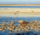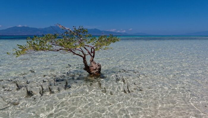
Pictured here is a solitary mangrove tree, rooted off the northern coast of the Indonesian island Flores. While this tree has the shallow sandy reef to itself, mangroves are often found clumped together in large forests covering tropical and subtropical coastlines. The propped-up roots of mangrove trees often tangle together, creating a dense natural barrier that can weaken the coastal impact of ocean tides, currents and storms. As a consequence, islands with mangrove forests on their coastlines experience less erosion and less damage from storm surges compared to barer shorelines.
Mangroves are also often said to provide protection against tsunami destruction. Indeed, there have been several cases in which mangroves trees were believed to have curtailed the devastating effect of tsunami waves. Recent research suggests that extensive mangrove forests hundreds of metres wide have been able to reduce tsunami wave heights by 5-30 percent.
Unfortunately, over the past decades, these environmental benefits are now under threat due to deforestation. About half of the global mangrove population (32 million hectares) has been wiped out, often to make way for fish farming operations. In Indonesia, mangrove ecosystem decline has been largely attributed to developing shrimp ponds and logging activities. There are now a number of places where mangrove plantations are supported by local individuals and governments.
Jörn Behrens, a professor of numerical methods in Earth sciences at the University of Hamburg in Germany, captured this shot while on a field trip in Indonesia. He and his colleagues were looking for traces of the powerful 1992 tsunami that struck the coast of the Indonesia island of Flores and other nearby smaller islands.
The tsunami, triggered by a magnitude 7.9 earthquake, sent waves reaching 4 to 27-metres high on the island’s northeastern coast, even destroying a whole village situated on the nearby island Babi. About 2,500 residents and tourists died from the event, with hundreds more injured, and thousands more homeless.
The 1992 Flores tsunami was also one of the first such events documented by an international survey that adhered to internationally accepted post-tsunami assessment standards. On their field trip Behrens and his colleagues revisited some of sites assessed by the 1992 post-tsunami survey, spoke to eye witnesses, learned about the region’s current mitigation measures, and exchanged latest results from modeling and experimental tsunami research.
While on this field trip, Behrens came across this solitary mangrove, surrounded by what appears to be young mangrove propagules growing out from the water.
By Olivia Trani, EGU Communications Officer
References
Spalding M, McIvor A, Tonneijck FH, Tol S and van Eijk P (2014) Mangroves for coastal defence. Guidelines for coastal managers & policy makers. Wetlands International and The Nature Conservancy.
Imaggeo is the EGU’s online open access geosciences image repository. All geoscientists (and others) can submit their photographs and videos to this repository and, since it is open access, these images can be used for free by scientists for their presentations or publications, by educators and the general public, and some images can even be used freely for commercial purposes. Photographers also retain full rights of use, as Imaggeo images are licensed and distributed by the EGU under a Creative Commons licence. Submit your photos at http://imaggeo.egu.eu/upload/.

