One of the regions that has experienced most warming over the second half of the 20th century is the Potter Peninsula on King George Island in Antartica. It is here that Marc Oliva and his collaborators are studying what the effects of the warming conditions on the geomorphological processes prevailing in these environments.
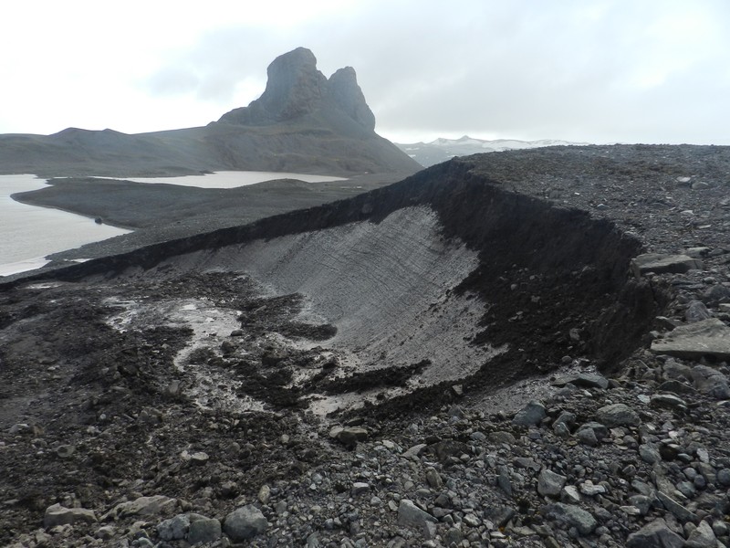
“Permafrost is present almost down to sea level in the South Shetland Islands, in Maritime Antarctica” says Marc, “in some recent deglaciated environments in this archipelago, the presence of permafrost favours very active paraglacial processes”.
Permafrost is defined as the ground that remains frozen for periods longer than two consecutive years and constitutes a key component of the Cryosphere. However, it is not fully understood how it reacts to climate variability. In this sense, there is an on-going effort to improve our knowledge on these topics by carrying out long–term monitoring of permafrost, as well as of geomorphological processes, in order to better understand the response of the terrestrial ecosystems to recent warming trends.
This weeks’ Imaggeo on Mondays picture shows a massive slump and the exposed permafrost in the shoreline of a lake in Potter Peninsula (King George Island, Maritime Antarctica). Following the deglaciation of this ice-free area paraglacial processes are very active transferring unconsolidated sediments down-slope to the lake.
Imaggeo is the EGU’s open access geosciences image repository. Photos uploaded to Imaggeo can be used by scientists, the press and the public provided the original author is credited. Photographers also retain full rights of use, as Imaggeo images are licensed and distributed by the EGU under a Creative Commons licence. You can submit your photos here.


Pingback: GeoLog | Imaggeo on Mondays: Arctic cottongrass in Svalbard
Pingback: GeoLog | Imaggeo on Mondays: Sneaking up from above