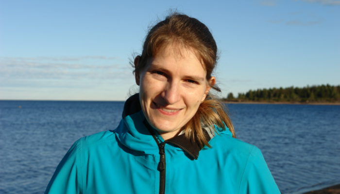
Hello Rebekka, thank you for taking the time to talk with us today! Could you introduce yourself to our readers?
Hi. Thanks for giving me the chance to talk about my research and plans as ECS Rep for the Geodesy Division. I’m a researcher in Geodesy at Lantmäteriet, which is the Swedish mapping, cadastral, and land registration authority (I prefer the much shorter Swedish version 😉). I’m working in Geodesy now although I’m actually a Geoscientist. I did my Diplom (good old German degree) in Geosciences with a specialization in Geophysics at the Friedrich-Schiller-University Jena in Germany. Most of my studies in Geophysics was directed towards the measurement and analysis of gravity data, which can also be counted as within the field of Geodesy. I then moved to Canada to do my PhD at the University of Calgary in Geomatics Engineering. So, back then I had already entered into the field of Geodesy. This was only for a short period as I had to switch supervisors and moved to the Geosciences department at the University of Calgary. I then worked on the occurrence of earthquakes in northern Canada and their relation to the ongoing land uplift after the last ice age. This brought me back to Europe where I started a PostDoc at Uppsala University and continued to work in Seismology and Geodynamics, thus apparently leaving behind Geodesy. I then had the chance in 2018 to join Lantmäteriet as a researcher in Geodesy, where I am still working. Lantmäteriet is a governmental organization and we have more than 2000 employees (which sounds quite small compared to universities), but only a small group of us (about a dozen) are doing research. So, we are kind of special there.
I also have two kids. One of them has attended the EGU General Assembly quite often already. He is a conference expert and misses going to conferences.
You’re the Early Career Scientist Representative for the Geodesy (G) Division, alongside your Co-Rep Andreas Kvas. Geodesy is an enigmatic subject for some of our readers. Could you tell us about the type of research that happens under your Division?
Of course! The G Division is small but covers many different geodetic topics. Still, people don’t really know what Geodesists actually do, although we are all in need of the results from Geodesists on our daily basis. The most famous examples are our mobile phone or car with a GPS inside. We all use it. Geodesists are trying to get more out of such signals. For example, the GNSS (Global Navigation Satellite System) signal can also be used to analyse the water vapor, which helps meteorologists to improve their weather forecast. We also work on finding improvements in determining the reference frame, which is needed to define the coordinate system. A stable coordinate system is crucial for studying changes within the Earth’s system, for example rising sea levels.
A large group of researchers affiliated with the Geodesy Division work with gravity data (ground, satellite, and airborne). This data can be used to analyse how saturated the ground is with water and then work towards flood predictions together with meteorologists, for example. The field of glacial isostatic adjustment, which covers everything related to the Earth deforming due to the growing and melting of ice sheets, is also settled in our Division and this is the reason why I feel most affiliated with Geodesy. We don’t only use geodetic data, like gravity and GNSS, but also use seismological models and geological data to model the movement of the Earth using geodynamic models. I can give you many more examples. Best is to join the 101 Short Course series at the next EGU General Assembly where we are planning to start “Geodesy 101”. There you will hear even more about what we are doing and what is behind the final datasets that researchers of other divisions frequently use.
Your own research investigates how glaciers interact with the Earth’s crust, and what climate change might mean for earthquakes. The latter may seem surprising to people who don’t intuitively see a connection between climate change with such seismic activity. Could summarise why the two are related to our readers?
People always connect climate change to rising sea level, weather extremes, etc. But, yes, earthquakes might be a consequence too. Not in areas that are known for large and frequent earthquakes – we have to focus on Greenland and Antarctica instead. I’m working in the field of glacial isostatic adjustment and I’m basically modelling the movement of the lithosphere due to the growing and melting of ice sheets. GNSS and gravity observations are frequently used to compare it to the modelled results.
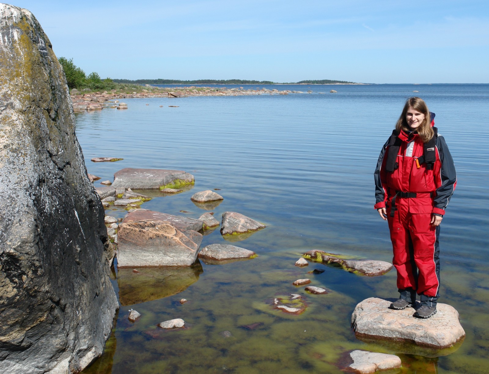
Rebekka visiting the famous Celsius rock in the Gävle Bay. This rock has a sea level mark from 1731, which is now ca. 2 m above current sea level showing the ongoing land uplift.
But, the stress field in the Earth’s crust is also changing and this might lead to more earthquakes. We have evidence for large magnitude earthquakes (possibly magnitudes of up to 8.2) in northern Europe and eastern Canada. The most famous example is in northern Sweden (the Pärvie fault) where an offset of 15 m can be seen in the landscape. We know that the offset was created by one or more earthquakes when the ice was retreating in northern Sweden. The same could probably happen in Greenland and Antarctica. Also, landslides connected to these earthquakes have been identified in northern Finland. We are trying to model the stress field changes and try to tell when the risk of earthquakes might increase with the melting of the ice sheets.
Still, the stress field changes are only a side product and first we have to find a glacial isostatic adjustment model that explains the deformation of the Earth by comparing our results to GNSS velocity fields, gravity observations and relative sea-level data. If we know the timing of earthquakes, we can even use them to constrain our models too. So, it is a field that combines many geoscientific aspects and it is a kind of tradition of having GIA in the Geodesy Division.
What does being an ECS Rep involve for you, and how can our readers get involved with the Geodesy Division?
As the ECS Rep of the Geodesy division I’m attending the frequent ECS Rep meetings, where all ECS Reps of each Division meet. We discuss changes that are needed to improve the standing of ECSs within the EGU. Andreas Kvas, my co-Rep, and I are also trying to get Geodesy more visible outside our division. As you already said in the beginning, Geodesy is an enigmatic subject for some of the readers. We want to change this. So, we are adding more posts on the Geodesy blog. We recently started a new series called “Geodesists on Tour” to show that Geodesist are not only sitting in front of a computer but also doing field work.
We are also working on networking within the Geodesy division. Due to the pandemic the ECS haven’t had the chance to interact with other researchers as before, and so we have started the EGU Campfire Series within our division. And then we are working on the Geodesy 101 short course, which will start at the next EGU General Assembly. Luckily we have been able to get a great team behind us and we are not alone. So, we have a group of ECSs who do all of this.
Of course, we would like to have more people involved and if you are interested to join, then please get in contact with us via ecs-g@egu.eu. You can follow us on Twitter and/or Facebook, and we have a mailing list where we send ECS-specific EGU news. Join us here.
What’s the take-home message you have for our readers about the geophysical processes at the Earth’s surface, from your position as an expert?
I think it is important to know that we all have to work together across disciplines. A glaciologist, geodesist, or seismologist alone cannot understand the processes that are involved when the ice is retreating. We have to find models that can explain as much as possible of the existing observations and then we can look more towards future predictions. It is important that we talk to each other and have an idea about what the others are doing and what is behind the applied datasets.
Finally, what you looking forward to in the future?
I’m currently working on a project from the Swedish National Space Board and this is my priority. My boss mentioned that he has many other work projects for me afterwards 😉. Besides, I’m also a project manager within Native Scientist, where I organize workshops with schools in Sweden. During these workshops we talk about our scientific work in our native language, which is German for me. This can be sometimes quite challenging as our scientific work is almost exclusively in English. Otherwise, I’m trying to spend as much time as possible with my family outside and exploring the Swedish nature (currently we are focused on looking for blueberries in the forests).