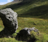
Take a stroll along the norther beaches of the French Channel Coast, some kilometers east from the entrance of the Channel Tunnel, and you’ll encounter an imposing cliff of soft, sandy composition which dominates the landscape.
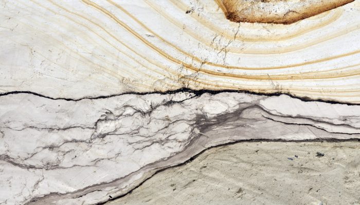
On close inspection, the sediments which make up the Quaternary aged deposits of the Sangatte Cliff, are beautiful, revealing intricate patterns which hold the key to the geological processes that formed them. Even at present, the landscape is being continuously shaped by marine processes which continuously erode the Quaternary soft deposits – especially during storms coupled with high tide events.
The Sangatte sedimentary sequence outcrops along a stretch of about 1.5 km along the French coast. Today’s featured image was taken by Pierre Antoine, at the base of the Quaternary sequence of the Sangatt Cliff. It corresponds to an observation window of about 80 cm large.
“At this location, explains Pierre, the Quaternary record is composed of raised beach deposits (flint pebble bar and sandy beach deposits, ± 3m thick) dating from a Middle Pleistocene interglacial (± 300 ka) and to a high sea level (± 5 m above the present day level), covered by a thick succession of chalky periglacial slope deposits, formed during periods of repeated freezing and thawing, associated with loesses and fossil soils know as palaeosols (8 to 12m).”
The greenish sandy deposits exposed at the base of the photo represent the top of the ancient marine beach deposits. These were overlain by a thin, dark bown, peat layer indicative of a phase of sea level drop. It is likely that during this time a peat bog, which was isolated from the sea by wind-driven sand dunes, developed .
This peat layer has, more recently, been strongly compressed and reworked during the deposition of the overlying thick bed of dense chalk mud. The greyish muds are the result of the weathering of the massive chalky slopes of the Sangatte Cliff, which occurred following a cold period after the sea-level decrease. The delicate rusty bands seen in the otherwise creamy chalky muds, are the result of infiltration of iron oxide minerals throughout the cliff.
Reference:
Antoine, P. 1989. Stratigraphie des formations pléistocènes de Sangatte (Pas-de-Calais), d’après les premiers travaux du Tunnel sous la Manche. Bulletin de l’Association Française pour l’Etude du Quaternaire, 37, 5-17.
Imaggeo is the EGU’s online open access geosciences image repository. All geoscientists (and others) can submit their photographs and videos to this repository and, since it is open access, these images can be used for free by scientists for their presentations or publications, by educators and the general public, and some images can even be used freely for commercial purposes. Photographers also retain full rights of use, as Imaggeo images are licensed and distributed by the EGU under a Creative Commons licence. Submit your photos at http://imaggeo.egu.eu/upload/.