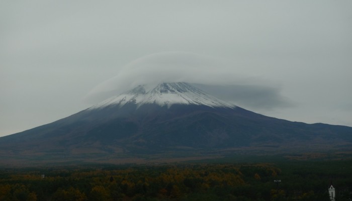
The first Imaggeo on Monday’s post of 2016 is quite spectacular! It features a lenticular cloud capping the heights of Mount Fuji, in Japan. Erricos Pavlis writes this post and describes how the unusual cloud formation comes about and why Mt. Fuji is such a prime place to catch a glimpse of this meteorological phenomena.
Mount Fuji at more than 3700 m is one of the highest volcanoes in the world and the highest mountain in Japan,located some one hundred or so kilometers southwest of Tokyo.
In November 2013 the International Laser Ranging Service (ILRS) held its annual Int. Laser Ranging Workshop at Fujiyoshida, a resort town very close to the volcano. The venue had a clear shot at the volcano and rewarded us daily with spectacular views of the entire volcano. On the first morning of my stay, November 9, I looked out the window very early on and Mt. Fuji was toped with a lenticular cloud, just like a nightcap for a cold winter night.
Being such a tall mountain and the only one in the area, Mt. Fuji is a perfect candidate to observe this rare kind of clouds that form in the troposphere and mostly over very tall topographic features. The lenticular clouds (formally called Altocumulus lenticularis) are the result of the obstructed wind flow due to an barrier, a mountain for example, but it could also happen with man-made obstacles like very tall buildings. They are formed at right angles to the wind direction and they are categorized in several different types, however, they all have the shape of lens and this has sometimes led viewers believe they saw an Unidentified Flying Object (UFO)! On rare occasions, the lucky ones might see several of these stacked on top of each other with thin layers of air separating them like a pile of pancakes! Even the single one was for me a very pleasant surprise though!
By Erricos Pavlis, Joint Center for Earth Systems Technology, Univ. of Maryland, Baltimore County, Baltimore, Maryland, United States of America.
Imaggeo is the EGU’s online open access geosciences image repository. All geoscientists (and others) can submit their photographs and videos to this repository and, since it is open access, these images can be used for free by scientists for their presentations or publications, by educators and the general public, and some images can even be used freely for commercial purposes. Photographers also retain full rights of use, as Imaggeo images are licensed and distributed by the EGU under a Creative Commons licence. Submit your photos at http://imaggeo.egu.eu/upload/.