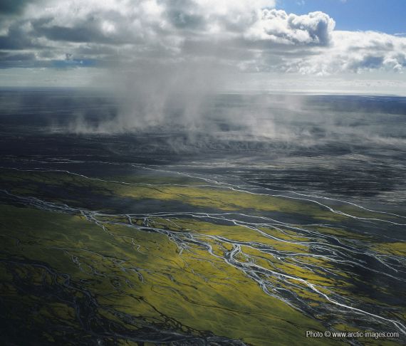
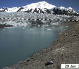
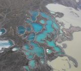
These are the outwash plains for the Icelandic volcano, Katla:

“Sandstorm, Myrdalssandur outwash plain, Iceland” by Ragnar Sigurdsson. This image is distributed by the European Geosciences Union under a Creative Commons licence.
An outwash plain (or sandur) is a broad, shallowly sloping region ahead of a glacial front. They are made up of material that has been deposited by glacial meltwater, released either by geothermal heating or a subglacial eruption. The extensive volcanism and abundance of ice-capped volcanoes in southern Iceland means that the outwash plains are particularly well developed here.

The Mýrdalssandur outwash plain in relation to the volcano Katla (Mýrdasljökull) [source: Jóhannesdóttir and Gísladóttir, 2010].
Between flooding events, some vegetation takes hold, but much of the soil is loose and easily transported by wind. Indeed, the soil islands you see in the photo are formed by wind-blown soil and if they were to erode, the area would be a desert consisting of glacial alluvial sediments alone. Sandstorms, such as the one above, carry fine particulate matter (clays and glacial till) from the outwash plains to other areas and even contribute to the particulate pollution in Reykjavík, some 110 km away!
References:
Jóhannesdóttir, G. and Gísladóttir, G.: People living under threat of volcanic hazard in southern Iceland: vulnerability and risk perception, Natural Hazards Earth System Science, 10, 407-420, doi:10.5194/nhess-10-407-2010, 2010.
Thorsteinsson, T., Gísladóttir, G., Bullard, J. and McTainsh, G.: Dust storm contributions to airbourne particulate matter in Reykjavík, Iceland, Atmospheric Environment, 45, 5924-5933.
Warner, N.H.: Catastrophic outwash plains on Earth and Mars: comparisons from Iceland and Chasma Boreale, Mars. PhD thesis, Arisona State University, December, 2008.
You can find more Arctic images from Ragnar Sigurdsson here, and more from the Imaggeo open access database here.
Imaggeo is the EGU’s online open access geosciences image repository. All geoscientists (and others) can submit their images to this repository and since it is open access, these photos can be used by scientists for their presentations or publications as well as by the press and public for educational purposes and otherwise. If you submit your images to Imaggeo, you retain full rights of use, since they are licensed and distributed by the EGU under a Creative Commons licence.


