This edition of “Beyond Tectonics” is brought to you by Dr. Derya Gürer and Luca Magri. Derya is a Lecturer in Earth Sciences at The University of Queensland in Brisbane, and Adjunct Lecturer at the University of Tasmania, and Luca is a PhD student at the University of Tasmania in Hobart, Australia. In early 2020, they participated in a research voyage to one of the most remote places on the planet: The Southern Ocean. Derya has a background in Tectonics/Geodynamics and uses a multi-disciplinary approach to reconstruct the tectonic evolution of the oceanic lithosphere from its formation at mid-ocean ridges, to its demise in subduction zones. Luca’s background is in geology and geophysics and his PhD project focuses on the seismic data collected during this research voyage. In this post Derya and Luca share their recent ventures looking for lost continents in the deep ocean aboard Australia’s research vessel (R/V) Investigator in the Furious Fifties and Roaring Forties, and their experience of returning to land amidst a global pandemic.
On a hot summer day in early January, Australia’s R/V Investigator embarked on a two-month research voyage from Fremantle, Western Australia to study the fiery past of continental break-up that is now preserved in depths of the cold and remote Southern Ocean. William’s (Kerguelen Plateau) and Broken ridges represent conjugates that underwent rifting, breakup, and separation of once contiguous oceanic plateaus (Fig. 1). While these prominent seafloor features are now 2700 km apart, they were contiguous until ~43 million years ago, not long after Australia and Antarctica broke up. The break-up was complex, and in the case of the central plateau led to formation of a microcontinent. In fact, during the opening of Labuan Basin (Fig. 1), from ~100-50 Ma, William’s Ridge partially detached from the main plateau, but due to the final ridge jump of the Southeast Indian Ridge, the process stopped and the northern part of the conjugate margin remained connected to the Central Kerguelen Plateau.
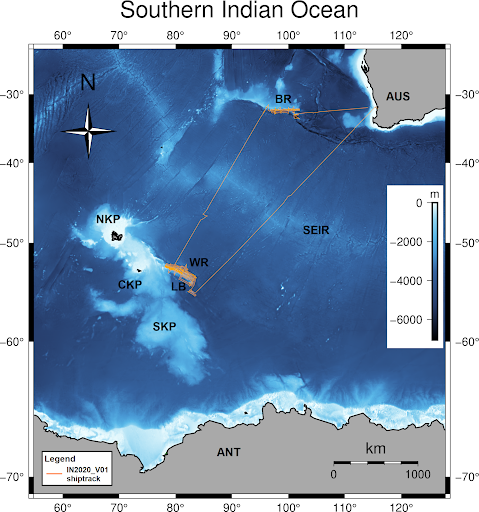
Fig. 1. Southern Indian Ocean region seafloor depth. The shiptrack of the IN2020_V01 voyage is shown in orange. NKP: Northern Kerguelen Plateau; CKP: Central Kerguelen Plateau; SKP: Southern Kerguelen Plateau; LB: Labuan Basin; WR: William’s Ridge (CKP); BR: Broken Ridge; SEIR: Southeast Indian Ridge; AUS: Australia; ANT: Antarctica.
To gain a better understanding of the tectonic history, including the structural architecture and the origin of the two segments of the plateau, the research conducted during the voyage focused on collecting multibeam/backscatter echo-sounding data, sub-bottom profiles, seismic reflection profiles, gravity data, and dredged rocks samples from the submerged plateaus in the Southern Ocean. A number of SOCCOM and Argo floats were also deployed to record ocean conditions.
The voyage was led by Chief Scientist Prof. Mike Coffin (Fig. 2) from the Institute for Marine and Antarctic Studies at the University of Tasmania, who has frequently participated and led research voyages to this remote region since 1985. On board the ship were 11 CSIRO/Marine National Facility science support staff, two medical specialists, 20 ship’s crew, and 23 scientists and students with a wide expertise ranging from geology, geophysics, marine biology/zoology, and marine policy. The science party was multinational and assembled from the following institutions: The University of Tasmania, Geoscience Australia, Macquarie University, The University of Queensland, GFZ German Research Centre for Geosciences, James Cook University, University of Western Australia, College of the Atlantic (USA), and the Institute of Oceanology, Chinese Academy of Sciences.
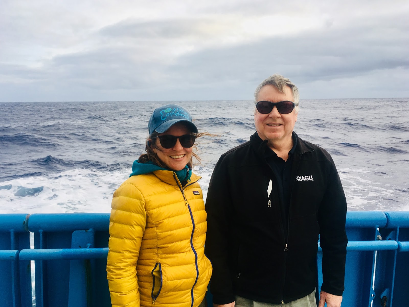
Fig. 2. Dr. Derya Gürer and seasoned sailor Chief Scientist Prof. Mike Coffin on the home stretch of a successful voyage: IN2020_V01. (credit: Dongdong Dong/CSIRO).
Life at sea
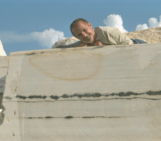
In the two months at sea, the science team was on 12 hours on, 12 hours off shifts and engaged in various activities outside this time and during three long transits to, between, and from the study sites. On her first research voyage, Derya had the unique opportunity to be part of the on board science management team, acting as day shift leader and lab custodian for the dirty wet lab (Fig. 3, 4), all of which contributed to a steep learning curve and a rewarding experience. In Derya’s case her routine was as follows: 5.45 am shift handover and update what has been done in the night shift, check-in at the rock lab, 7 am breakfast, 8 am bridge meeting with the voyage’s senior management team consisting of Chief and Co-Chief scientists, the ship’s Master, and the Voyage Manager to discuss the next 24-48 hours of operation. The daily routine continued with 8.30 am – 12 pm science tasks depending on the ongoing activities. 12.30 pm lunch, followed by a coffee at the bow (weather permitting). 1.45 pm shift handover between students, 2 pm daily seminar, followed by science activities, 5.30 pm dinner, and extracurricular activities such as yoga and tea, occasional late-night snack, shower, and sleep (sea state permitting).
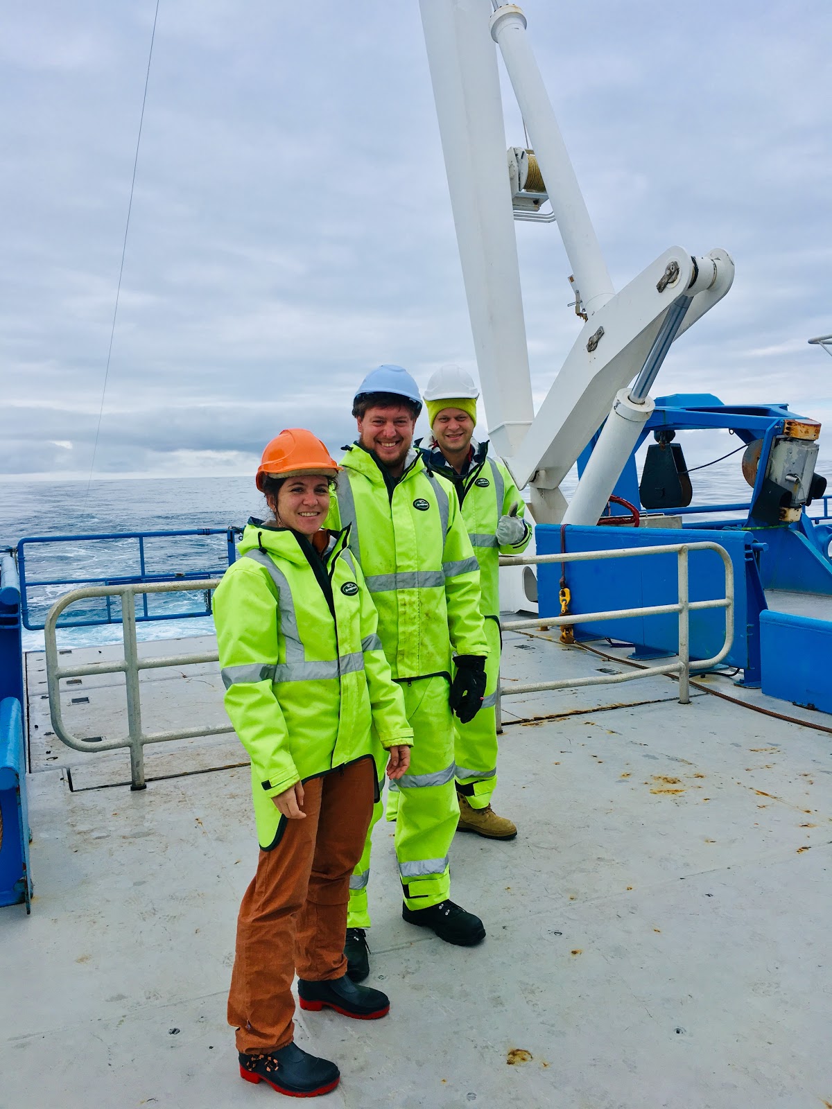
Fig. 3. From left to right: Dr. Derya Gürer, Luca Magri and Michal Wenderlich (James Cook University) enjoying a quiet sea state on the after deck of Australia’s R/V Investigator. The afterdeck is where the seismic gear is deployed from and towed at 4 kt. (credit: CSIRO).
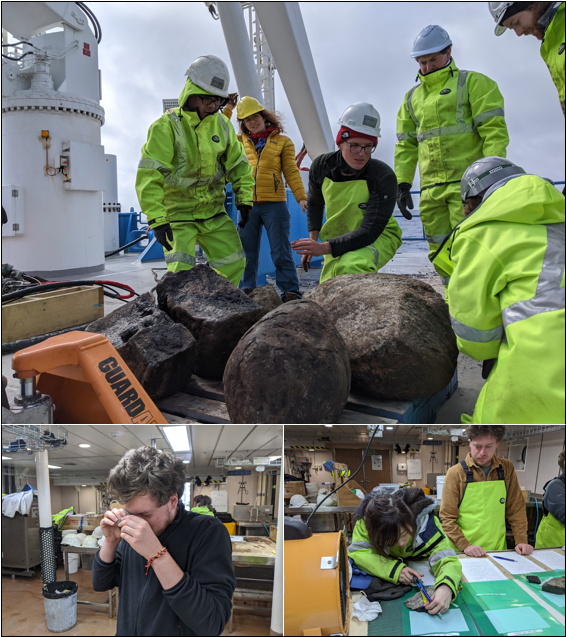
Fig. 4. Members of the science party, including UTAS PhD student Luca Magri in the dirty wet lab on board Australia’s R/V Investigator examining rocks that were dredged from great depth in the Southern Ocean (credit: David Dieckfoss/CSIRO).
Similarly, it was Luca’s first time on a research vessel (and in fact his first visit to Australia – he had only landed from his home country Italy to embark on R/V Investigator). During his undergraduate studies in Italy, Luca developed a strong interest and passion for marine geology and geophysics, along with a desire to discover how life at sea is and the willingness to explore remote corners of the planet. The possibility to participate in such an expedition, led by some of the most internationally recognised experts, and to see first-hand how marine geophysical data are collected, was an opportunity to learn so big that he didn’t hesitate to accept.
Traversing the Furious Fifties and the Roaring Forties
The team spent four weeks far south in the Furious Fifties, a region beyond 50°S where the weather and sea conditions are particularly fierce, mapping and sampling remote parts of the Southern Indian Ocean, which had never been mapped in detail before. These included William’s Ridge and Rig Seismic Seamount as parts of the oceanic plateau that was formed by the Kerguelen hotspot starting or following with the breakup of Gondwana around 130 million years ago and hosting micro-continental fragments (e.g., Frey et al., 2000). Although the crustal structure of the Kerguelen Plateau is poorly understood due to its large extent and remote location, a purely oceanic origin of the plateau had been challenged by gneissic metamorphic and felsic igneous samples recovered from drilling on Elan Bank during ODP leg 183 (Coffin et al., 2000) to the west of the first study area (William’s Ridge). The finding of continental rocks may indicate a more significant involvement of continental crust in the foundations of the plateau than was previously assumed (Nicolaysen et al., 2001), which the recent voyage to this region aimed to explore further.
After a stormy ~2700 km long northward transit (61 kt = 112 km/h winds, 10 m swell, Fig. 5) through the Roaring Forties – an equally as rough region as the Furious Fifties – R/V Investigator arrived on Broken Ridge ~2000 km southwest of Perth (Fig. 1). In contrast to the first study area, a swath of the ocean floor across the Broken Ridge region represents the largest area of the ocean that has ever been surveyed in high resolution as a result of the two-year international search for missing Malaysian Airlines flight MH370.
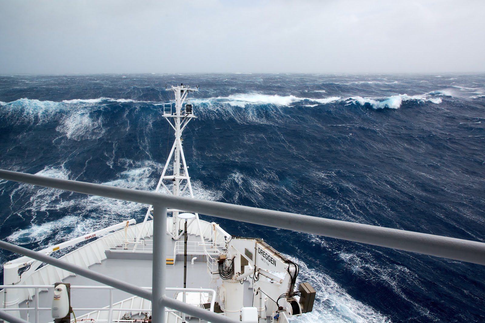
Fig. 5. Stormy seas on board Australia’s R/V Investigator in the Southern Indian Ocean in the Roaring Forties just north of the Kerguelen Plateau. On this particular day the ship’s crew navigated 61 kt winds, 10 m waves. The storm lasted for about 18 hours on the transit to the second study site Broken Ridge (credit: Derya Gürer/CSIRO).
Making waves
Seismic data were acquired with MNF’s new seismic system, consisting of a 40-channel, 500-m-long, 12.5-m group spacing streamer and two GI seismic sources (Fig. 6, 7). Once deployed in the water column and activated, the seismic sources regularly discharge a high-pressure bubble of air, which is generated by compressors powered by the engines of the ship. The sudden release of the bubble creates acoustic waves. Luca is interested in studying the acoustic cross-sections of the seafloor and sub-seafloor produced by the seismic system, and interpreting the stratigraphy, structure, and tectonics revealed by them. He is currently processing these seismic reflection data to produce the best possible images.
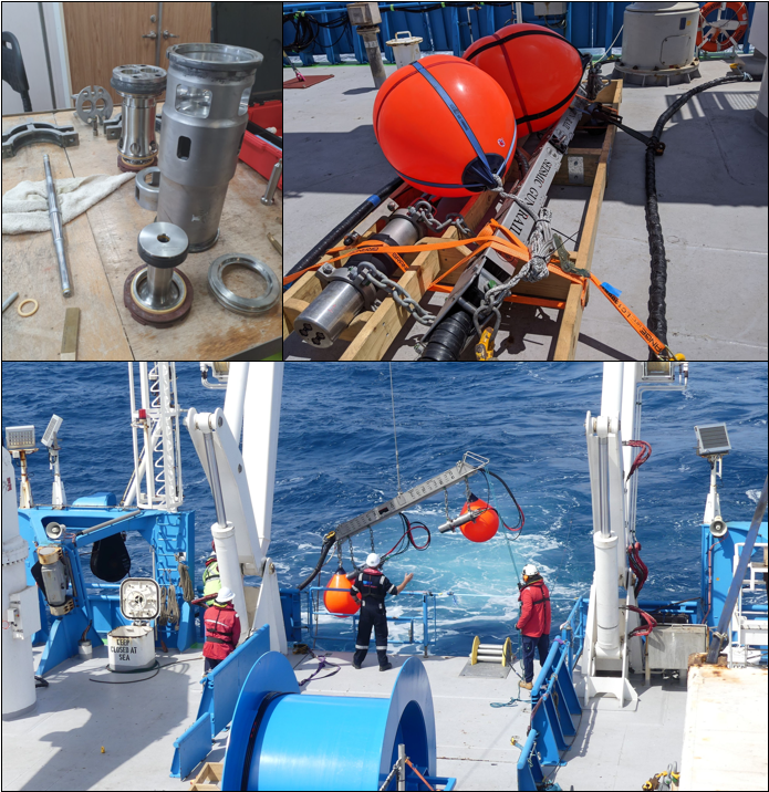
Fig. 6. Disassembled GI airgun (top-left) and GI airguns system (top-right) during the deployment (bottom) (credit: Luca Magri/CSIRO).
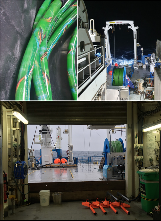
Fig. 7. Close-up of a part of the streamer (top-left) and the after deck of the R/V Investigator with seismic equipment ready to be deployed (top-right and bottom). (credit: Luca Magri, Derya Gürer/CSIRO).
Looking at the preliminary results of the seismic data acquired during the voyage, Luca found that Broken Ridge seems to have the morphological characteristics to be defined as the shoulder of a rift system. Its steep southern slope ascends to water depths as shallow as ~1500 m. From its shallowest point, the seafloor gently slopes northward and does not show evidence for horst and graben structures. However, a set of normal faults that affect the basement and overlying sediment were identified. These observations contrast with previous work in which Broken Ridge was defined as a conjugate end member characterized by the absence of major structures and evidence of lithospheric thinning (Mutter and Cande, 1983; Karner and Driscoll, 1993).
Breaking recods
After 57 days at sea, R/V Investigator returned to port breaking several previous ship records – including longest endurance and greatest distance sailed, largest number of deep (>4000 m) rock dredges, and largest mapped area (>100,000 km2) of the seafloor. The team acquired 1,103 line-km of seismic reflection data, recovered 20 successful dredges, and held a total of 65 seminars. Prof. Coffin concluded that “the data and samples collected during the research voyage, along with results from shore-based petrological and geochemical analyses of the dredged rock samples will be important to reveal the fundamental tectonic, volcanic, and geodynamic processes involved in the evolution of this part of the oceanic lithosphere.” Further, the data collected have implications for extending Australia’s marine jurisdiction, as Prof. Coffin explains “In 2008 the United Nations Commission on the Limits of the Continental Shelf noted that the data Australia submitted for William’s Ridge seemed to give only indirect evidence of its nature and origin, and the Commission was of the opinion that the geological origin of William’s Ridge remained unresolved. Therefore, the Commission did not consider it justified for William’s Ridge to be regarded as a submarine elevation that is a natural component of the continental margin.”
In splendid isolation
While at sea and without seeing land for two months, news of severe bushfires and floods affecting the Australian continent continued to reach the ship. By the second half of the voyage, the news increasingly focused on the COVID-19 virus and pandemic that was making its way to even the most remote corners of the globe, but seemingly still worlds away from the Southern Indian Ocean. The remoteness and solitude the 56 souls on board enjoyed at sea ended when R/V Investigator returned to port in early March to a world that had seemingly changed.
Once back on land, many members of the expedition went into self-isolation in their respective countries. The ship’s next research voyage was cancelled, and it promptly returned to its home port in Hobart, Tasmania, where it remained until late August, as the Marine National Facility/CSIRO had to pause operations due to the pandemic. Back in Brisbane, Derya benefited from the daily routine on the long and remote voyage that equipped her to build resilience, and helped her a great deal with being quarantined at home for the equal amount of time at sea once back on land. She reflected in another post on what scientists can learn in splendid isolation on extended remote research trips at sea and on land. Luca (after having the first pizza in two months in Fremantle) continued his adventure by finding his feet on new territory and moving to Tasmania to a PhD project based on the seismic data acquired during this voyage amidst the pandemic.
During long research fieldworks and expeditions it is easy to lose track of time. The moon is always a good reference point to track time, and the team saw really dark and clear skies and two full moons in the Southern Ocean. Now, many months later, the moon is still a reference point that reminds the team of this unique experience at sea. Gazing at the moon Derya is always reminded that “we know more about the Moon than we know about the bottom of the ocean.” In fact only 19% of the global seafloor has been surveyed to modern standards (Nippon Foundation-GEBCO SEABED 2030 Project). There is so much that remains to be discovered as we are setting sail for the UN Decade of Ocean Science (2021-2030)!

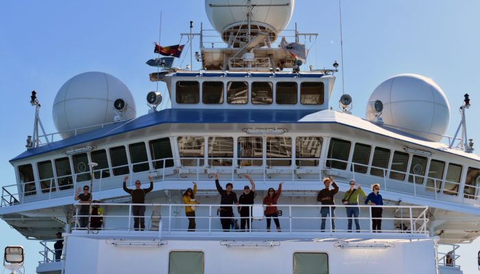
The sailors of IN2020_V01 on the home stretch at the bow of the ship (credit: CSIRO).
Written by Derya Gürer & Luca Magri
Edited by Hannah Davies and Elenora van Rijsingen
Note: Derya and Luca would like to sincerely thank Chief Scientist Prof. Mike Coffin for the opportunity to participate in this voyage and all shipmates aboard IN2020_V01 for this rewarding experience.
References
Coffin, M.F., Frey, F.A., Delius, H., Duncan, R.A. and Inokuchi, H., 2000. Kerguelen Plateau-Broken Ridge: A large igneous province: Covering Leg 183 of the cruises of the Drilling Vessel JOIDES Resolution, Fremantle, Australia, to Fremantle, Australia, Sites 1135-1142, 7 December 1998-11 February 1999. In Proceedings of the Ocean Drilling Program. Part A, Initial report (Vol. 183).
Frey, F.A., Coffin, M.F., Wallace, P.J., Weis, D., Zhao, X., Wise Jr, S.W., Wähnert, V., Teagle, D.A.H., Saccocia, P.J., Reusch, D.N. and Pringle, M.S., 2000. Origin and evolution of a submarine large igneous province: the Kerguelen Plateau and Broken Ridge, southern Indian Ocean. Earth and Planetary Science Letters, 176(1), pp.73-89.
Karner, GD, and NW Driscoll. 1993. ‘Rift flank topography and extensional basin architecture: formation of Broken Ridge, southeast Indian Ocean’, ANAIS-ACADEMIA BRASILEIRA DE CIENCIAS, 65: 263-63.
Mutter, John C, and Steven C Cande. 1983. ‘The early opening between Broken Ridge and Kerguelen Plateau’, Earth and Planetary Science Letters, 65: 369-76.
Nicolaysen, K., Bowring, S., Frey, F., Weis, D., Ingle, S., Pringle, M.S. and Coffin, M.F., 2001. Provenance of proterozoic garnet-biotite gneiss recovered from Elan Bank, Kerguelen plateau, southern Indian Ocean. Geology, 29(3), pp.235-238.
Website link: Feature article in Nature Careers Nature 581 In splendid isolation: the research voyages that prepared us for the pandemic, 487-488 (2020) doi: 10.1038/d41586-020-01457-8
Website link: Nippon Foundation-GEBCO SEABED 2030 Project, https://www.bbc.com/news/science-environment-53119686
Website link: UN Decade of Ocean Science, https://www.oceandecade.org/

Herb Newman
It was an exciting, somewhat dangerous, and the type of trip a younger me would have given his eyeteeth to be on. I hope the data pans out well. The rocks in figure 4 look interesting as did the system in figures 6 & 7. Thanks for a report that let the reader travel with you (at least to some extent).
(I am only a 79 year old hobbyist but for me your report was energizing. I am curious as to how you explain the breakup and then seemingly later insertion of the SEIR. There were different movements in different directions involved at different times? If so, then to escape a random plate movement model, one must factor in the probability that the rotational axis changed orientation somewhat – probably more than once.)