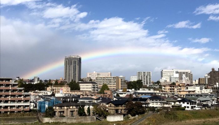
Sendai and its people live on the edge. The city and its citizens learned to live over a subduction zone. Sendai has survived 500 years of hazards; it is a resilient and industrious city. People know disaster will strike again, but also that they will rise up when it does.
Japan, ‘the sunrise country’, would be much better named ‘the land of sinking tectonic plates’. Above the point where the Pacific plate sinks below East Asia and the Philippine Sea Plate, Japan gets the might and helplessness of subduction. Seas and mountains give as much as they take: fish, volcanoes, rice, earthquakes, hot springs, tsunamis and tea. Facing the Pacific to the east and the Ōu Mountains (up to 2000 m) anywhere else, Sendai does not look at the ocean and the ranges, Sendai watches over them. Surrounded by a cluster of active stratovolcanoes, whose hot springs steam their foothills, Sendai attracts tourists to the ski and spa resorts, and at the same time, trembles with fear when volcanoes get angry. Not being enough, Sendai lies over one of the most seismically active subduction sites of the world, and is therefore frequently hit by earthquakes. About every week! Every time Sendai shakes, I feel torn between my geo-heart, that jumps of joy, and my geo-mind, that scares the hell out of me.
Sendai, the capital of Tohoku
Sendai is the unofficial capital of Tohoku, (North East Japan) and the second largest city to the north of Tokyo. Funded by Masamune Date, ‘the one-eyed dragon’, one of the most successful samurai war-lords during the Edo period, Sendai grew around the Aoba castle until its current population of more than one million. The city was completely burned out after the World War II bombings, and grew over its ashes to become a modern, neon light, colorful, 365-24-7-opened city. Although Japanese tend to think of Sendai as a cold city, it has very few days of extreme temperatures, either warm or cold. Here, seasons are well marked. Spring and Autumn are moderate, sunny and dry, and winters are cool, with some snowfall. Summers are warm, really wet, and very sticky, which is not welcoming for drylanders like me, from Castilla y Leon (Spain). Sendai hosts Tohoku University, where I work, one of the oldest and more important universities of Japan.
The Great Tohoku Earthquake of 2011
A shallow megathrust earthquake of magnitude 9.0, with its epicenter 70 km away from Sendai coast, stroke on the 11th of March of 2011. This is the most powerful earthquake measured in Japan, and the fourth of the entire world, and was followed by a series of aftershocks, some of them over 7.0 of magnitude. Although the earthquake couldn’t beat the extraordinary earthquake-proof Japanese engineering, it triggered an unprecedented tsunami that swept Tohoku’s coast away. The tsunami wave, in some points over 40-meter-high, traveled at a speed of 700 km/h in the Sendai area and reached up to 10 km inland. The inhabitants of Sendai had only eight to ten minutes of warning, the roads collapsed and people in shelters could only see their neighbors swept away. The majority of Sendai citizens lost someone in this natural disaster. Everyone that saw such images on TV has them etched in their minds, forever. Now, nine years later, Sendai looks completely renewed after the total destruction by the tsunami. Only Arahama school, left by the beach as the only memorial, reminds us of the devastation and the lives gone by the fury of the Earth.
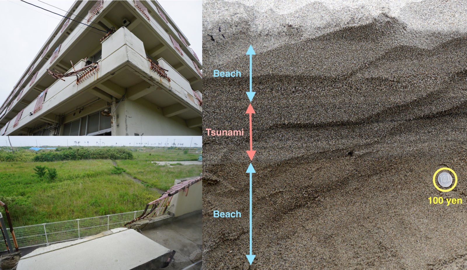
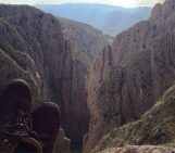
The only places in Sendai where you can know a disaster happened. To the left, Arahama school, the memorial of the Great Tohoku Earthquake and Tsunami. This school, only a few hundred meters to the beach was severely damaged during the earthquake. However, all students survived. To the right, tsunami deposits at the neighbor, Arahama beach. Credit: Daniel Pastor-Galán.
The city that overthrusts the Pacific Ocean plate
Sendai and its surroundings have witnessed a long journey of consumption of oceanic plate below it. Together with the dramatic consequences of subduction in the shape of earthquakes and eruptions, here we have the longest subduction record of the world, from the tsunami deposits of the large Tohoku earthquake that happened 9 years ago to the Cambrian first record of subduction. Beyond the human tragedy, a geologist can see the scars of subduction everywhere in Sendai and its surroundings. The demise of oceanic plates for more than 500 million years wrote many rocky pages in Sendai’s geological book of history. Most of Sendai lays on top of Miocene to very recent magmatic arc rocks, including volcanic tuffs, pyroclastic flows, lavas -mostly andesitic- and alluvial sedimentary rocks, including classical series of thinning upwards from conglomerates to pelitic levels with lots of pumice. These rocks show different structures, such as faults and folds, mostly related to the opening of the Japan Sea, or later subduction events. The recent volcanics are omnipresent in Sendai: The prominent Zao, one of the most active volcanoes in Japan and a major ski and hot-spring resort where sendai citizens spend their winter holidays; The Akiu falls, which erode the rocks that Masamune Date chose to build his castle, and are the favorite place for ‘Imoni-kai’, a Sendai tradition of having soup by the river in October; or Matsushima bay, one of the top three scenic views of Japan according to the greatest poet, Matsuo Bashō, and one of the best places in Japan to eat oysters.
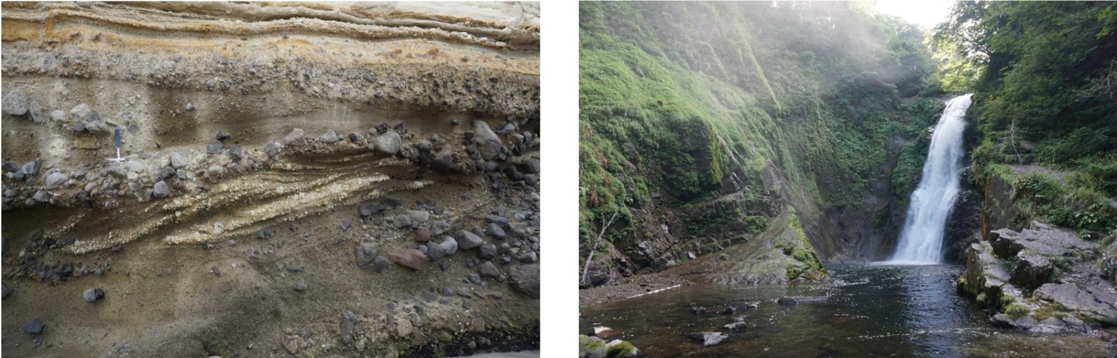
Left: Fluvial facies in Omotehama beach. Conglomerates in channels come from the andesites in the photo on the right. Cross bedding in bars includes relatively coarse grain pumice. The fluvial sequence evolve to a homogeneous tuff on top. Right: Akiu falls in the Akiu andesites and basalts. Credit: Daniel Pastor-Galán.
The geological origins of Sendai and Tohoku are rooted to the subduction initiation of an ocean, possibly a Panthalassic one. The first relics of subduction are scarce within the city boundaries, but abundant not far away. Rocks proving Early Paleozoic subduction crop out at the neighbor city of Hiraizumi, that hosts a UNESCO world heritage buddhist center. These rocks are the very first proof of subduction initiation and development of an arc in all Japan. These rocks crop out together with a succession of Paleozoic, Mesozoic and Cenozoic subduction related rocks in the Kitakami mountains and Sanriku Rias. The area of Sanriku-Kitakami, previously a major beach and mountain area was cruelly hit by the tsunami of 2011. Many villages completely disappeared and beaches have been almost empty for years. Recently people started losing their fear of the ocean, first surfers, and little by little young people and families now enjoy the Sanriku coast again.
Sendai is too well known for the rage of subduction and unfortunately, not so much for the marvelous cicatrices that Pacific-Panthalassa oceans left in its history book of rocks. A book telling the story of a city that overthrust the Pacific Ocean plate, stumbles frequently but always rises back up. Between the sound and the fury, Sendai, my city.
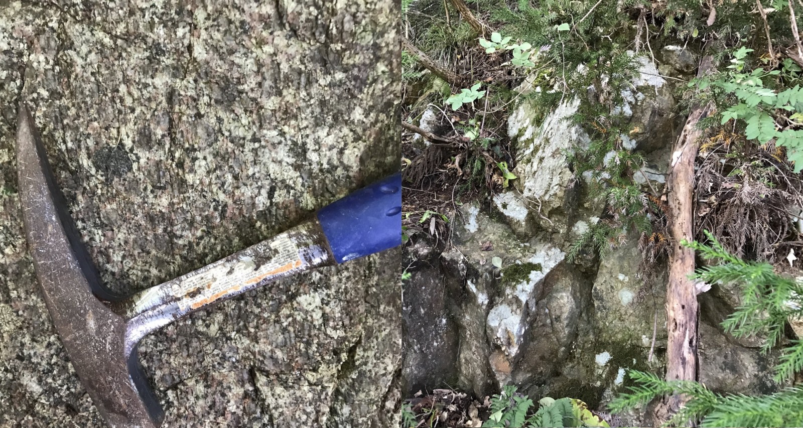
Left: Hikami granodiorite, a Silurian arc related rock. Right: Early Ordovician Pillow lavas. Both to the north of Sendai. Credit: Daniel Pastor-Galán.

xin xian-wu
Remember when the tsunami, there is a female announcer, in order to allow more people to evacuate, would rather die.