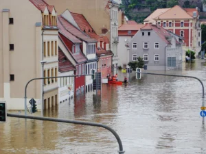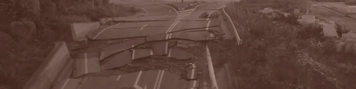
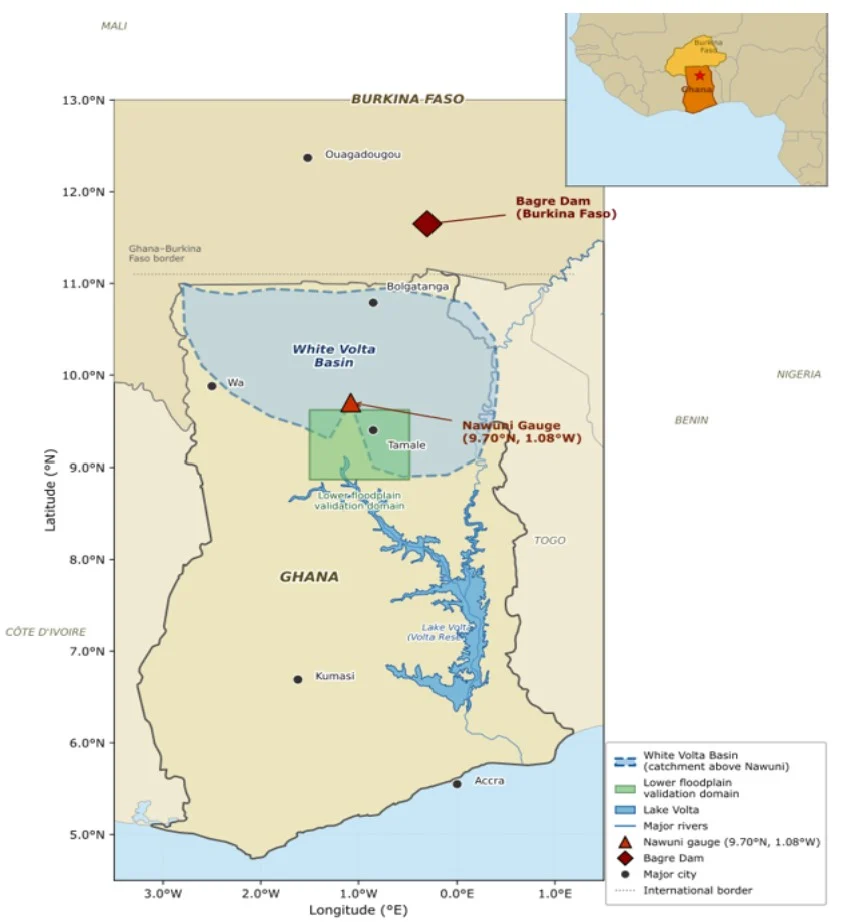
On 25 August 2025, SONABEL – Burkina Faso’s national utility – began releasing water from the Bagre Dam two days ahead of schedule. The reservoir had reached 90% of its capacity, just 0.73 metres below its maximum retention limit [9]. The Water Resources Commission and the National Disaster Management Organization (NADMO) in Ghana issued immediate evacuation advisories for communities along the White and Black Volta rivers. It was, in the words of the Centre for Climate Change and Food Security, a “grave concern” and it was also, to anyone who has studied this basin, entirely predictable. The 2007 Bagre spillage affected over 307,000 people and wiped out more than 12,000 hectares of farmland. In 2018, 17 lives were lost [9]. Each year the pattern repeats: water is released, warnings arrive late or not at all, and communities absorb losses that take multiple growing seasons to recover from. The question is not whether Bagre will spill. It is whether the warning will come in time.
The invisible driver
For the White Volta Basin in northern Ghana, the failure of early warning has a specific and underappreciated cause: the Bagre Dam, sitting approximately 180 km upstream in Burkina Faso. Bagre is one of the largest freshwater reservoirs in Burkina Faso, built for irrigation and hydroelectric generation. When the West African Monsoon fills it during the rainy season, releases can send flood pulses downstream to Ghana within two to three days [3]. Communities in the Central Gonja and Savannah districts have understood this dynamic for generations. The formal warning systems have not caught up.
Ghana’s existing flood forecast platform, myDEWETRA-VOLTALARM, relies on the Global Flood Awareness System (GloFAS) global model output [3]. GloFAS is a creditable system with global reach, but it is calibrated globally and has no explicit representation of Bagre reservoir state. In a basin where the most destructive events are driven not by local rainfall but by operational decisions made across an international border (and where no formal transboundary notification requirement exists) that is a fundamental blind spot [6]. The 2007 flood season, which produced the highest discharge on record at the Nawuni gauging station (2,279 m³/s), was driven by Bagre releases compounding heavy local rainfall. The system that was supposed to warn communities could not see the dam.
A problem hiding in plain sight
There is something almost paradoxical about the White Volta flood problem. The driver is not hidden. It is a large dam, with a known location, a known storage capacity, and a filling pattern that follows the West African Monsoon with reasonable predictability. Satellites have been watching it for decades. And yet the communities most at risk (farming households in some of Ghana’s most food-insecure districts) routinely find out about major releases too late to do much more than move to higher ground and hope.
Part of the reason is institutional. The Bagre Dam was built in Burkina Faso primarily for irrigation, with no formal obligation to notify downstream Ghanaian authorities before a major release [6]. Part of the reason is technical. Ghana’s operational flood forecast platform uses a global model that was not designed with Bagre in mind and has no way to see what is happening inside that reservoir. And part of the reason is something more uncomfortable: the communities most exposed to this risk are rural, poor, and far from the centres of political and scientific attention where early warning systems get designed and funded. Their flood events are underreported in global databases, underfunded in national budgets, and underweighted in the models that decide who gets warned and when.
This is not a problem unique to Ghana. Across sub-Saharan Africa, South Asia, and Southeast Asia, hundreds of millions of people live in transboundary river basins where upstream dam operations drive downstream flood risk across borders with no formal notification infrastructure. The Volta is one basin. In each of these systems, the gap between what satellites can see and what communities actually receive as a warning is not primarily a data problem. It is a governance problem, dressed up as a technical one.What satellites can see that the models ignore.
Our research started from a simple observation: the information needed to warn communities about Bagre-driven floods already exists, openly available, in the satellite record. The Joint Research Centre (JRC) Global Surface Water dataset has been tracking the Bagre reservoir’s surface extent since 1984 [8]. Every major flood year in the White Volta Basin (2007, 2010, 2016, 2019 and 2020) was preceded by the reservoir filling to near its historical maximum – though it fills in most other years too, so a full reservoir tells us the dam can spill, not that it will. That signal is visible from space. It is not visible to the models currently issuing forecasts for this basin.
We built a system that uses this satellite information to account for reservoir filling. Using observed river discharge and openly available satellite data – CHIRPS rainfall estimates [2], ERA5-Land atmospheric reanalysis [4] and the JRC reservoir record – we trained an ensemble of machine learning models to forecast discharge at the Nawuni gauging station, the main monitoring point on the White Volta, at one-, three-, and five-day lead times. The reservoir record feeds directly into the forecast. It also acts as a seasonal “reservoir watch”: when the satellite record shows Bagre at or near capacity, downstream districts are told that the dam is full and capable of spilling, whatever the discharge model is predicting.
We tested the system against two decades of river records at Nawuni (1987–2007), checking each year with a model that had not been trained on it. It caught about nine in ten of the most severe (red-tier) flood days one day ahead, with roughly one false alarm for every six correct red alerts, and about three in four five days ahead [7]. By comparison, the global model currently used for the basin performed worse than simply assuming an average day at Nawuni, because it cannot see the dam. These are tests on past records: the system has not yet been run operationally, and its benefits on the ground still need to be evaluated together with the Ghana Meteorological Agency and NADMO.
The system is designed to slot into Ghana’s existing warning infrastructure at the Ghana Meteorological Agency, NADMO, the Community Disaster Volunteer networks that form the last link in the chain between a forecast and a family deciding whether to move. Alerts are issued in three languages: Gonja, Dagbani and English. Operating the system requires no new institutional infrastructure, no proprietary data and no bilateral agreement with Burkina Faso. The software runs on a standard computer with an internet connection, well within the resources the Ghana Meteorological Agency already has.
From a forecast to a decision
One of the things we have thought hardest about in this work is the distance between a number on a screen and a decision made by a real person under pressure. A forecast that says discharge at Nawuni will exceed 1,900 cubic metres per second in three days is technically precise. But what does it mean to a NADMO district officer who has limited staff, unreliable communications infrastructure, and a community that has been issued warnings before that came to nothing? What does it mean to a farming household that has already moved three times this season?
This is why the paper spends as much time on the alert architecture as on the model performance. We designed a four-tier system (green, yellow, orange and red) whose thresholds come from a flood-frequency analysis of thirty years of wet-season peaks at Nawuni, set at roughly the 1.5-, 2- and 5-year floods [7]. Yellow at five days means community awareness: time to move livestock and harvested stock off the floodplain margins, check on vulnerable neighbours and identify evacuation routes. Orange at three days means pre-positioning relief supplies and opening shelters. Red at one day means evacuation. The tiers are not arbitrary. They are built around what communities and institutions can realistically do with the time they are given. The thresholds and the actions attached to each tier follow established guidance on people-centred and impact-based warning [1,10].
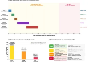
Operational alert cascade from forecast run to community warning delivery. (a) Gantt style timeline showing the five architecture layers and their task sequence after the daily 06:00 UTC forecast run, with lead-time windows for Yellow, Orange, and Red alerts indicated. (b) Community action time available after subtracting the 7-hour institutional cascade. (c) Message format and dissemination channels for each alert tier. (Source: Authors)
The distance between a well-designed warning system and one that actually changes outcomes on the ground is ultimately measured not in model skill scores but in governance capacity and community trust. Civil society surveys suggest that more than 90% of residents along the Volta Basin have never heard of the Volta Basin Authority, the regional body whose mandate covers exactly this kind of transboundary coordination [9]. A technically excellent alert that enters a dissemination chain communities do not trust, or through channels they do not monitor, is not a warning. It is a data point that goes nowhere. Getting the technical signal right is necessary but not sufficient.
A problem worth solving – and not only here
The White Volta Basin is a specific place with a specific history. But the problem it represents is not specific at all. Every transboundary basin in a data-sparse region where upstream decisions drive downstream consequences and where the communities most at risk are the least likely to appear in the databases that global warning systems are built on – faces some version of this challenge. The contribution of work like this is not just a better forecast for one basin. It is evidence that locally calibrated, satellite-informed early warning can be designed for exactly the places where global systems fall short, using data that are largely open and computing resources that national agencies already have. For the communities along the White Volta, the difference this could make is concrete. A five-day warning leaves time to move livestock, seed stocks and harvested grain off the floodplain before the water arrives, which matters enormously in districts where a single flood can wipe out the food and income of several seasons. Messages in Gonja and Dagbani, carried by community radio and the volunteers people already know, reach households that an English-language bulletin on social media does not.
None of this happens on paper alone. Alongside the forecasting work, we are developing the Household experience Reports for Adaptive Local Disaster Response (HERALD), a platform through which flood-affected communities can report, anonymously, what happened to them and whether a warning reached them in time. Reports like these would give us the local knowledge that official Global databases lack: which places flood, how badly, and where warnings fail. We hope to bring HERALD to the White Volta floodplain, working with NADMO and Community Disaster Volunteers so that communities can help set the alert levels and responses that are meant to protect them. A warning system earns trust only if the people it serves have a hand in shaping it.
If you work on early warning systems, transboundary river governance, or flood risk in data-sparse contexts or if you simply have a view on whether we have asked the right questions, we would genuinely like to hear from you.
References
[1] Basher, R. (2006) ‘Global early warning systems for natural hazards: systematic and people-centred’, Philosophical Transactions of the Royal Society A, 364(1845), pp. 2167–2182. https://doi.org/10.1098/rsta.2006.1819
[2] Funk, C., Peterson, P., Landsfeld, M., Pedreros, D., Verdin, J., Shukla, S., Husak, G., Rowland, J., Harrison, L., Hoell, A. and Michaelsen, J. (2015) ‘The climate hazards infrared precipitation with stations: a new environmental record for monitoring extremes’, Scientific Data, 2, 150066. https://doi.org/10.1038/sdata.2015.66
[3] Katsekpor, J.T., Greve, K., Yamba, E.I. and Amoah, E.G. (2025) ‘Flood early warning systems in the White Volta Basin, Ghana: challenges and opportunities’, Journal of Flood Risk Management, e70146. https://doi.org/10.1111/jfr3.70146
[4] Muñoz-Sabater, J., Dutra, E., Agustí-Panareda, A., Albergel, C., Arduini, G., Balsamo, G., Boussetta, S., Choulga, M., Harrigan, S., Hersbach, H., Martens, B., Miralles, D.G., Piles, M., Rodríguez-Fernández, N.J., Zsoter, E., Buontempo, C. and Thépaut, J.-N. (2021) ‘ERA5-Land: a state-of-the-art global reanalysis dataset for land applications’, Earth System Science Data, 13, pp. 4349–4383. https://doi.org/10.5194/essd-13-4349-2021
[5] Nkegbe, P.K., Abu, B.M. and Issahaku, H. (2017) ‘Food security in the Savannah Accelerated Development Authority Zone of Ghana: an ordered probit with household hunger scale approach’, Agriculture & Food Security, 6, 35. https://doi.org/10.1186/s40066-017-0111-y
[6] Obeng, J., Yuan, H., Chen, T., Huang, L. and Baryomunsi, A.J. (2026) ‘Governing the warning chain: socio-technical misalignment in flood early warning systems in Ghana’, Progress in Disaster Science, 31, 100650. https://doi.org/10.1016/j.pdisas.2026.100650
[7] Obeng, J.J., Yuan, H., Chen, T. and Huang, L. (2026) ‘From forecast to alert: an open-data AI flood early warning system with reservoir monitoring for the White Volta Basin’, Natural Hazards and Earth System Sciences (in press). Preprint: https://doi.org/10.5194/egusphere-2026-2168
[8] Pekel, J.-F., Cottam, A., Gorelick, N. and Belward, A.S. (2016) ‘High-resolution mapping of global surface water and its long-term changes’, Nature, 540, pp. 418–422. https://doi.org/10.1038/nature20584
[9] Tetteh, E. (2025) ‘Bagre Dam Spillage: CCCFS demands urgent action as flood fears mount’, MyJoyOnline, 26 August. Available at: https://www.myjoyonline.com/bagre-dam-spillage-cccfs-demands-urgent-action-as-flood-fears-mount/
[10] World Meteorological Organization (WMO) (2015) WMO Guidelines on Multi-hazard Impact-based Forecast and Warning Services (WMO-No. 1150). Geneva: WMO.
Blog post edited by: Harriet Thompson and Hedieh Soltanpour