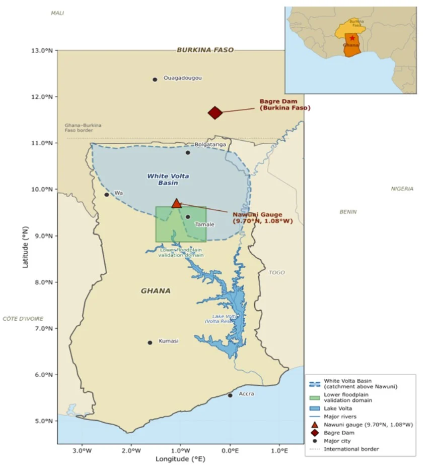
On 25 August 2025, SONABEL – Burkina Faso’s national utility – began releasing water from the Bagre Dam two days ahead of schedule. The reservoir had reached 90% of its capacity, just 0.73 metres below its maximum retention limit [9]. The Water Resources Commission and the National Disaster Management Organization (NADMO) in Ghana issued immediate …[Read More]
The dam upstream: why flood warnings fail the White Volta Basin and what we can do about it