Climate research questions tend to focus on the future. What will global temperature be in 2100? Will extreme weather events become more frequent? When will sea level rise render coastal homes uninhabitable? But our understanding of climate processes first comes from observing the past: palaeoclimatology. To get these records, scientists often go on fieldwork to collect samples. But what happens w ...[Read More]
Image of the Week — Into Iceberg Alley
Crew in hardhats and red safety gear bustle about, preparing our ship for departure. A whale spouts nearby in the Straits of Magellan, a fluke waving in brief salute, before it submerges again. Our international team of 29 scientists and 2 science communicators, led by co-Chief Scientists Mike Weber and Maureen Raymo, is boarding the JOIDES Resolution, a scientific drilling ship. We’re about to jo ...[Read More]
Image of the Week – Seven weeks in Antarctica [and how to study its surface mass balance]
After only two months of PhD at the Laboratoire de Glaciologie of the Université libre de Bruxelles (ULB, Belgium), I had the chance to participate in an ice core drilling campaign in the Princess Ragnhild coastal region, East Antarctica, during seven weeks in December 2018 – January 2019 for the Mass2Ant project. Our goal was to collect ice cores to better evaluate the evolution of the surf ...[Read More]
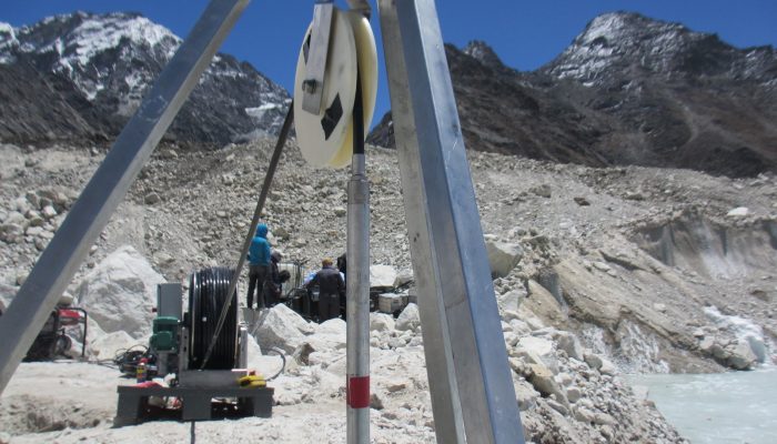
Image of the Week – Drilling into a Himalayan glacier

How water travels through and beneath the interior of debris-covered glaciers is poorly understood, partly because it can be difficult to access these glaciers at all, never mind explore their interiors. In this Image of the Week, find out how these aspects can be investigated by drilling holes all the way through the ice… Hydrological features of debris-covered glaciers Debris-covered glaciers ca ...[Read More]
