I really like to combine science and art. This puts science in a larger perspective and can help understand it in different ways. And perhaps more importantly, it evokes emotion. I wrote haikus and created stencils for every chapter of my PhD thesis. I created these artworks to illustrate the dimensions of the permafrost region and the consequences of global warming on permafrost. Let me show you my artworks and explain the story behind them.
About the art
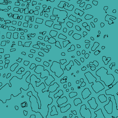
A haiku is a short Japanese poem with seventeen phonetic units (similar to syllables). Traditionally, motifs of haikus are close to nature and often hold some mention of seasons or seasonal changes. My haikus focus on the aspect of nature: I describe some of the study sites of my work in Siberia. In some haikus, I refer to landscape changes on a seasonal to decadal scale. In others, I describe a rather static situation to illustrate the impressive view and size of the sites. I also refer to my love for nature and bird watching. You can listen to me reading the haikus below the images. The stencils I created are permafrost landscapes as seen from the sky. More specifically, I took satellite images and created the outlines of the permafrost landscape features. Observing permafrost from above is not unusual: some researchers monitor changes in permafrost landscapes using satellite images, drones and other remote sensing data.
My science
A recent study showed that the Arctic is warming four times faster than the global average. This affects permafrost landscapes throughout the Arctic. You may not know what permafrost is yet: we refer to permafrost as ground that remains below 0 °C for at least 2 years, regardless of the changing seasons. To learn more about permafrost ground, you can take a look here or here. As permafrost sediments thaw, the organic matter (such as plant remains) stored in these deposits becomes increasingly accessible to microbes. By decomposing the organic matter, the microbes produce and release greenhouse gases, which can reach the atmosphere and contribute to global warming. In my PhD project, I studied how permafrost thaw affects the storage of organic matter in deep (>3 m depth) ice-rich (>20 % ice by volume) permafrost deposits. Such deposits are common throughout the Arctic and are vulnerable to permafrost degradation (the term used to indicate the thawing of permafrost), which can occur relatively quickly for example below thermokarst lakes (haiku 2 and 3), along rivers and coasts (haiku 4) and on exposed slopes (haiku 5). Let’s start at the very beginning, a very good place to start.
1. Introduction
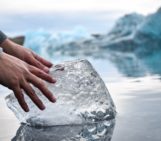
This haiku describes my first introduction into permafrost science during my semester abroad in Longyearbyen, Svalbard, in 2016. I would often walk down to the fjord and watch the mountains on the other side of the fjord and the very long sunsets. The mountains and water always displayed different colors. This magnificent sight made me feel very small. We went on field trips on snowmobiles to study the features of permafrost landscapes such as patterned ground and ice wedges. Ice wedges form in permafrost soils because of repeated thermal cracking, water infiltration and freezing. Ice wedges can become meters high and wide, real big ice monsters! Apparently, it is also really impressive to hear the cracking sound in autumn, although not many people have the opportunity to experience that. In his article on the sound and speed of ice-wedge cracking in the Canadian Arctic, Mackay (1993) described the sound to be similar to lake ice cracking, a rifle shot or like “a bang comparable to the launching of a mortar”. Impressive indeed! These ice wedges form polygonal ground, which is especially nice to see from above, as the stencil shows.
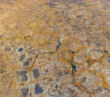
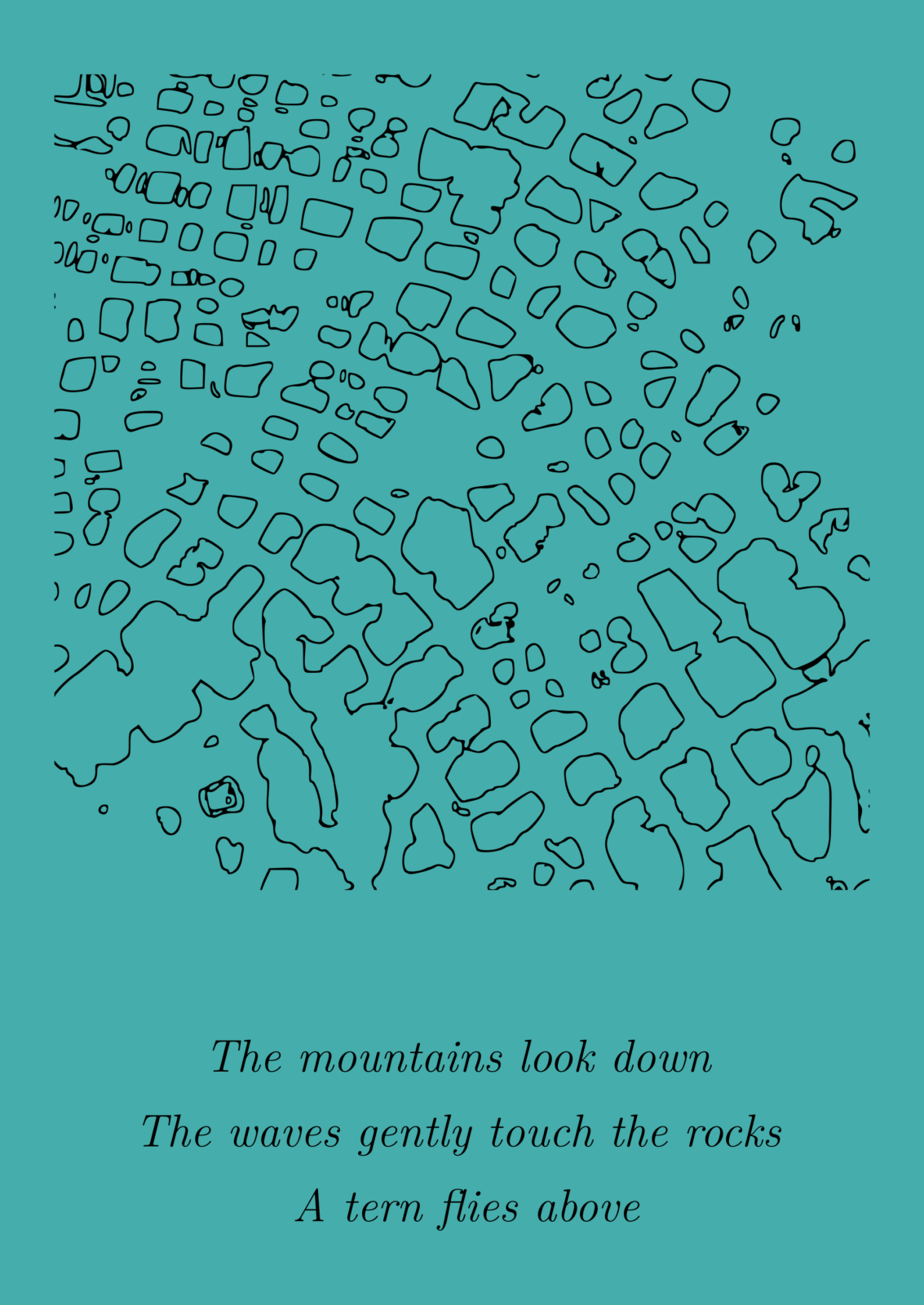
2. Bykovsky Peninsula
The Bykovsky Peninsula is located on the coast of the Laptev Sea, southeast of the Lena Delta, in northeastern Siberia, and is the first study site presented in my thesis. Here, we can find very ice-rich permafrost deposits (they include large ice wedges!). Furthermore, there are many thermokarst lakes, which form because of the thawing of ice-rich permafrost and the melting of ground ice. These lakes can make the landscape look like a big cheese with holes in it (see the stencil), yummy! In my work, I focused on biomarkers, which are molecular fossils from once living organisms. They can tell us something about the origin of the organic matter found in the permafrost sediments and how well it was preserved under frozen (or thawed) conditions. I spent many hours in the biochemistry lab preparing and analyzing samples. As the permafrost erodes on this peninsula, the thermokarst lakes are eventually submerged by the sea, turning them into thermokarst lagoons. This is also what the haiku describes: the fresh water lake that I studied and all surrounding sediments will be swallowed by the sea. So it is a very dynamic landscape!
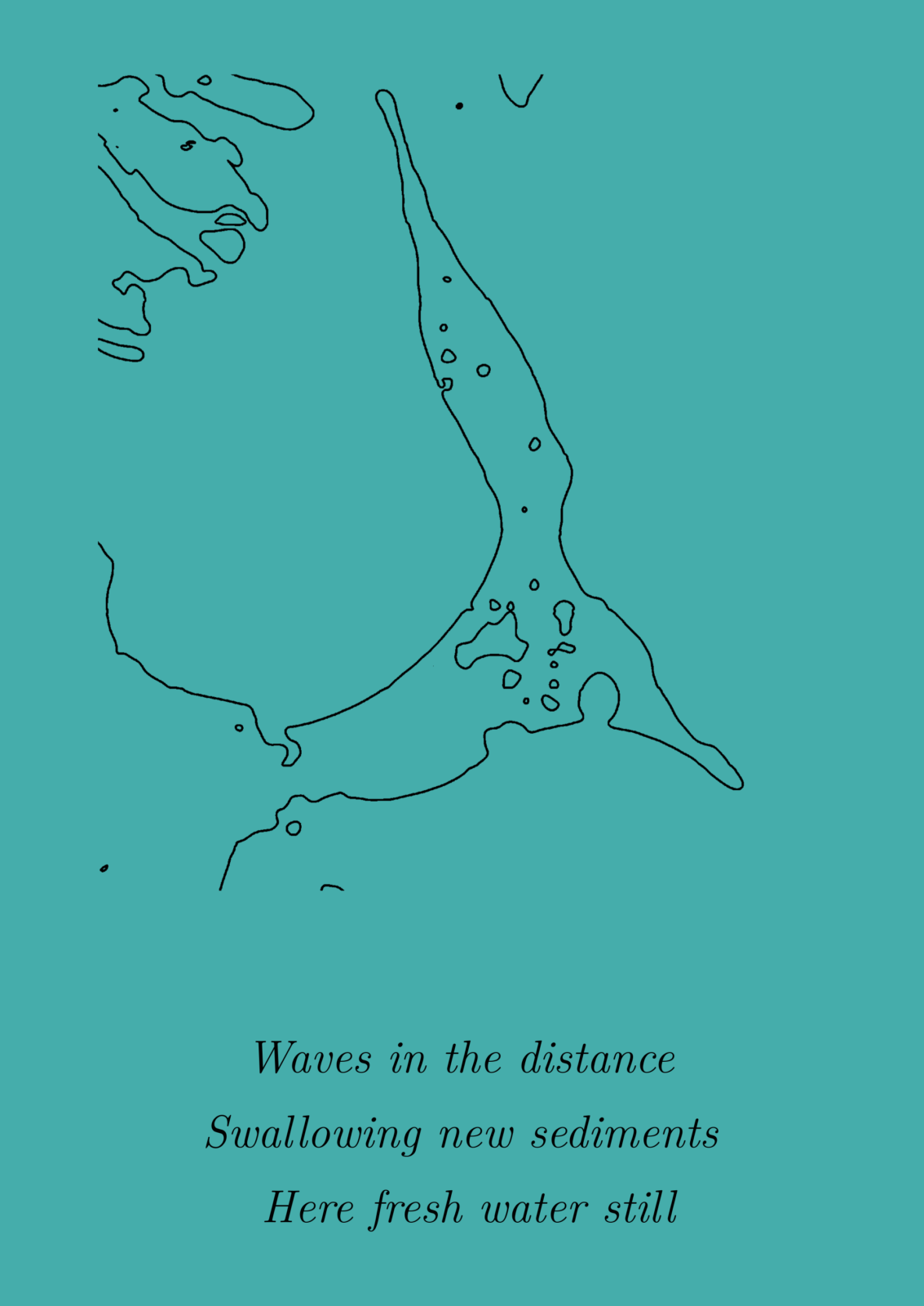
3. Yukechi Alas
The Yukechi Alas is a region in Central Yakutia that contains many thermokarst lakes. When the lakes grow deep enough (>2 m), the lake ice no longer freezes to the ground in winter. This means that the water temperature on the bottom of the lake is higher (>0 °C) than the temperature of the surrounding permafrost sediments (<0 °C) and so the sediments below the lakes thaw down to tens of meters deep. The size of the lake also determines the thawing depth. In the thawed sediments, microbes start decomposing organic matter, thereby producing and releasing greenhouse gases. Considering the large number of thermokarst lakes with deep thaw bulbs underneath, there is an impressive reservoir of thawed sediments where greenhouse gases can be produced all year round! When thermokarst lakes drain, permafrost can return and eventually, a new thermokarst lake can form in the refrozen drained lake basin. In the stencil, you can also see this: the larger shapes are old drained basins and the smaller shapes are younger lakes that may form in the ice-rich permafrost or in an older basin. The haiku illustrates the dynamics of thermokarst lake formation.
4. Sobo-Sise cliff

The Sobo-Sise cliff is a river cliff in the Lena Delta. The Lena Delta is the largest delta in the Arctic: it discharges staggering amounts of water and sediment into the Laptev Sea every year. There are about 1500 islands in the delta, and one of them is the Sobo-Sise Island. Thick ice-rich permafrost deposits from the late Pleistocene, also known as Yedoma permafrost, cover a large part of the island. Each year, the northern cliff of the island erodes rapidly with an average rate of 15.7 meters per year (see this study). Considering the short time period that the Lena River is ice-free during the summer months (June-September), this means that each month, the 22-meter high cliff shrinks the island by about four meters. A very remarkable song indeed (see the haiku)! This erosion process transports huge amounts of sediments including organic matter and nutrients into the river each year. It is still largely unknown how this phenomenon affects aquatic systems. For example, the increased sediment load could reduce light conditions in the water and alter the food web.
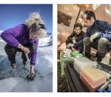
5. Batagay thaw slump
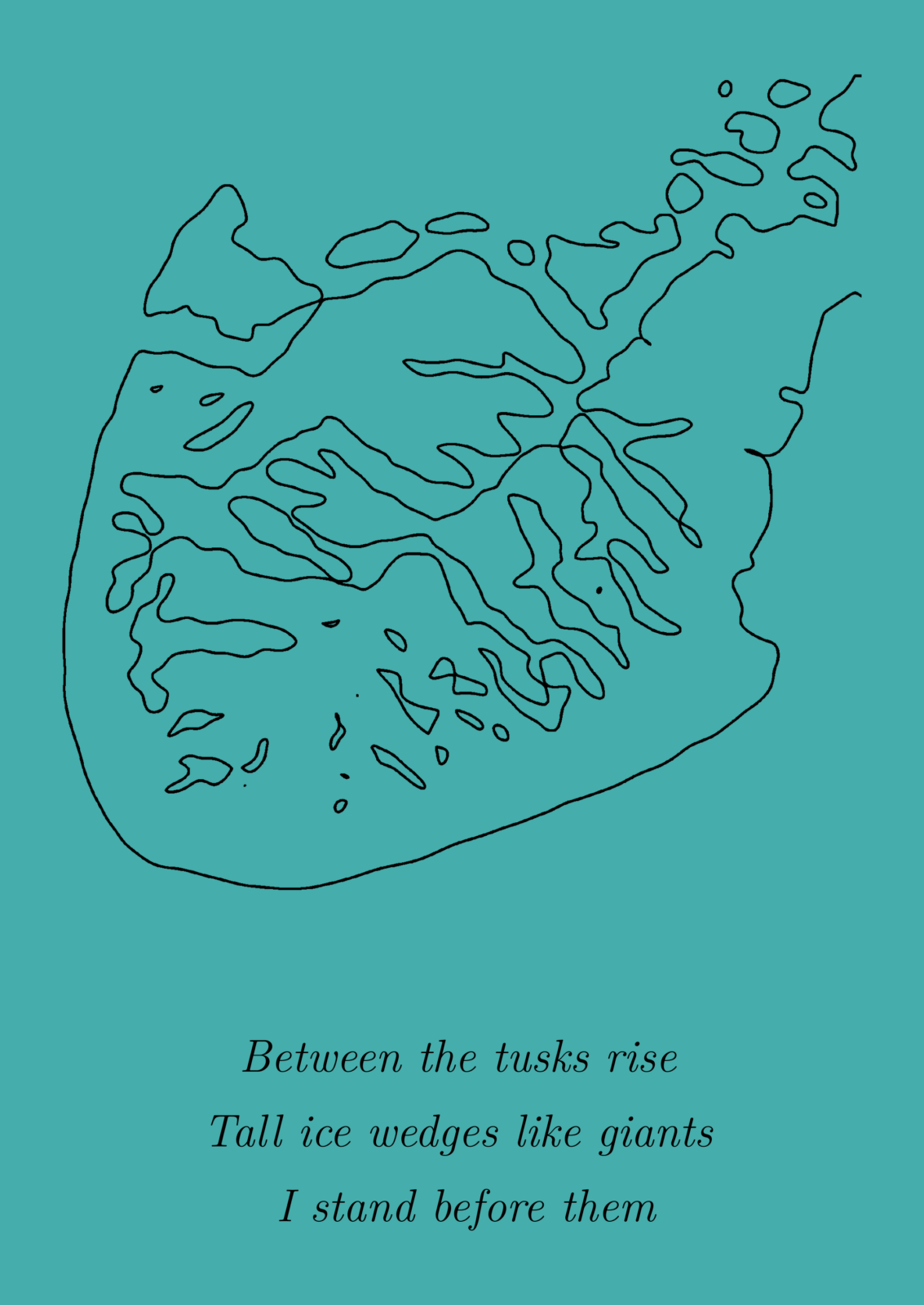
Visiting the Batagay thaw slump was definitely a highlight of my PhD project. This is an impressive open scar in the permafrost landscape that is growing fast. The expedition took place in spring, because this season makes it easier to get around and work: the top soil layer is still frozen and so it is not muddy and soggy, which makes it possible to travel with for example an all-terrain vehicle called vezdekhod (Russian: Вездеход) or “anywhere goer”. And furthermore, there are no mosquitos! This region has a strong continental climate with very cold winters (average air temperature: 40 °C) and mild to warm summers. Lately, we can even say that the summers are hot: in June 2020, scientists recorded a scorching 38°C during a heat wave in the nearby town Verhkoyansk. Retrogressive thaw slumps form when ice-rich sediments on a slope thaw, tumble and slump down the slope. The thaw slump in Batagay is the largest known in the world: when I was there in 2019, it was about 890 m wide and the headwall (along the head of the tadpole-shape, see the stencil) 55 m high! I stood in front of this extraordinary wall with its huge ice wedges (see the haiku). Another cool fact is that we can find very old permafrost sediments here: the second oldest directly dated in the Northern Hemisphere (~600,000 years BP; see this study). They have survived multiple glacial/interglacial cycles!
6. Synthesis
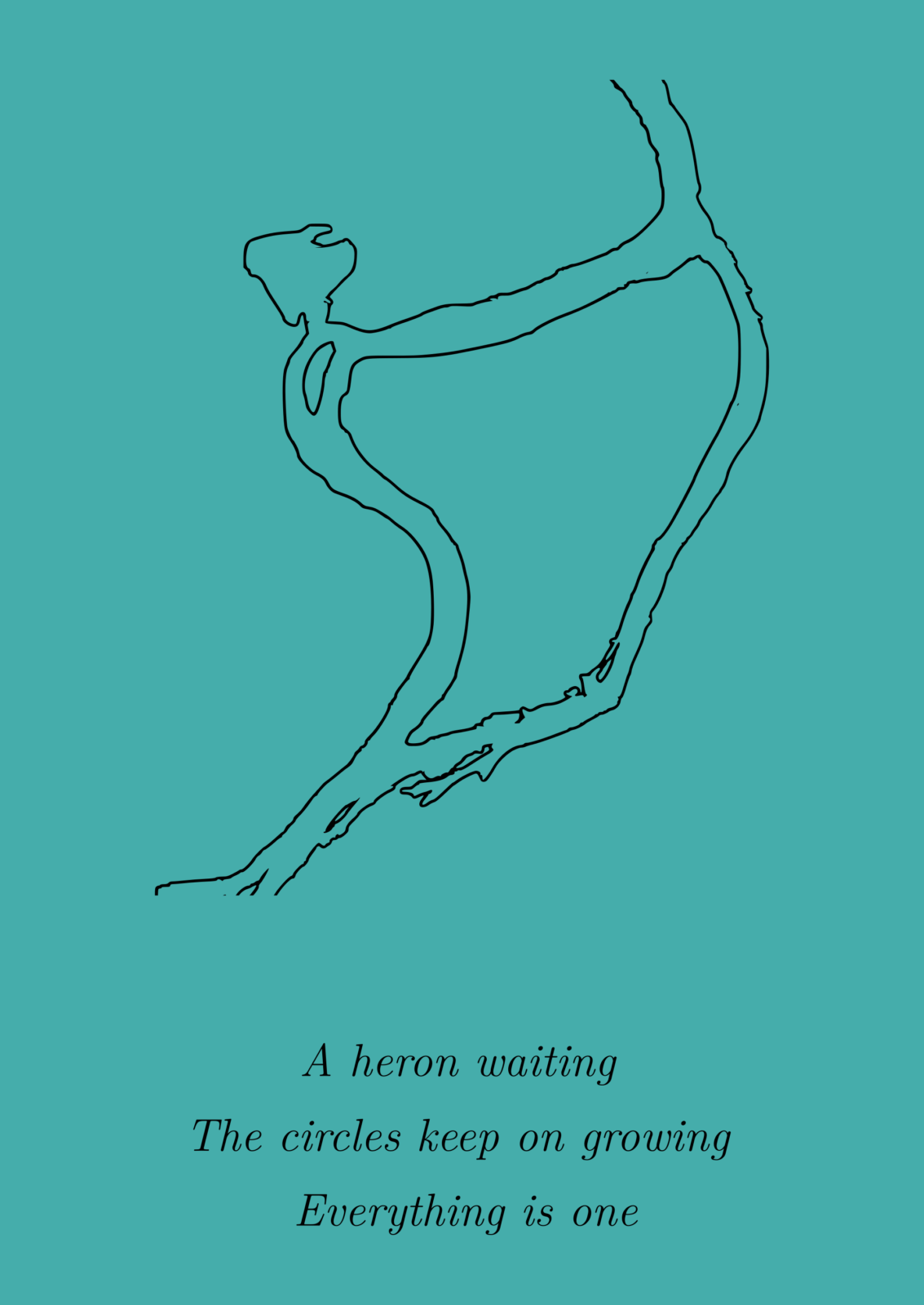
This last stencil shows a part of the Ambaryana River near Norilsk. In this region, a huge oil spill took place in May 2020. Large amounts of diesel oil (>20,000 tons) polluted an area of about 180,000 m² after a diesel tank collapsed. Thawing of permafrost ground probably caused the collapse of the tank: as ground ice in ice-rich permafrost deposits melts, the surface can subside by tens of meters. Especially when the ground ice is not evenly distributed, this has large impacts for the infrastructure such as houses, roads or pipelines. I also picked this place for the haiku because the river coming together symbolizes for me a synthesis. That is, a synthesis of my thesis but also on a larger scale. This disastrous event represents the manifolds impacts of climate change in the Arctic. To understand the impact of climate change on permafrost landscapes and the implications on livelihoods in the Arctic, we need to integrate knowledge across academic disciplines and involve non-academic stakeholders in all phases of research. So we need a synthesis of people! Also, this part of the river looks a bit like a dancer. Or maybe you see yet other things in it :-).
Credits for all images and media shared in this post go to the author, Loeka Jongejans
Further reading
- Previous blog post by Maria Scheel about permafrost microbes: It’s getting hot in here: Ancient microbes in thawing permafrost
- Loeka’s previous permafrost poetry post: You left us to early: a eulogy to permafrost
- Oxford Polar Forum podcast episode about permafrost thawing: Carbon in the Ground 3: A landscape like butter
Edited by Ugo Nanni and Giovanni Baccolo
 Loeka Jongejans just received her doctoral degree in geosciences at the University of Potsdam and the Alfred Wegener Institute, Potsdam, Germany. She researched the greenhouse gas potential from permafrost sediments following permafrost thaw. For this, she went on field expeditions to the Russian Arctic and analyzed sediment samples in biochemical laboratories. She likes science communication such as organizing science events for school kids and students, and writing science poems. Loeka is one of the chief editors of the EGU_Cryosphere blog. She tweets as @JongejansLoeka. Contact email: loeka.jongejans@live.nl