Beneath dusted peaks of mountain dew
A dense and rigid backcloth skulks,
Worn down and compacted with
Fractured decades of aged powder;
Trodden into rocky outcrops
To lie barrenly against
This frozen, ancient soil.
Subtle shifts of these forgotten rocks
Ripple across subterranean sediments,
Dislodging once-stable foundations
That now cascade like an ocean;
Echoing across the fragile firmament
To loudly denounce their buried past.
Beneath the jutting shadows
Of glaring, metallic stations
We bore artificial holes,
Treading carefully
As we silently caress exposed skin;
Mapping the resistance to our touch
Like goose bumps
Rising to the surface
On a withered, sun-kissed limb.
Charting out these imperfections
Reveals the unevenness
Of our approach,
As broken consequences
Reverberate beneath our feet;
An unheard shot across the bow.
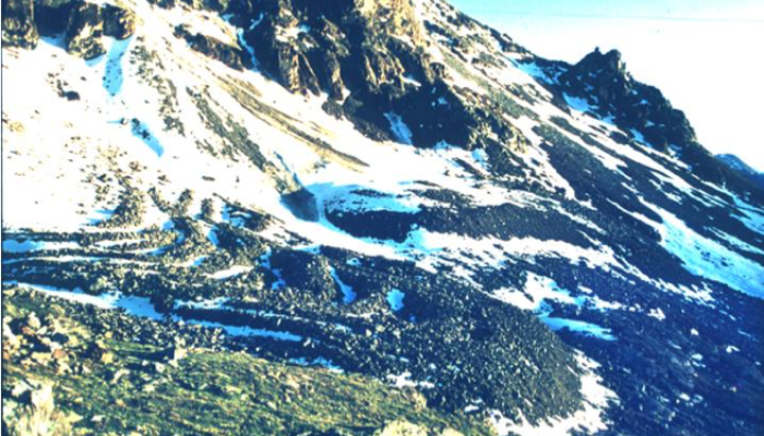
This poem is inspired by recent research, which has found that there has been a clear degradation in mountain permafrost across the central Alps over the past two decades.
Permafrost is permanently frozen ground, consisting of rock or soil that has remained at or below 0ºC for at least two years. In Europe, Arctic permafrost is found only in the northernmost parts of Scandinavia, meaning that mountain permafrost is the dominating permafrost across the continent. This permafrost influences the evolution of mountain landscapes and can severely affect both human infrastructure and safety, with permafrost warming (or thawing) affecting the potential for natural hazards, such as rock falls. Mountain permafrost is also sensitive to climate change and has been affected by a significant warming trend across the European Alps over the last two decades. However, as this permafrost occurs across a large variety of very different locations, any warming trends are far from uniform, and in order to better understand these changes more accurate monitoring is required.
The researchers in this study made use of Electrical Resistivity Tomography (or ERT), a technique which involves inducing a current in the ground, and then measuring the extent to which the flow of this current is resisted (see this previous post). Any resistivity will depend on what the subsurface structure looks like, and it can be used to map geologic variations such as fracture zones, variations in soil structure, and the presence of permafrost. By using long-term ERT monitoring across a network of permanent sites in the central Alps, this research has demonstrated that there has been a noticeable degradation in mountain permafrost over the past 19 years across this region. The researchers have also demonstrated that a degradation is detectable across shorter timescales, a finding which is significant for better understanding the impacts of climate change across the region.
Further reading
- Mollaret, C., Hilbich, C., Pellet, C., Flores-Orozco, A., Delaloye, R., & Hauck, C. (2019). Mountain permafrost degradation documented through a network of permanent electrical resistivity tomography sites. The Cryosphere, 13(10), 2557-2578.
- Global Terrestrial Network for Permafrost data for Murtèl-Corvatsch
- Guardian article on rockfalls in the Swiss Alps
- Image of the Week – Powering up the ground in search for ice
- Sam Illingworth’s website
The poem and blog post was written by Dr Sam Illingworth, and also features on his website here.
Edited by Jenny Turton
 Dr Sam Illingworth is a senior lecturer in science communication at Manchester Metropolitan University, UK. His research focuses on how science can be used to empower society through creative tools and products. To read more of Sam’s poetry and blogs, and to listen to more podcasts, visit https://www.samillingworth.com/. He tweets from @samillingworth.