Although traditionally used to study earthquakes, like today’s M 8.1 in Mexico, seismometers have now become so sophisticated they are able to detect the slightest ground movements; whether they come from deep within the bowels of the planet or are triggered by events at the surface. But how, exactly, do earthquake scientists decipher the signals picked up by seismometers across the world? And mo ...[Read More]
Imaggeo on Mondays: Sediments make the colour
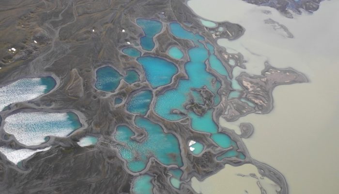
Earth is spectacularly beautiful, especially when seen from a bird’s eye view. This image, of a sweeping pattern made by a river in Iceland is testimony to it. The picture shows river Leirá which drains sediment-loaded glacial water from the Myrdalsjökull glacier in Iceland. Myrdalsjökull glacier covers Katla, one of Iceland’s most active and ice-covered volcanoes. A high sediment load (the suspen ...[Read More]
GeoSciences Column: Can seismic signals help understand landslides and rockfalls?
From the top of a small gully in the French Alps, a 472 kg block is launched into the chasm. Every detail of it’s trajectory down the slope is scrutinised by two cameras and a network of seismometers. They zealously record every bounce, scrape and tumble – precious data in the quest to better understand landslides. What makes landslides tick? In 2016, fatalities caused by landslides tipped 2 ...[Read More]
GeoTalk: Beatriz Gaite on why videos are a great tool for communicating your research to a broad audience
If you’ve not heard about our Communicate Your Science Video Competition before it gives early career scientists the chance to produce a video up-to-three-minutes long to share their research with the general public. The winning entry receives a free registration to the General Assembly the following year. In this GeoTalk interview, Laura Roberts talks to Beatriz Gaite an early career scientist wh ...[Read More]