Floods are powerful natural events that can wreak havoc on communities and ecosystems. Every year, millions of people are affected by floods, leading to loss of life, damage to homes, and disruption of daily life. This blog post explores a new method for quickly mapping flood zones and predicting their impacts. To help communities and decision-makers better prepare, the authors of a recent publication by our Geoscientific Model Development journal present a model that uses existing river discharge data to create rapid, accurate flood maps. The model, integrated into the CLIMADA platform, can assess flood risks for entire countries in just a few minutes. Tested in Pakistan, this tool offers valuable insights for managing flood risks and improving disaster response.
Imagine this: you’re curled up on your couch with a hot cup of tea, watching the rain gently tap on the window. It seems peaceful—until it’s not. Suddenly, that quiet drizzle becomes a downpour, the streets outside are turning into rivers, and before you know it, there’s a flood. It’s one of nature’s most powerful and unpredictable forces, worsened by climate change, and every year it claims the lives of many people, leaves millions of others displaced, destroys homes, and renders entire communities in a long struggle to recover from the damages. But floods aren’t just bad luck or accidents—they’re part of a larger story that’s getting more intense as our planet warms. With climate change in full swing, floods are becoming more frequent, more severe, and more widespread. In fact, the number of people exposed to floods and other natural disasters has been steadily climbing over the years. The worst part? It’s often those least prepared and most vulnerable who bear the brunt of it. Lukas Riedel et al. authors of this publication, say that
Displacement further causes severe humanitarian impacts, with challenges in providing adequate shelter, food, clean water, health care, and long-term support to affected populations. Displaced children in particular are at risk of exploitation and abuse and being exposed to malnutrition and disease.
Scientists are working tirelessly to develop ways to predict floods before they strike—almost like having a weather report that tells you not just when it’ll rain, but exactly which streets, neighbourhoods, or even entire cities will be underwater.
So, how do these predictions work?
This is all part of a growing field called flood modelling. Here’s how it works: think of it like a virtual simulation of how water moves through the world. Scientists feed tons of data—weather forecasts, river levels, historical flood records—into complex models. These models then simulate how rainfall or storm surges might turn into flash floods, river overflows, or coastal inundations. From there, they create maps that show exactly which areas are most at risk and how deep the water might get. The best part? These simulations are becoming so efficient that in some cases, they can model entire countries within minutes!
Of course, the process isn’t without its challenges. To model something as chaotic as a flood takes serious computing power. We’re talking supercomputers with hundreds of processors running for hours. But despite these challenges, the results are ground-breaking. In fact, researchers have even developed models that can simulate floods on a global scale, helping governments plan for future disasters.
Take, for instance, the work being done with the Global Flood Awareness System (GloFAS). This system uses real-time river data to predict flood risks around the world, creating maps that show not just where floods might happen, but also how they could impact people living in those areas. For countries like Pakistan, which has faced devastating floods in recent years, this kind of predictive technology could be a game-changer, and could help communities prepare and reduce the number of people displaced by floods.
How are advanced models mapping out flood risks?
The flood model described here works like a smart system that predicts flood patterns based on river data. It takes global river discharge information (the amount of water flowing through rivers) and uses a type of mathematical analysis called “extreme value analysis” to estimate flood risks. Essentially, the model looks at past river data, figures out how bad future floods could be, and creates flood maps showing which areas are likely to be affected.
Here’s how it works in simpler steps:
- Gathering River Data: The model uses global river flow data from the GloFAS system, which tracks river levels and forecasts floods worldwide. The data covers both historical events (going back to 1979) and current forecasts.
- Fitting a Model: For each location, the model checks how often extreme river levels have occurred in the past and fits a “Gumbel distribution” (a statistical model) to this data to predict how often similar events might happen again.
- Creating Flood Maps: By linking the river discharge data to pre-made flood hazard maps (which show where and how deep floods could be), the model creates a visual footprint of potential floods.
- Adding Protection Info: It also factors in whether certain areas have flood defences, like dams, to adjust predictions for places that are better protected.
- Final Output: The model generates maps showing where floods might occur, how deep the water will get, and the likely impact on communities.
Pakistan’s 2022 floods: The case study
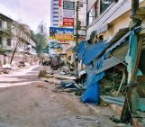
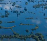
In the summer of 2022, Pakistan faced one of its most catastrophic floods ever, with a perfect storm of high temperatures, glacier melt, and relentless monsoon rains. Over 30 million people were affected, with more than 20 million needing humanitarian help. But amidst the chaos, there’s a silver lining: this flood event provided researchers with valuable data to improve flood prediction and response systems.
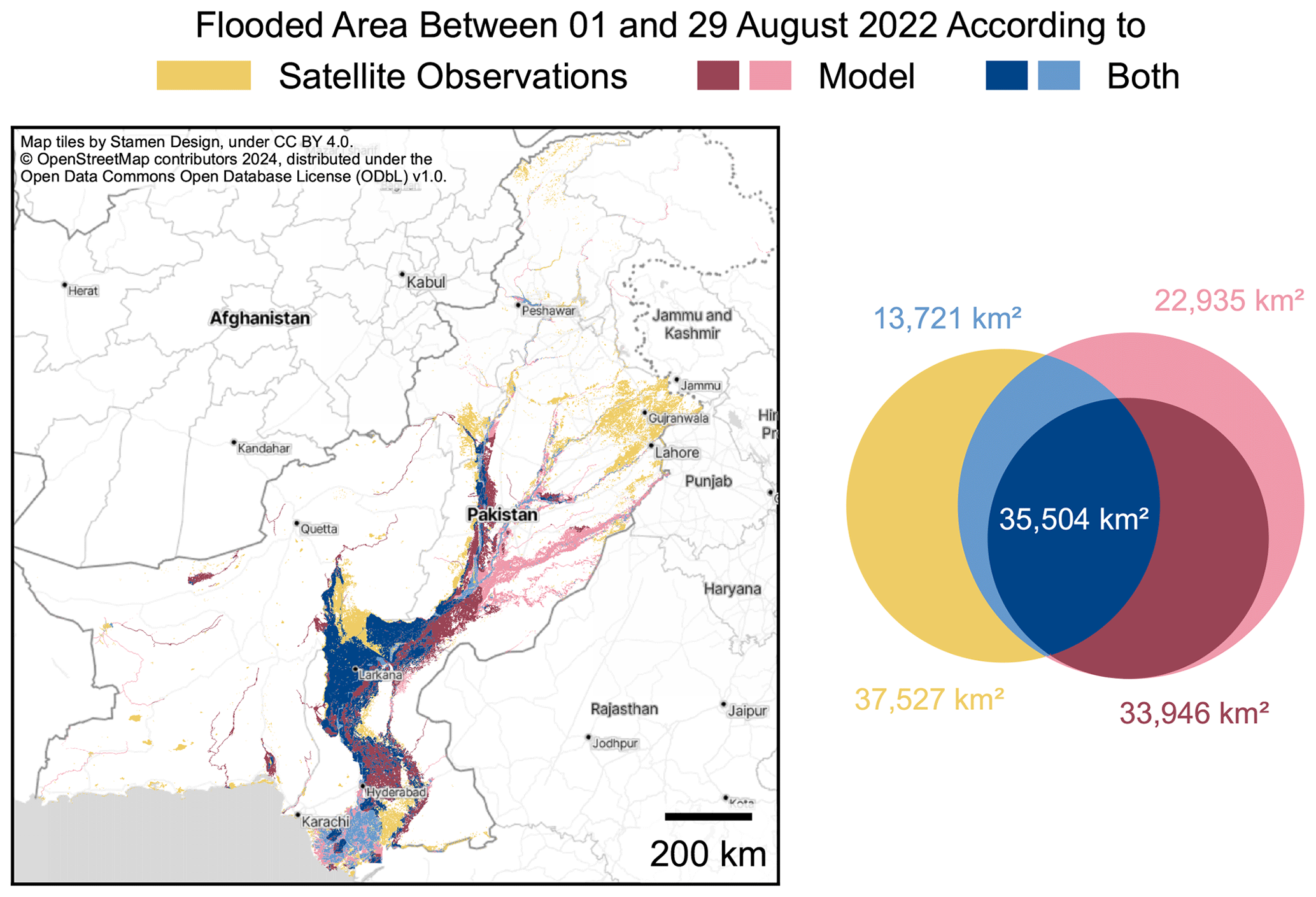
The researchers used a powerful flood model to analyze this event, comparing predictions with actual satellite data. Their goal? To see how well their model could forecast flood extents and help us better understand future risks. They even factored in whether flood defences, like dams and levees, made a difference. The results showed that while the model did a good job in some areas, it missed others—especially in regions with weaker flood protection.
Predicting the impact on displacement
Using data from Sindh Province, where millions were displaced, the team calibrated their model to see how flooding directly impacts population displacement. By plugging in real-world population and flood data, the model estimated how many people would be forced from their homes depending on how deep the water got. The model was then used to predict future flood impacts, not just for the 2022 disaster but also for potential floods in 2023.
On impact-based forecasting
The study didn’t stop with the 2022 floods—it also explored how well the model could predict future floods and their impact. During the 2023 monsoon season, the researchers used river discharge forecasts to predict possible displacement from floods in real-time. The results were striking: in one scenario, up to 255,000 people could be displaced without flood protection. By considering uncertainty and various flood models, the team is better equipped to give early warnings and help vulnerable populations prepare.
Final reflections:
The model presented in this paper turns river flow data into actionable flood maps with impressive speed and global reach. This could definitely revolutionise disaster preparedness. Imagine governments and humanitarian organizations receiving early warnings that pinpoint not just the flood zones but also the communities at risk, allowing for pre-emptive evacuations, resource allocation, and life-saving interventions. By integrating this model with real-time data, humans could move from reacting to disasters to anticipating them, transforming flood management from a scramble for aid into a coordinated response that minimizes loss and disruption.