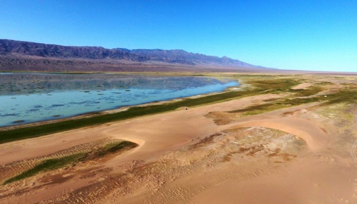
At the transition from the Gobi Altay ranges to the Valley of the Lakes in South West Mongolia, the Ikh Bogd mountain towers almost 3000 m above the aridifying endorheic Orog Nuur Basin. The actively deforming mountain front shows traces of multiple earthquakes, which in turn affect the alluvial sediments deposited in the basin. Simultaneously, strong south-eastward winds create beautiful barchan dunes. This photo reflects the interplay of multiple dynamic factors that shape and influence the landscape system.
Description by Jorien van der Wal, after the description on imaggeo.egu.eu.
Imaggeo is the EGU’s online open access geosciences image repository. All geoscientists (and others) can submit their photographs and videos to this repository and, since it is open access, these images can be used for free by scientists for their presentations or publications, by educators and the general public, and some images can even be used freely for commercial purposes. Photographers also retain full rights of use, as Imaggeo images are licensed and distributed by the EGU under a Creative Commons licence. Submit your photos at http://imaggeo.egu.eu/upload/.

