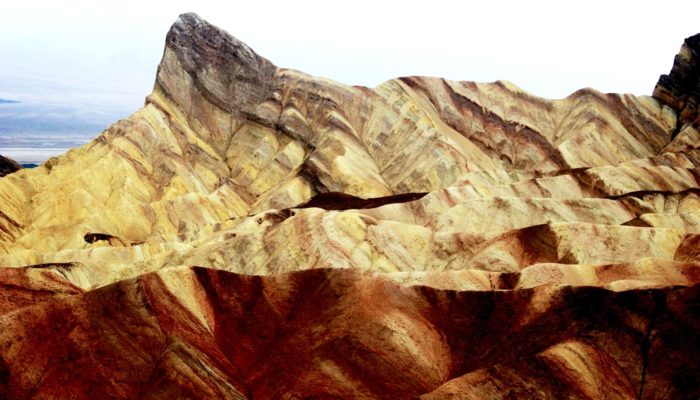
The badlands at the Zabriskie Point (Death Valley, California, USA) rest upon a mudstone foundation. In the prehistoric lakes of Death Valley, fine grained sediments were deposited to form soft rocks. The clay minerals in the mudstone are shaped like tiny plates, which helps create the layers. The combination of the almost impermeable mudstone and Death Valley’s low rainfall makes plant growth and soil development nearly impossible. This means you can see dry, golden-brown rock everywhere in the badlands of Death Valley. Vegetation has almost no presence.
At Death Valley rainfall is intense but does not happen frequently. Very long periods of drought are punctuated with drenching downpours. With so little vegetation and no soil, when water reaches the ground, there is nothing to absorb the rainfall. During Death Valley’s rain showers, water hits the surface and immediately begins to rush down the steep slopes, sweeping along particles of loosened mud. An astonishing high rate of erosion leaves distinct patterns in the landform at the Zabriskie Point that would only otherwise be visible in landforms of several hundred square kilometres. The badlands at the Zabriskie Point are therefore like experimental smaller scale models that mimic massive continental scale landforms.
Description by Basudev Biswal, from the description on imaggeo.egu.eu.
Imaggeo is the EGU’s online open access geosciences image repository. All geoscientists (and others) can submit their photographs and videos to this repository and, since it is open access, these images can be used for free by scientists for their presentations or publications, by educators and the general public, and some images can even be used freely for commercial purposes. Photographers also retain full rights of use, as Imaggeo images are licensed and distributed by the EGU under a Creative Commons licence. Submit your photos at http://imaggeo.egu.eu/upload/.

