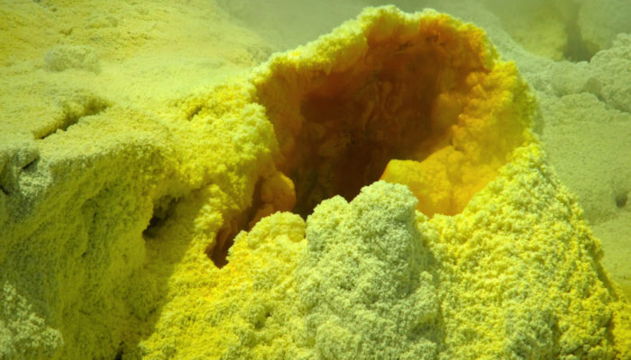
This photograph was taken in 2012 on a guided tour to Whakaari/White Island, an active volcano 50 km off the east coast of the North Island of New Zealand. The volcano lies on the northern end of the Taupo Volcanic zone and has possibly been active for the past 150,000 years. How dangerous this island is, was demonstrated by a number of explosive eruptions in recent history, the latest of which occurred on December 9, 2019 and sadly claimed the lives of 21 people.
Our 2012 tour took us across a otherworldy crater landscape, hostile and devoid of any live. Sulphur was mined here until the early 20th century and sure enough yellow patches flashed from the white rocks on the path. The air was thick with a foul smell and steam that made it hard to see at times. With a sharp hissing noise, superheated water was shooting up several meters straight into the air from fumaroles hidden in a cloud of steam. As the wind changed for a few seconds, a fumarole close by was unveiled and I rushed over to take this picture.
Description by Thomas Wöhling.
Imaggeo is the EGU’s online open access geosciences image repository. All geoscientists (and others) can submit their photographs and videos to this repository and, since it is open access, these images can be used for free by scientists for their presentations or publications, by educators and the general public, and some images can even be used freely for commercial purposes. Photographers also retain full rights of use, as Imaggeo images are licensed and distributed by the EGU under a Creative Commons licence. Submit your photos at http://imaggeo.egu.eu/upload/.


