Forests in the tropics account for about half the above-ground carbon on Earth and as the trees grow older they are capable of storing more and more. In fact, their carbon-storing potential is so large that they are increasingly being viewed as a means of mitigating climate change. Take, for example, the United Nations effort to reduce degradation and deforestation by assigning value to forest carbon. But programmes like this can only operate if we can calculate forest carbon stocks effectively.
The first step is to suss out a tree’s dimensions. Biomass directly relates to tree height and trunk diameter, so if you know these two details you can work out the amount of carbon stored in a particular tree. This calculation owes its ease to a lot of hard-collected data on tree dimensions and biomass, which, when combined, produces a neat relationship between the two.

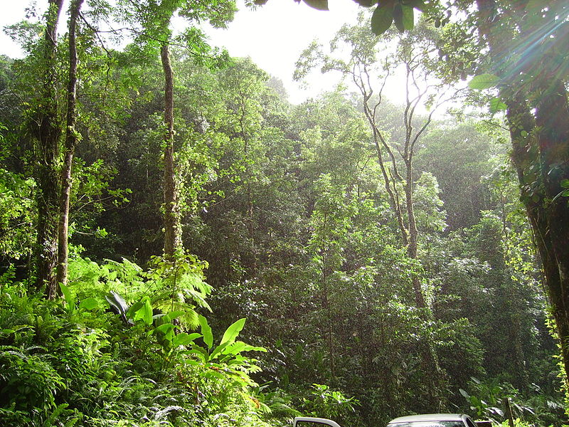
Tropical forest in Martinique. Credit: Wikimedia Commons user Fameme)
You can calculate tree height using a tape measure or using LIDAR. LIDAR, short for Light Detection and Ranging, uses a laser to measure the distance to an object by analysing the amount of light reflected back to a detector. Whether you’re using the high tech method or the tape, you’ll always need a little trigonometry. With a quick calculation you can use the distance to the tree base, the distance to the tree top, and the angle from where you’re standing to the top of the tree to work out its height. There are other ways to work this out if you fancy conducting a garden experiment with your smartphone .
But what if you wanted to work out the biomass of not one tree, ten or a hundred, but an entire forest of them? Trekking your way through the trees to measure each in turn would take an unimaginably long time, not to mention that, by the time you finish, the trees you started with will have grown, changed and increased their biomass to boot.
Is there a more practical method? Yes! Satellites are also capable of using LIDAR to estimate tree height remotely – data can be used to calculate the amount of carbon contained in a tropical forest.

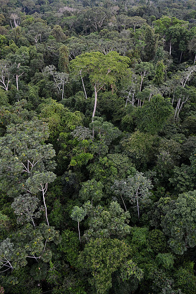
Forest canopy in Peru. (Credit: Geoff Gallice)
The method is a treat for the budding biogeoscientist. Here’s how it works:
- Head out to your favoured forest and use your field skills to measure the height and diameter of 100 or so trees. This means you can ground-truth your measurements and apply them to the rest of the forest.
- Scoop up some satellite data on tree height.
- Use the relationship between height and biomass that you gathered from trees in the field to find the biomass of the rest of the forest.
A group of scientists, led by Maria Hunter, set out to understand the uncertainty in these measures of biomass. Provided you have your 100 or so local trees as a reference, the biggest uncertainty lies in determining their height. A whole host of uncertainties enter here: from the method used to grab the data to the obstacles that cause you to both over- (in the case of tape measures) or under- (in the case of LIDAR) estimate the height of a tree. Some of these uncertainties can cause major problems for tree height estimation, particularly when the tree is unusually tall.
Despite these difficulties, Hunter found that values for forest biomass were still rather good. This is because many measurement errors cancel each other out when applying the results to a large area. What’s more, since the majority of trees are not unusually tall, their contribution to biomass determining difficulties are relatively small, leading to an overall error in biomass estimates of approximately 6%. Not too bad at all.
By Sara Mynott, EGU Communications Officer
Reference
Hunter, M. O., Keller, M., Victoria, D., and Morton, D. C.: Tree height and tropical forest biomass estimation, Biogeosciences, 10, 2013.


