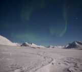
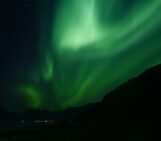
The northern lights, or aurora borealis, are created as charged particles interact with the Earth’s atmosphere. These electrons are part of the solar wind and as they pass through the Earth’s magnetic shield (the magnetosphere); the charged particles collide with those in our atmosphere, emitting light. In the southern hemisphere this phenomenon is known as the aurora australis, but both are caused by the same process, producing a brilliant light show like this one – the northern lights in Abisko, Sweden:
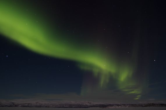
“Green over white” by Carme Bosch. Distributed by the EGU under a Creative Commons licence.
This strange and beautiful phenomenon captivates people the world over and many people flock as close to the poles as they can to glimpse the aurora. So how can we study it? Ryuho Kataoka from Japan’s National Institute of Polar Research came up with an ingenious, yet simple method of viewing the aurora in 3D. How? Using Digital SLR cameras.
We are capable of seeing relatively close objects in 3D because our eyes are separated by a small distance. The difference in the visual information in both eyes allows us to form a 3D image of our surroundings. Because the aurora is so much further away (some 90-400 km above the Earth’s surface), the cameras have to be placed several kilometres apart. Take two snaps simultaneously and voila! A 3D image of the lights above!
These 3D images can be used to calculate the emission height of the aurora and measure small-scale features in the northern and southern lights at relatively little cost. The simplicity of the method opens up the possibility for citizen scientists to study the aurora too. Interested? Here’s how Kataoka and his team put the method to the test.
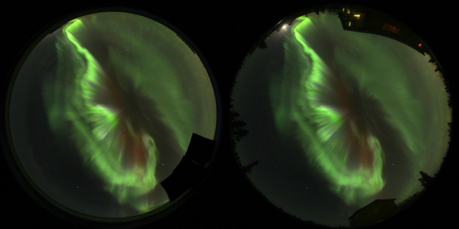
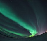
All-sky images of the aurora borealis. (Credit: Kataoka et al., 2013)
Reference:
Kataoka, R., Miyoshi, Y., Shigematsu, K., Hampton, D., Mori, Y., Kubo, T., Yamashita, A., Tanaka, M., Takahei, T., Nakai, T., Miyahara, H., and Shiokawa, K.: Stereoscopic determination of all-sky altitude map of aurora using two ground-based Nikon DSLR cameras, Ann. Geophys., 31, 1543-1548, 2013.
For a summary of the study, published in Annales Geophysicae, see this press release.
Imaggeo is the EGU’s open access geosciences image repository. A new and improved Imaggeo site will be launching soon, so you will be able to peruse an even better database of visually stunning geoscience images. Photos uploaded to Imaggeo can be used by scientists, the press and the public provided the original author is credited. Photographers also retain full rights of use, as Imaggeo images are licensed and distributed by the EGU under a Creative Commons licence. You can submit your photos here.