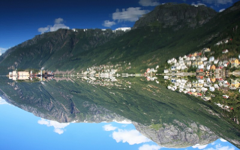
Located just southeast of Bergen on the Norwegian Atlantic coast, Hardangerfjorden is the third longest fjord in the world, measuring more than 170 km from the Atlantic Ocean to the Hardangervidda mountain plateau. Its longest branch, Sørfjorden, cuts 50 km from the main fjord and ends at Odda.

A sunny morning in Sørfjorden by Martin Mergili, distributed by EGU under a Creative Commons licence.
Geormorphologist Martin Mergili visited the area in 2008, following the 33rd International Geological Congress in Oslo. “The photo was taken from the small town of Odda at the southernmost tip of the Sørfjord, a southern branch of the Hardangerfjord. The western slopes of the deeply incised fjord, which are shown on the photograph, lead up to the Folgefonna, one of the major ice fields of Norway. Partly glacierised highlands and deeply incised fjords are characteristic landforms of western Norway, formed during the Pleistocene. The picture was shot on a sunny and calm morning,” he recollects.
Fjords are formed by abrasion, when a retreating glacier cuts a U-shaped valley into the surrounding bedrock. They are primarily located in mountainous regions, against prevailing westerly marine winds that are orthogonally lifted over the mountains resulting in abundant snowfall to feed the glaciers. Coasts featuring the most pronounced fjords can be found in western Norway, northwestern North America, and southwestern New Zealand.
To view more from Martin Mergili’s collection of photos, many of which have geoscientific relevance, please visit: www.mergili.at/worldimages.
Imaggeo is the online open access geosciences image repository of the European Geosciences Union. Every geoscientist who is an amateur photographer (but also other people) can submit their images to this repository. Being open access, it can be used by scientists for their presentations or publications as well as by the press. If you submit your images to imaggeo, you retain full rights of use, since they are licenced and distributed by EGU under a Creative Commons licence.
