Let’s look back on the first 22 HS blog posts published since our first Welcome to the HS division blog post in March. First and foremost, thanks to all the authors who contributed to the successful start of our blog in 2019! We hope to continue with the fortnightly publication of posts covering various topics related to hydrological sciences. If you have an idea for a topic, would like to write s ...[Read More]
Natural Hazards
Behind the scene: knowing the President of the EGU Natural Hazard Division – Ira Didenkulova!
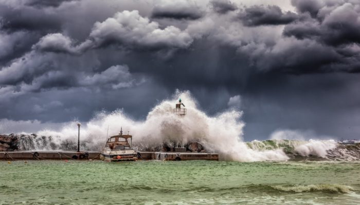
In this last post of 2019, I have the pleasure to ask some questions to Ira Didenkulova, the President of the EGU Natural Hazards division who has been recently elected for a second mandate. Ira, can you introduce yourself and tell what led you the position of EGU Natural Hazard (NH) Division president? What are the main challenges you had and what’s next for the NH division? It seems this ...[Read More]
Biogeosciences
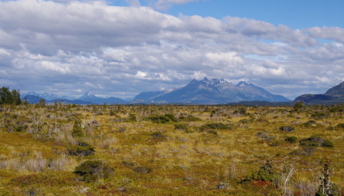
EGU2020 BG Sessions in the spotlight: Permafrost
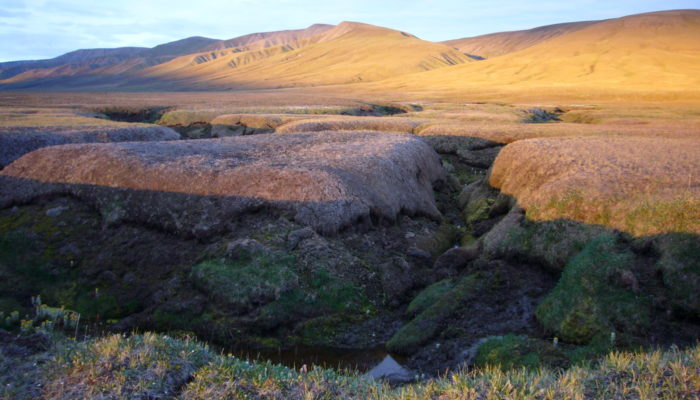
The EGU 2020 abstract submissions are open until January 15. Here, we’ll highlight the planned biogeoscience (BG) sessions. Stay tuned and find the session for your abstract! Today’s focus is on permafrost. These perennially frozen regions span the Arctic, the Tibetan Plateau, and mountain regions throughout the globe. Permafrost is highly vulnerable to current and future climate change and could ...[Read More]
Tectonics and Structural Geology
Features from the field: Bedding/Stratification

Bedding (also called stratification) is one of the most prominent features of sedimentary rocks, which are usually made up of ‘piles’ of layers (called ‘strata‘) of sediments deposited one on top of another. Every stratum is characterized by its own lithology (composition), sedimentary structures, grain size and fossil content that make it unique and different from the stra ...[Read More]
Biogeosciences
EGU2020 BG Sessions in the spotlight: Extreme environments
Less than one month left for the EGU 2020 abstract deadline on January 15. Today we highlight two sessions of BG 5 – Geomicrobiology, extreme environments on Earth and planetary analogues. First, BG5.1: Biology and Geology of extreme environments on Earth and planetary analogs. This session is convened by Monica Pondrelli, Jessica Flahaut, Frances Westall, Helge Niemann and Barbara Cavalazz ...[Read More]
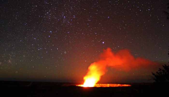
Seismology
Merry Christmas!
Biogeosciences
EGU2020 BG Sessions in the spotlight: Methane
The EGU 2020 abstract submissions are open until January 15. Here, we’ll highlight the planned biogeosciences sessions. Stay tuned and find the session for your abstract! Today’s focus is on Methane. Methane, a potent greenhouse gas, is steadily increasing in concentration in the atmosphere, prompting fears that it could scupper our chances to meet the global climate targets. But given its relativ ...[Read More]
Stratigraphy, Sedimentology and Palaeontology
Workshop on planning of the Weihe Basin Drilling Project: Cenozoic tectonic-climate interactions – in Xi’an, China
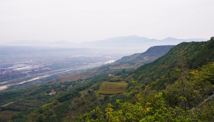
From climate to drilling technology – international participants of the workshop for planning the ‘Weihe Basin Drilling Project: Cenozoic tectonic-climate interactions’ covered a wide range of topics. In Xi’an, Institute of Earth Environment, Chinese Academy of Sciences (IEECAS) invited an international team of researchers to discuss a possible International Continental Scientific Drilling Program ...[Read More]
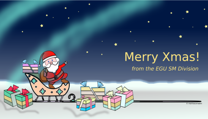
Cryospheric Sciences
Did you know about… nature’s street lights for Santa Claus?
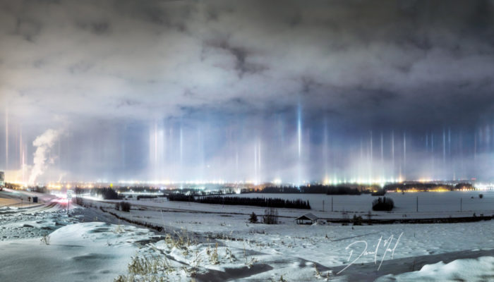
Only a couple of days left until Santa Claus’ big night! Once again the beardy guy in the red and white suit will fly around the world with his sledge pulled by his strong reindeers to make young and old children happy! But how does he navigate in the dark? Luckily, nature provides some solutions, for example light pillars… Light pillars form when ice particles are suspended in the air. These part ...[Read More]
Geochemistry, Mineralogy, Petrology & Volcanology
#EGU2020 sessions in the spotlight: Magma differentiation: crystals, isotopes, and experiments
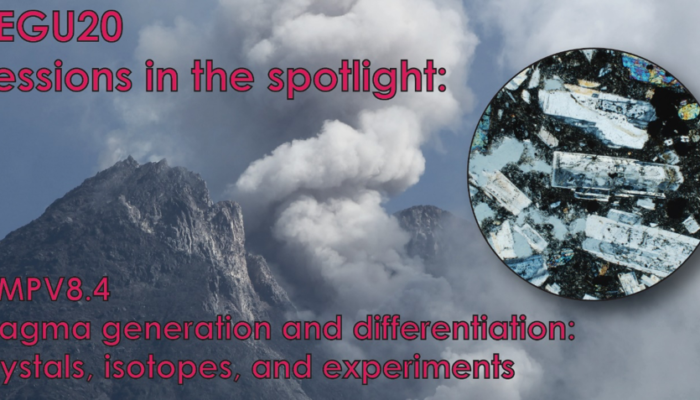
Today in the #EGU2020 sessions in the spotlight series (our last one before the holidays!), it’s GMPV8.4’s turn: Magma differentiation: crystals, isotopes, and experiments, organised by Frances Deegan (Uppsala University), Ben Ellis (ETH Zurich), Carmela Freda (INGV Rome) and Valentin Troll (Uppsala University). Keynote speaker: Marian Holness (Cambridge University). Crystals that grow in magmatic ...[Read More]