In simple words, the volcanic risk (R) can be defined as R = Value × Vulnerability × Hazard. The value is a figure that varies according to the total number of population and / or infrastructures at risk during a volcanic eruption, vulnerability is the percentage of value at risk for a given volcanic event and the hazard is the probability that a certain place may be affected by a determined hazard, for example a volcano. Several studies have since worked to reveal the areas subject to volcanic eruptions and create maps of volcanic risk that can help determine which are the areas most in need of protection and secured (Scandone et al., 1993). These models are particularly useful for understanding the probable damage in a determined area and can help those territories to take countermeasure actions. However, most models consider a type of static risk, evaluating fixed elements, like infrastructure. It is well evident that this can be a problem for the modeling of all those who are able to move during a volcanic event. In recent years, several authors i.e Jumadi et al. (2020) have dealt with assessing the volcanic risk, no longer in a static way, but in a dynamic way, taking into consideration the variable relating to the behavior of people during an evacuation and the relative consequent danger dynamics. The idea of dynamic risk can be applied to any type of geological risk, but it becomes particularly important in the case of volcanic eruptions, where being in the wrong place at the wrong time could lead to a significant increase in the number of victims. These models related to the assessment of dynamic volcanic risks allow us to highlight how much the assessment of the hazard of an area can vary not only based on the place where we are, but also based on the behavior of individuals and their movements in a specific moment.

Explosive activity at the main crater and lava field of Geldingadalir resumed on 11 September 2021 (photo by Stefan Forster).
To this date, much volcanological information is also obtained thanks to tourists and photographers who go to active volcanoes to film the eruptions. This occurred for example during the effusive eruptions of Fagradalsfjall (Reykjanes, Iceland) and Cumbre Vieja (La Palma, Spain), in which the information obtained from tourists and photographers was shared with volcanologists who study these areas of high risk (Wadsworth et al., 2022). However, this kind of dynamic is risky, in the sense that the approach to “controlled” volcanic eruptions can be a “boomerang effect”, because these people, who try to help scientists, in some cases, do not care about the real danger of volcanic eruptions. It is indeed necessary to consider the type of volcanic eruptions we are working on and how these can change over time. We can cite three deadly examples of people recording volcanic eruption videos to share on social networks: Ontake in 2014, Fuego in 2018 and White Island in 2019.
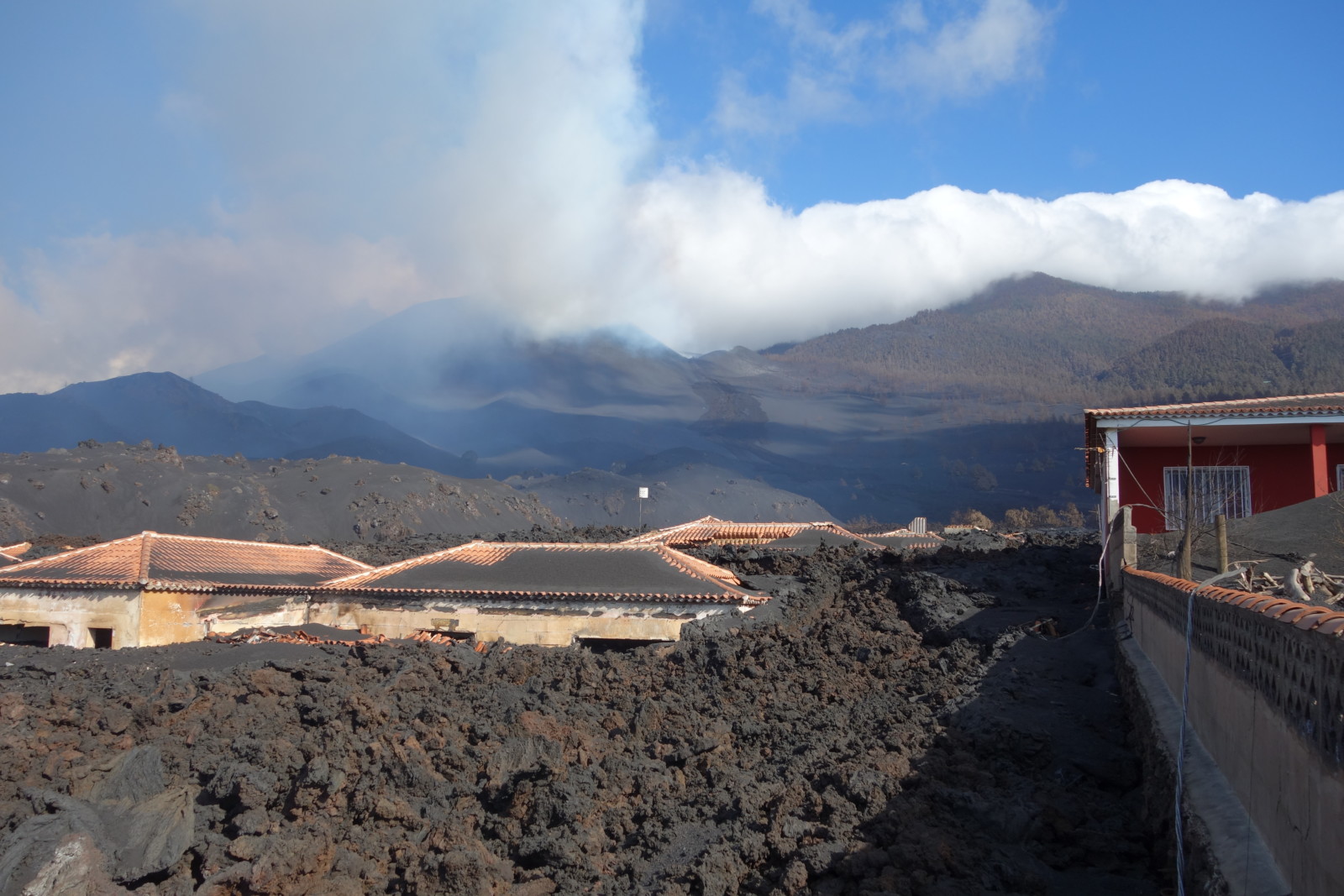
Residential area destroyed by the lava flow of Cumbre Vieja volcano, La Palma, Spain (Photo by Gino González Ilama)
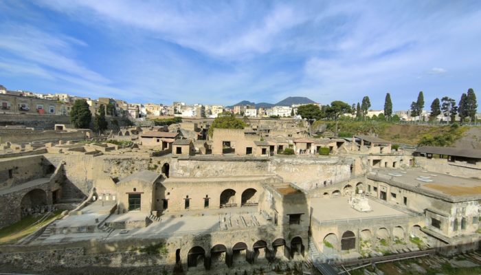
Let’s think for example of the case of Herculaneum during the eruption of Vesuvius in 79 AD. At that time the population did not know what the Vesuvius volcano could be and what the volcanic risk could mean. Most of the people who were overwhelmed by the eruption were found with bodies that identify escaping movements, and in particular many of them were found in the former beach of Herculaneum, inside the shores where they believed they could be saved. But if we think of a hypothetical Herculaneum today, what could happen? What would the dynamic risk assessment be like? How could the whole population be managed? Since the world population has increased significantly compared to ancient times, how can one best quantify this dynamic risk?
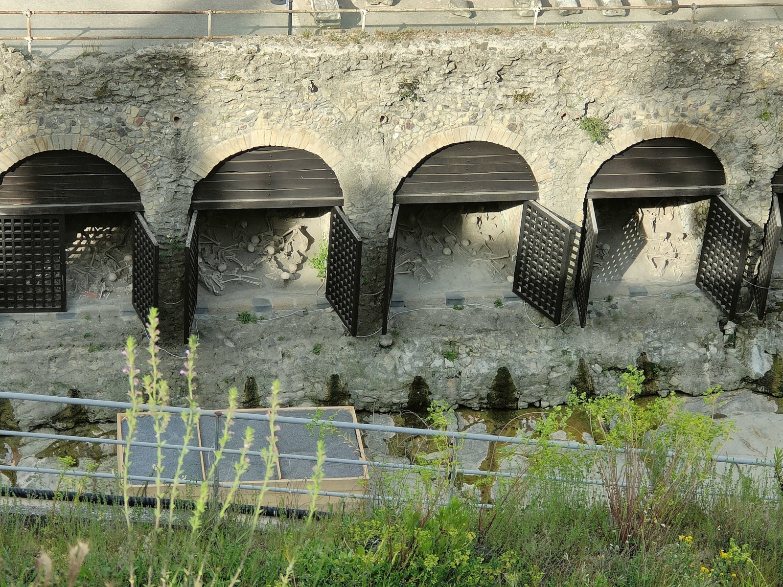
The photo shows the ancient beach and the ancient shores of the city of Herculaneum, in which the bodies of the inhabitants of Herculaneum were found trying to take refuge (Photo by Elisabetta Billotta).
Nowadays, the National Institute of Geophysics and Volcanology (INGV), the University and the Civil Protection are involved in monitoring Vesuvius to understand all the signs that will lead to a future eruption. In the future, if an eruption similar to that of 79 AD occurred, of Vesuvius, probably today, we would be able to recognize the warning signs of the eruption. However, have we considered the number of people who would want to get closer to the volcano? Currently, evacuation maps are only calculated based on the number of residents and do not take into account other aspects such as the number of motorists in the cities or possible tourists who might visit during an eruption. This could be a big deal today, because there have already been incidents in the past of people who during volcanic eruptions came close to danger to watch these events.
In light of many of these factors, defining volcanic hazard maps and possible evacuation plans is steadily becoming increasingly difficult. However, in the past few years, different research teams have been studying the issues related to dynamic risk and human curiosity. Then, we should be conscientious in using all this sharing of images, videos and ideas only for positive purposes without causing further problems for ourselves as well as for society as a whole.
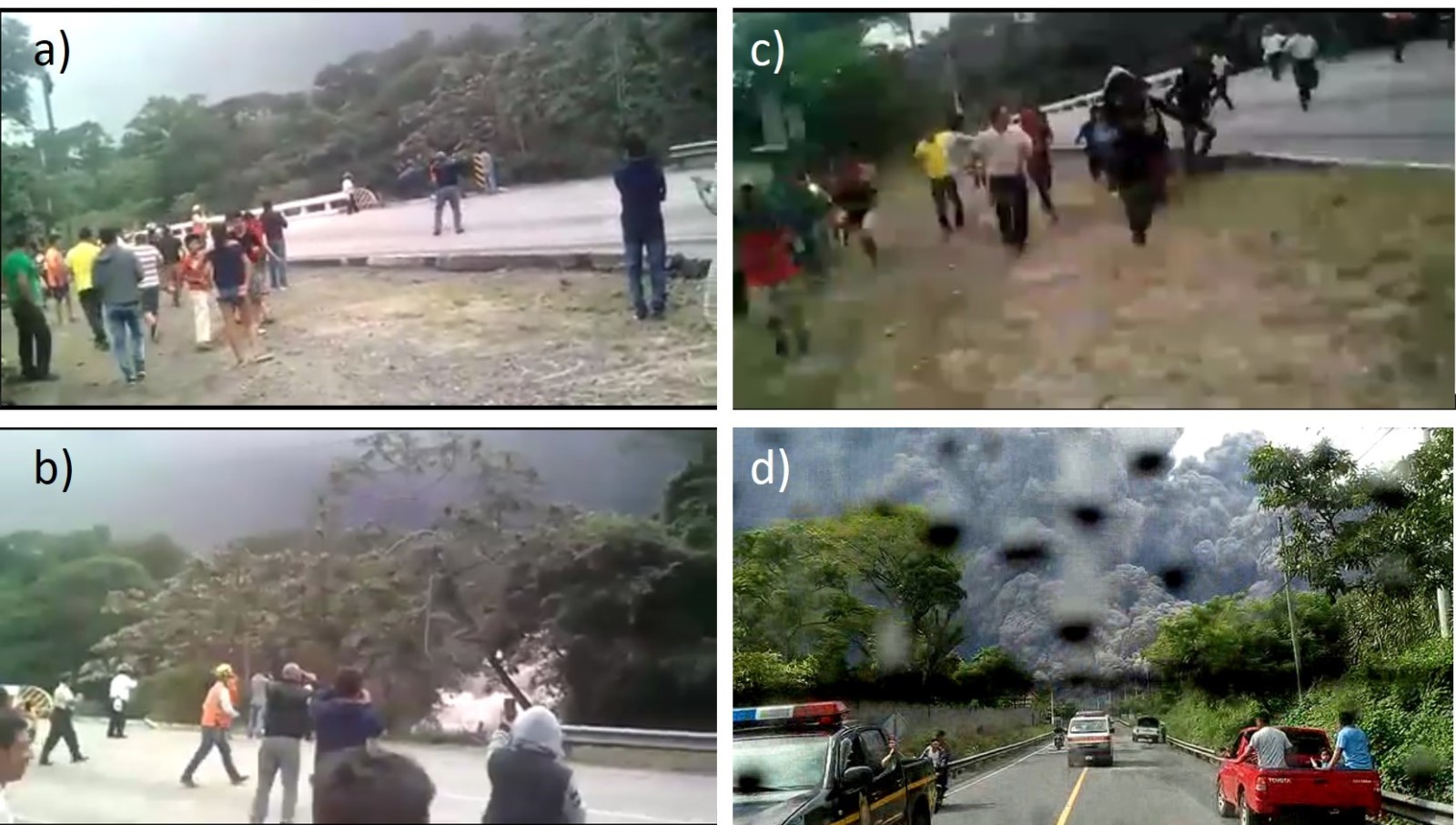
Time sequence in the Lajas bridge, where people were recording videos and taking photos of the June 3, 2018 Fuego volcanic eruption to share on social media. a) “Social event” previous of the second PDC. b) Arrival of the second PDC. c) People trying to escape from the second PDC. d) Dimension of the second PDC and people in cars trying to approach Lajas Brigde due to the social media outburst.
Reference
Jumadi, J., Malleson, N., Carver, S., & Quincey, D. (2020). Estimating spatio-temporal risks from volcanic eruptions using an agent-based model. Jasss, 23(2). https://doi.org/10.18564/jasss.4241
Lirer, L., Petrosino, P., & Alberico, I. (2010). Hazard and risk assessment in a complex multi-source volcanic area: The example of the Campania Region, Italy. Bulletin of Volcanology, 72(4), 411–429. https://doi.org/10.1007/s00445-009-0334-2
Scandone, R., Arganese, G., & Galdi, F. (1993). The evaluation of volcanic risk in the Vesuvian area. Journal of Volcanology and Geothermal Research, 58(1–4), 263–271. https://doi.org/10.1016/0377-0273(93)90112-5
Wadsworth, F. B., Llewellin, E. W., Farquharson, J. I., Gillies, J. K., Loisel, A., Frey, L., Ilyinskaya, E., Thordarson, T., Tramontano, S., Lev, E., Pankhurst, M. J., Rull, A. G., Asensio-ramos, M., Pérez, N. M., Hernández, P. A., Calvo, D., Solana, M. C., Kueppers, U., & Santabárbara, A. P. (2022). Crowd-sourcing observations of volcanic eruptions during the 2021 Fagradalsfjall and Cumbre Vieja events. 1–5. https://doi.org/10.1038/s41467-022-30333-4