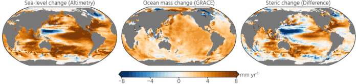
The Gravity Recovery and Climate Experiment (GRACE) satellite mission (2002-2017) consisted of two satellites at ~500 km altitude separated by 200 km, following each other in the same orbit. The distance between the two GRACE satellites changes because of the gravitational pull of the masses beneath the satellites. As such, mass changes at or near the Earth’s surface caused variations in the dista ...[Read More]
High resolution terrestrial water storage changes from combination of GRACE and models
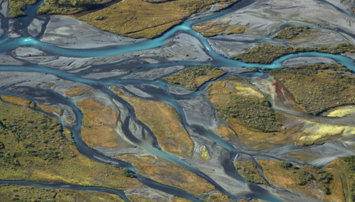
Image credits: Jakob Keck (distributed via imaggeo.egu.eu)