ERE
Energy, Resources and the Environment

Words on Wednesday

Words on Wednesday: Using historical hydrology to lengthen flood records of rare and extreme events

Words on Wednesday aims at promoting interesting/fun/exciting publications on topics related to Energy, Resources and the Environment. If you would like to be featured on WoW, please send us a link of the paper, or your own post, at ERE.Matters@gmail.com.
***
Benito, G., Brázdil, R., Herget, J., and Machado, M. J.: Quantitative historical hydrology in Europe, Hydrol. Earth Syst. Sci., 19, 3517-3539, doi:10.5194/hess-19-3517-2015, 2015.
***

Abstract:

In recent decades, the quantification of flood hydrological characteristics (peak discharge, hydrograph shape, and runoff volume) from documentary evidence has gained scientific recognition as a method to lengthen flood records of rare and extreme events. This paper describes the methodological evolution of quantitative historical hydrology under the influence of developments in hydraulics and statistics.

In the 19th century, discharge calculations based on flood marks were the only source of hydrological data for engineering design, but were later left aside in favour of systematic gauge records and conventional hydrological procedures. In the last two decades, there has been growing scientific and public interest in understanding long-term patterns of rare floods, in maintaining the flood heritage and memory of extremes, and developing methods for deterministic and statistical application to different scientific and engineering problems.

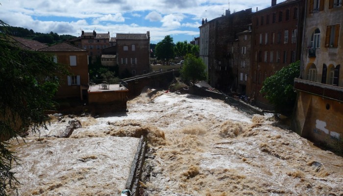
A compilation of 46 case studies across Europe with reconstructed discharges demonstrates that (1) in most cases present flood magnitudes are not unusual within the context of the last millennium, although recent floods may exceed past floods in some temperate European rivers (e.g. the Vltava and Po rivers); (2) the frequency of extreme floods has decreased since the 1950s, although some rivers (e.g. the Gardon and Ouse rivers) show a reactivation of rare events over the last two decades. There is a great potential for gaining understanding of individual extreme events based on a combined multiproxy approach (palaeoflood and documentary records) providing high-resolution time flood series and their environmental and climatic changes; and for developing non-systematic and non-stationary statistical models based on relations of past floods with external and internal covariates under natural low-frequency climate variability.


Words on Wednesday: Developing El Niño could bring rain to drought-stricken California

Words on Wednesday aims at promoting interesting/fun/exciting publications on topics related to Energy, Resources and the Environment. If you would like to be featured on WoW, please send us a link of the paper, or your own post, at ERE.Matters@gmail.com.

***

A recent Nature News Explainer by Chris Cesare describes how forecasters with the US National Oceanic and Atmospheric Administration (NOAA) say that the El Niño weather pattern developing in the Pacific Ocean could eventually rank among the strongest on record and could bring rain to California.

Cesare, C. 2015. Developing El Niño could be strongest on record:Event could bring rain to drought-stricken California and dry conditions to Australia. Nature News:Explainer. http://www.nature.com/news/developing-el-ni%C3%B1o-could-be-strongest-on-record-1.18184

Cesare writes that a strong El Niño — signalled by the periodic warming of ocean-surface temperatures in the equatorial Pacific — can lead to heavy rain in parts of North America and drier-than-normal conditions in Australia, Indonesia and parts of India. NOAA says that there is an 85% chance that the current El Niño will last through the first few months of next year, with its strength peaking in November or December.

If ocean-surface temperatures in the Niño-3.4 region (in the eastern equatorial Pacific) are between 0.5 to 1 °C above average during a three-month window, NOAA declares a weak El Niño. Forecasters label an El Niño as strong if it exceeds the average by 1.5 °C. NOAA projects that the current event could produce temperatures that are 2 °C higher than average, or more. The strongest El Niño on record occurred in 1997–98 and produced temperatures 2.3 °C above average.

This year the El Niño started unusually early — in March instead of June. This could be because warm waters left over from last year’s weak El Niño gave it a head start – this would be the second El Niño year in a row, following the weak El Niño that developed late last year. A similar El Niño double-header happened between 1986 and 1988, but forecasters predict that the current El Niño will become stronger than either of those two events.

Elevated ocean surface temperatures in the eastern Pacific Ocean are a sign of El Niño. Image from http://www.nature.com/news/developing-el-ni%C3%B1o-could-be-strongest-on-record-1.18184, originally from NOAA

Importantly, El Niño could offer some relief to the US state of California, which is now in the fourth year of a historic drought. Forecasters say that there is a good chance that southern California will receive more rainfall than usual throughout the winter. In the past, very strong El Niños have also soaked the central and northern parts of the state. Although this is unlikely to “erase four years of drought”.


Are you READY for a flood event?

As evidenced by the EU Floods Directive (2007/60/EC), flood management strategies in Europe have undergone a shift in focus in recent years. The goal of flood prevention using structural measures has been replaced by an emphasis on the management of flood risks using non-structural measures. One implication of this is that public authorities alone not only take responsibility for flood management. A broader range of stakeholders, who may personally experience the negative effects of flooding, also take on responsibility for protecting themselves. Therefore, it is vital that information concerning flood risks is conveyed to those who may be affected in order to facilitate the self-protection of citizens. Experience shows that problems persist even where efforts have been made to communicate flood risks.

There is a need for the development of new tools that are able to rapidly disseminate flood-risk information to the general public. To be useful these tools must be able to present information relevant to the location of the user. Moreover, the content and design of the tool need to be adjusted to laypeople’s needs. Dissemination and communication influence both people’s access to and understanding of natural risk information. Such a tool could be a useful aid to effective management of flood risks.

To address this gap, a web-based geographical information system (WebGIS) has been developed through the collaborative efforts of a group of scientists, hazard and risk analysts and managers, GIS analysts, system developers and communication designers.

This tool, called “READY: Risk, Extreme Events, Adaptation, Defend Yourself”, aims to enhance the general public knowledge of flood risk, making citizens more capable of responding appropriately during a flood event. The READY WebGIS has allowed for the visualization and easy querying of a complex hazard and risk database thanks to a high degree of interactivity and easily read maps. In this way, READY has enabled fast exploration of alternative flood scenarios or past calamitous events. Combined also with a system of graphic symbols designed ad hoc for communication of self-protection behaviours, it is believed READY could lead to an increase in citizen participation, informed discussion and consensus building.

The platform has been developed for a site-specific application: the Basilicata region, Italy, has been selected as pilot application area. The goal of the prototype is to raise citizen awareness of flood risks and to build social capacity and enhanced resilience to flood events.

Read the whole paper here: Albano, R., Sole, A., and Adamowski, J.: READY: a web-based geographical information system for enhanced flood resilience through raising awareness in citizens, Nat. Hazards Earth Syst. Sci., 15, 1645-1658, doi:10.5194/nhess-15-1645-2015, 2015.

Example of the recommendations, provided by the READY platform, for behavioural actions in case of alert, intended for selfprotection enhancement.

Example of the recommendations, provided by the READY platform, for behavioural actions in case of alert, intended for selfprotection enhancement.

Can climate data help to better predict floods?

Can climate data help to better predict floods?

Many studies report that hydrologic regimes are modulated by large-scale modes of climate variability such as the El Niño Southern Oscillation (ENSO) or the North Atlantic Oscillation (NAO). Climate-informed frequency analysis models have therefore been proposed to condition the distribution of hydrologic variables on climate indices. However, standard climate indices may be poor predictors in some regions. Instead of trying to describe climatic cycles using a single parameter, Renard and Lall developed a model using a range of parameters.

You can read the whole paper here: Renard, B., and U. Lall (2014), Regional frequency analysis conditioned on large-scale atmospheric or oceanic fields, Water Resour. Res., 50, 95369554, doi:10.1002/2014WR016277.