Rising sea levels due to climate change. Natural climatic cycles, like El Niño. Land subsidence due to fluid pumping.
There are many reasons that can increase the risk of flooding of cities and other areas. We might not always be able to control it, but is there a way to better predict and prepare for it?
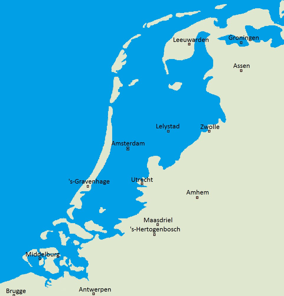
I come from the Low Lands (Netherlands), and that means we are very close to water, living on a delta created by the interplay of the North Sea and a total of four rivers. It has made the Dutch excellent water managers, with most of our current land that lies below sealevel being manmade (the Dutch ‘polders’). With a large part of the country being at or below sealevel (only half is more than 1 m above sealevel!) we have faced many floods in the past.

Without dikes, this part of the Netherlands would be flooded.Credit: Wikipedia
The North Sea Flood of 1953 resulted from a storm tide and killed over 1000 people. After that a special committee, assigned to evaluate the potential to reduce the risk of such a flood in the future, developed the Deltaplan, aimed at closing off the estuary mouths in the south of the country to the sea. Nowadays, the Deltaworks, as these storm surge barriers are called, protect the country from high tides during storms. Under normal conditions they remain open to the sea, allowing sea water and the tides to reach inland.
At the same time, sea level rise has meant that we need to continuously re-enforce and broaden existing sea and river dunes. The Rhine River floods annually, resulting in significant economic and property damage. In an attempt to better guide these floods, and decrease their impact, the Room for the River project was started. Within this project, the four main rivers (the Rhine, the Meuse, the Waal and the IJssel) are literally given more room to flood, be moving some of the surrounding dykes broading the flood plain, increasing the depth of the flood plains and removing obstacles.
That’s how the Netherlands is trying to live with its surrounding water. This week, I will be posting a number of interesting papers and articles in relation to this topic. To illustrate if flood risk can be predicted, and what the flood risks are in other parts of the world.

