A few month ago, we were taking you on a trip back to Antarctic fieldwork 50 years ago, today we go back to Greenland during 1930s! When geopolitics serves cryospheric sciences The Permanent Court of International Justice in The Hague awarded Danish sovereignty over Greenland in 1933 and besides geopolitical interests, Denmark had a keen interest in searching for natural resources and new opportun ...[Read More]
Image of the Week — Historical aerial imagery of Greenland
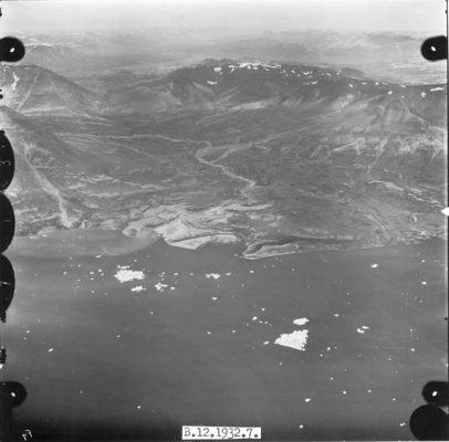
Aerial photo of the Zackenberg delta in North-East Greenland taken in 1932.
(Credit: Danish Geodata Agency)