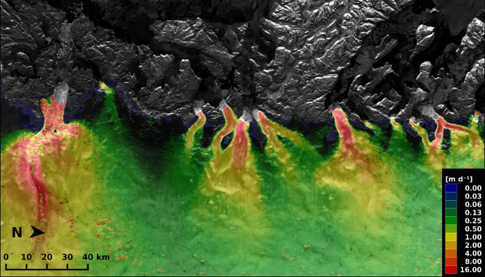
Thickness of floating ice shelves in Antarctica. Ice thickness is greatest close to the grounding line where it can reach 1000 meters or more (red). Away from the grounding line, the ice rapidly thins to reach a few hundreds of meters at the calving front. Ice thickness varies greatly from one ice shelf to another. Within ice shelves, “streams of ice” can be spotted originating from in ...[Read More]
Image of the Week: Antarctic ice-shelf thickness
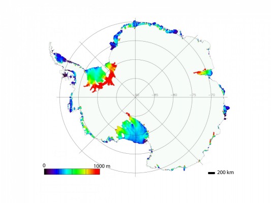
Thickness of the Antarctic ice shelves. Credit: M. Depoorter