CR
Cryospheric Sciences

EGU Guest blogger

This guest post was contributed by a scientist, student or a professional in the Earth, planetary or space sciences. The EGU blogs welcome guest contributions, so if you've got a great idea for a post or fancy trying your hand at science communication, please contact the blog editor or the EGU Communications Officer to pitch your idea.

Riding the Storm: The Arctic Circle Traverse 2015

Riding the Storm: The Arctic Circle Traverse 2015

In the morning on the 19th of May, we – the Arctic Circle Traverse 2015 – found ourselves in a great dilemma; to stay or to go? On our check-in conversation with the KISS crew, we were informed that an east front from Kulusuk was expected to hit our location up on the ice sheet sometime in the afternoon. The relatively low winds that we were experiencing would get stronger, and the visibility woul ...[Read More]

Karthaus Summer School 2015

Karthaus Summer School 2015

After a train, the London Underground, another train, a flight, three more trains and a taxi (shared with people I had met on my way); I had arrived in a small Alpine village in the very north of Italy. The reason for this rather convoluted journey? To attend the Karthaus Summer School on ice sheets and glaciers in the climate system. I’m pleased to say it was definitely worth the trip getting the ...[Read More]

Image of the Week: Hochjochferner

Image of the Week: Hochjochferner

The margin of the glacier “Hochjochferner” on the border between Austria and Italy. This glacier has been monitored with an Automatic Weather Station for several years by the Institute for Marine and Atmospheric research in Utrecth, NL.It is also the destination of the field trip that takes place during the annual Karthaus summer school in ice and climate. Here, students are exploring ...[Read More]

Image of the Week: GISP II Borehole

Image of the Week: GISP II Borehole

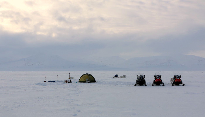
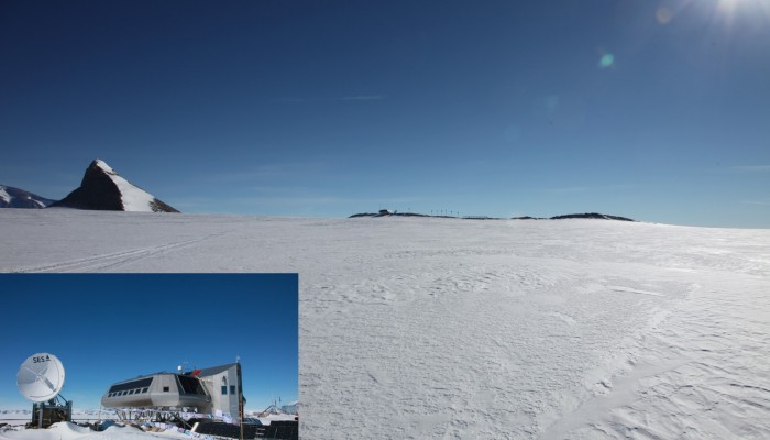
Climate records from ice cores have helped scientists understand the past changes in climate.
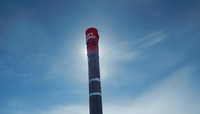
The GISP II (Greenland Ice Sheet Project Two) ice core was more than 3km long and was drilled during a five year period in the 1990s. After the drilling ended the casing of the borehole was extended above the surface, so that the borehole can still be accessed for remeasurements of, for example, temperatur ...[Read More]

Camping on the Svalbard coast

Camping on the Svalbard coast

In early April 2015, a small team of 2 Belgian and 2 French researchers went to Svalbard. The goal? Testing new methods to measure sea-ice thickness and ice algal biomass, but also measuring greenhouse gases in the sea ice in relation with the ‘STeP’ (Storfjorden Polynya multidisciplinary study) campaign. With funding from the French Polar Institute (IPEV) and IPSL and logistical arrangements by t ...[Read More]

Image of the Week: Greenland Ice Streams

Image of the Week: Greenland Ice Streams

This image is from the west coast of Greenland and it shows several glaciers flowing towards the sea (upper part of the image), transporting ice into the ocean. The colours show the velocity of the ice. As the ice gets nearer to the coast it speeds up reaching speeds over 15m/day. The velocities were calculated using two Sentinel-1A radar scans from 3 and 15 January 2015. You can download a high r ...[Read More]

Cruising for mud: Sediments from the ocean floor as a climate indicator

Cruising for mud: Sediments from the ocean floor as a climate indicator

Going on a cruise for a month sounds tempting for most people and that is exactly how I spent one month of my summer. Instead of sunshine and 25 degrees, the temperature was closer to the freezing point on the thermometer and normal summer weather was replaced by milder weather conditions. The destination of the cruise was the western Nordic Sea and the east Greenland Margin. The ice2ice cruise wa ...[Read More]

Science and Shovels: Traversing across the Greenland Ice Sheet.

Science and Shovels: Traversing across the Greenland Ice Sheet.

Moving 150 tonnes of equipment more than 450km across the Greenland Ice Sheet sounds like a crazy idea. In that context, moving a 14-metre high, dome-shaped, wooden structure seems like a minor point, but it really is not. I do not think I realised what an awesome and awe-inspiring project I was part of, until I was out there, in the middle of the blindingly white ice sheet, and I saw the enormous ...[Read More]

Ice Nomads: The iSTAR traverse of Pine Island Glacier, West Antarctica

It’s the 2nd December 2013 and I find myself in one of those rare occasions in life where I feel I need to pinch myself to see if I’m dreaming. Why? Somehow I’m in control of a British Antarctic Survey De Havilland Twin Otter aircraft flying over the white featureless expanse of the West Antarctic Ice Sheet. I’m part of a team of 12 heading to Pine Island Glacier, a remote ice stream 75°S and arou ...[Read More]

My first journey to Antarctica – Brice Van Liefferinge

My first journey to Antarctica – Brice Van Liefferinge

19 November 2014, the Iliuchine 76 gently lands on the runway of the Russian Antarctic station, Novolazarevskaya, in Dronning Maud Land. For the first time, I’m in Antarctica! It is 4 o’clock in the morning and we need to hurriedly offload 2 tons of material intended for our field mission near the Belgian Princess Elisabeth Station. I’m deeply impressed by the landscape although it is dotted with ...[Read More]