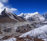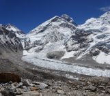
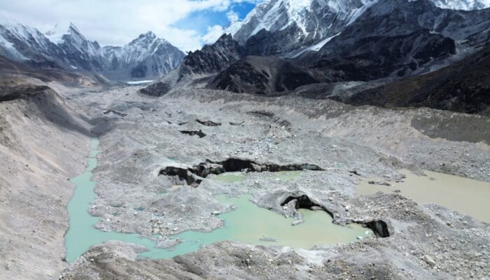
Turquoise lakes. Towering Himalayan peaks. A maze of rock, ice and meltwater. At first glance, this hardly looks like a glacier at all (Figure 1)… Yet as glaciers thin and retreat across the Himalayas, networks of meltwater ponds and glacial lakes are forming both on glacier surfaces and at their margins: one of the most visible signs of a changing high-mountain landscape. I spent four weeks in Nepal’s Sagarmāthā National Park in May and June 2025 as part of the Glacial Lake Observatory (GLO) project surveying these lakes and their downstream valleys using drones. The goal: to collect thousands of aerial images that can be transformed into detailed maps and 3D models, helping us better understand how these lakes are evolving and the flood hazards they may pose. What followed was more than 200 km+ in trekking, 12,000 m in elevation gain, thousands of drone photos, countless cups of Chiya (Nepali milk tea) and an unforgettable field season.
Glacial lakes: a Himalayan hazard
You may or may not be familiar with glacial lakes. Around the world, as the cryosphere changes and glaciers thin and retreat, meltwater collects in depressions on glacier surfaces, at their margins and in recently deglaciated terrain, forming lakes that can expand and evolve rapidly. From the Himalayas and Andes to the Arctic and the Greenland Ice Sheet, these lakes are becoming one of the most visible signs of rapid cryospheric change.
Across High-Mountain Asia (HMA), also known as the ‘Third Pole’ as it contains the largest concentration of snow and ice outside the polar regions, glacial lakes are rapidly evolving in response to a warming climate. The region is experiencing some of the highest rates of glacial lake growth globally (Shugar et al., 2020; Zhang et al., 2024) and whilst they play an important role in storing and regulating meltwater runoff, they can also pose serious hazards to downstream communities and infrastructure.
As existing lakes become larger and new lakes form, concerns grow over their potential to generate glacial lake outburst floods (GLOFs). While many lakes are stable, some are held back by weak natural dams of sediment, rock debris or even remnants of glacial ice. If these dams fail, large volumes of water can be rapidly released, travelling tens of kilometers downstream and causing significant environmental, economic and societal impacts.
This is where the Glacial Lake Observatory (GLO) project comes in. The goal is to improve understanding of glacial lakes across HMA, how they’re evolving and the flood hazards they may pose. By combining satellite observations with drone surveys and lake depth measurements collected in the field, we can generate high-resolution maps and 3D models of lakes and their surrounding landscapes. These datasets allow us to better characterise lake geometry, provide field-based estimates of lake depth and volume, map moraine dams and provide detailed topographic information (that is currently lacking) for flood modelling and simulations.
Whilst satellite imagery and the processing of these datasets happen from the comfort of the office in Leeds (UK), the collection of high-resolution datasets to produce them begins in the field. In May-June 2025, this took the GLO team and I to Sagarmāthā National Park in Nepal, known to many as the Everest region. Famous for its towering mountains including Mount Everest, high-altitude trekking routes and spectacular scenery, it became the backdrop to four weeks of unforgettable fieldwork.
From satellites to reality
Before travelling to Nepal, I had already spent months looking at glacial lakes in the region from satellites. From my desk, I traced lake outlines, planned drone surveys and examined the valleys we would eventually visit. However, from a computer screen it is difficult to appreciate the scale of the landscape from hundreds of kilometers above the Earth surface.
A few months later, I found myself stepping off the small plane at Lukla airport, famous for its short (527 m), sloping (11%) runway and dramatic mountain setting. It was the gateway to the Everest region. Even before the trek began, I was blown away by the sheer size of the mountains (sounds cliché I know!).
From there, it was all on foot. Over the next four weeks, our route would take us through many of the major valleys and villages of the Khumbu region, from Thame and Gokyo in the west to Lobuche and Chukhung in the east, crossing two high mountain passes and, of course, surveying glaciers and lakes along the way (Figure 2).
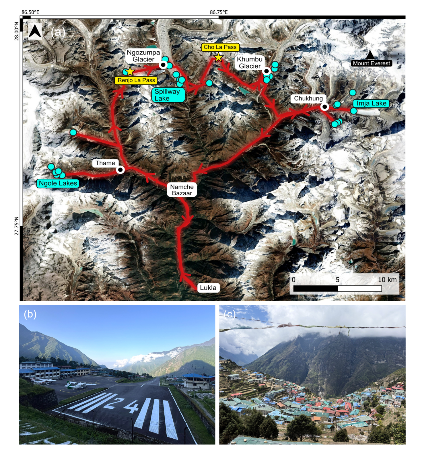
Figure 2. (a) Map of the trekking route and survey locations for Glacial Lake Observatory fieldwork in Sagarmāthā National Park, Nepal (May-June 2025). Key areas are shown, including glaciers and villages (white), lakes (blue) and high-mountain passes (yellow) [Credit: Google Satellite, QGIS]; (b) The runway at Lukla (Tenzing-Hilary) airport located at 2,845 m a.s.l.; (c) Namche Bazaar village, one of the largest Sherpa settlements in the Khumbu region at 3,440 m a.s.l.. [Credit: Lauren D. Rawlins]
Our first major destination was the village of Thame. Less than a year earlier in August 2024, a glacial lake outburst flood (GLOF) had swept through the village, destroying homes, the local school and damaging hydropower infrastructure. Approaching the village, the impacts were clearly visible with wide landscape scars, huge boulders strewn across the valley floor and deep cracks in the ground (Figure 3a). The impacts became even more striking when we visited what had been the local school, with classrooms filled with mud, debris and scattered textbooks (Figure 3b). Luckily no casualties occurred here, however it is a stark reminder of the human impacts of such events. The Upper and Lower Ngole glacial lakes, the source of the cascading GLOF, were 10 km upstream (Figure 3c) and the first of the lakes to be surveyed on this Everest region round trip, and my first experience of trekking to nearly 5000 m (above sea level, or a.s.l).
After a few days of hiking and rest, we reached the Ngole lakes (Figure 3d). Five clustered turquoise blue lakes, two of which the cause of the 2024 GLOF – the sheer scale of the landscape very much hard to comprehend from my computer screen in the office. Surveying began!
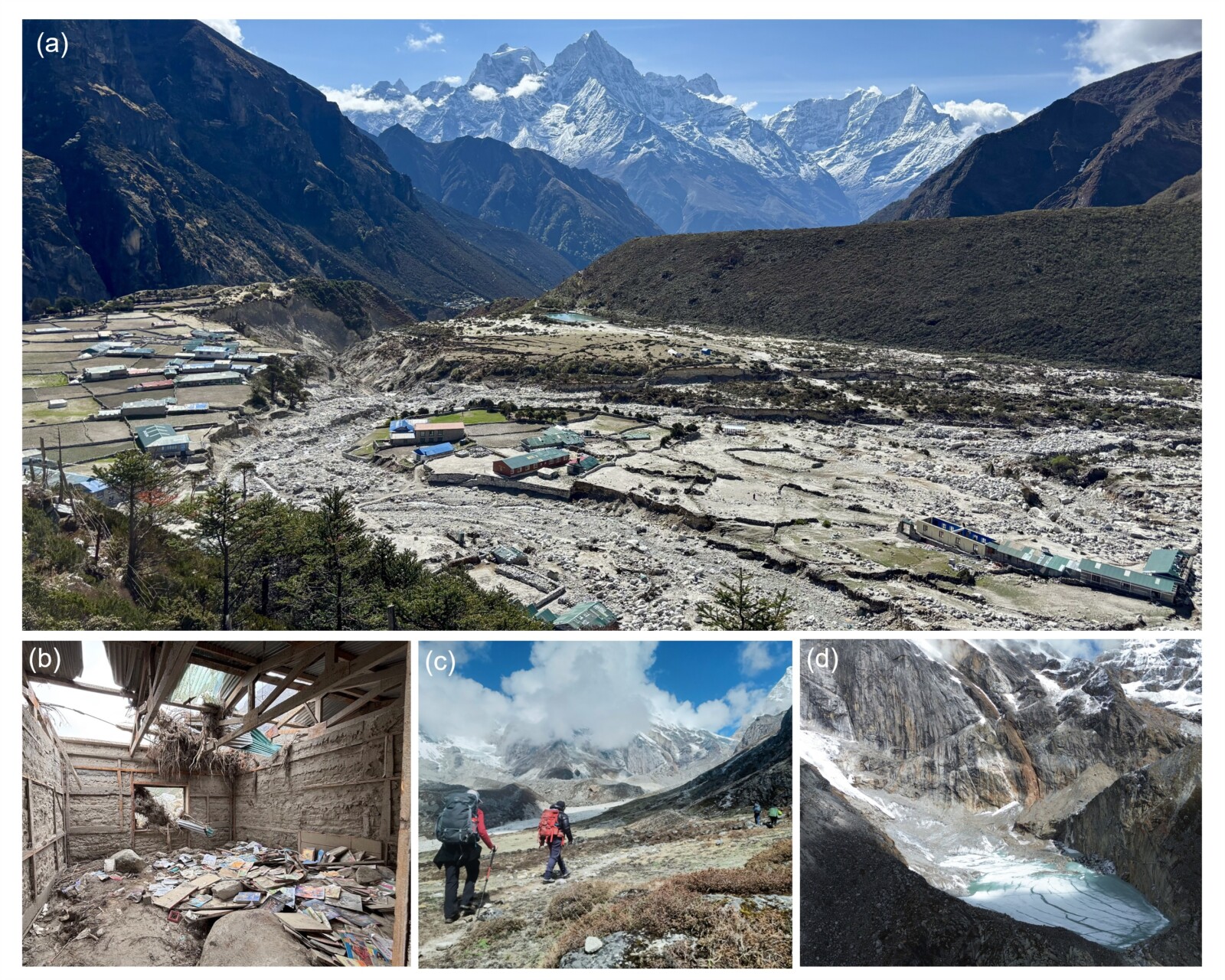
Figure 3. (a) A view across the village of Thame showing extensive flood damage and erosional scars from the August 2024 glacial lake outburst flood; (b): damage to Thame school classroom; (c) GLO team on route to the glacial lakes; (d) the Upper Ngole glacial lake at 4900 m a.s.l , still partially frozen, responsible for the start of the cascading lake drainage event on 16th August 2024 [Credit: (a,b) Lauren D. Rawlins; (c) Rajendra Shrestha; (d) C. Scott Watson]
The Ngole lakes, however, were just the beginning…
Over the following weeks, our route took us across much of the Khumbu region, surveying lakes at the margins of glaciers dammed by loose sediment and rock, while others spanned the surface of glaciers itself. No two lakes were the same, each coming with its own logistical challenges, whether that be the distance travelled to reach them or navigating the maze of rocks, ice cliffs and meltwater on debris-covered glacier surfaces.
But the field season was about far more than just surveying glacial lakes. It was also connecting with and appreciating the landscape, the culture and the local people who call these mountains home. Between survey sites, we spent days trekking with our local guides through spectacular (and sometimes sketchy) terrain marked with colourful prayer flags, crossing suspension bridges high above roaring glacial rivers, climbing high mountain passes and passing yak and donkeys transporting supplies between remote settlements. The tinkling of yak bells became our trekking soundscape. Evenings were spent in family-run teahouses, with welcoming hosts fuelling us with Dhal Bhat (a traditional Nepali meal of lentil soup, rice and vegetables) and countless cups of Chiya (a sweel Nepali milk tea) whilst warming up around the communal stove often fuelled by dried yak dung.
Surveying the landscapes and waiting for blue skies
After hours (sometimes days) of trekking to reach a survey site, it wasn’t as easy as just turning up, unpacking and collecting data. The weather was in charge. Whilst trekking determined where we could survey, and altitude determined how fast we got there, the weather dictated when. Mornings began much in the same way: unzip the sleeping bag, open the teahouse curtains and look outside. A clear morning, yay! Time to get moving.
Drone surveying started early to get ahead of the afternoon cloud that regularly drifted into the valleys. Sometimes I spent hours waiting for a clear window. Then it was GO GO GO. Batteries unpacked, flight plans checked and the drone launched (Figure 4). The drone was flown back and forth in a grid-like formation across the glacier, lake(s) and valley, capturing hundreds of overlapping photographs. Cold temperatures limited flights to around 20 minutes before batteries needed changing and recharging from a portable power bank. To help maintain line of sight, I often walked several kilometres along the moraine as it followed its survey route.
Of course, no field campaign is complete without unexpected equipment issues. One of our larger drones decided it had no interest in flying in the Khumbu (likely due to geofencing restrictions at the time). Thankfully, we had a backup drone with us, which saved the day and allowed the surveys to continue (Figure 4). A challenge I had also not fully appreciated beforehand was helicopters. Even outside of the main tourist season, helicopters would zip up and down valley, particularly to and from Everest base camp. This meant constantly scanning the sky and listening out for the hum of rotor blades, and either lowering the drone or landing back at the moraine until the aircraft passed.
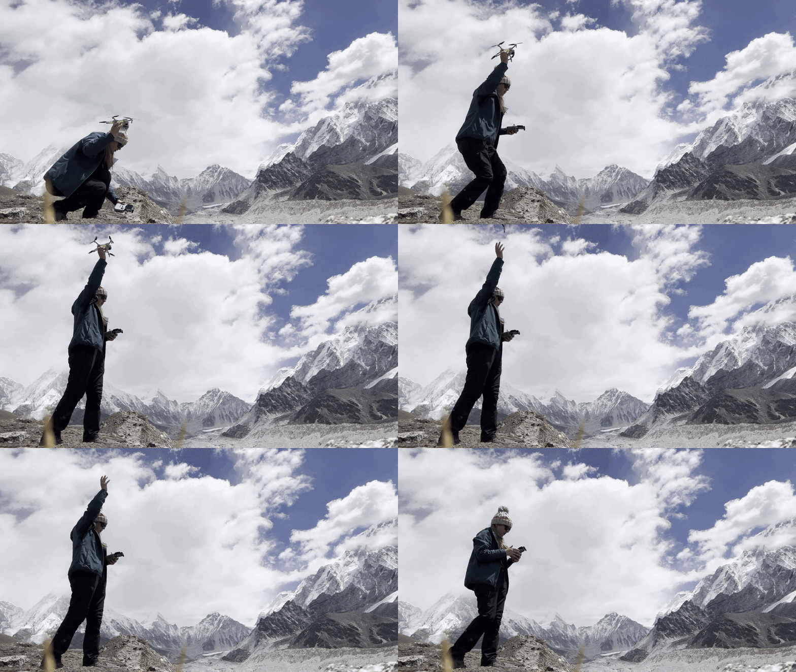
Figure 4. Drone take off ready for surveying of the Khumbu Glacier, Nepal. [Credit: Lauren D. Rawlins]
What about below the lake surface?
Whilst I focused on collecting aerial imagery and high-precision GPS (GNSS) measurements of the lakes, moraines and surrounding valleys, GLO Principal Investigator Scott Watson carried out depth surveys, known as bathymetry surveys, from a small inflatable kayak (Figure 5). Using a sonar system mounted on the kayak, he mapped the depth and shape of the lake bed while paddling along parallel survey lines. Combined with the drone imagery, these datasets allow us to build detailed 3D models and better estimate lake water volume. From the moraine ridges, I could often see the kayak moving as a tiny speck in the distance.
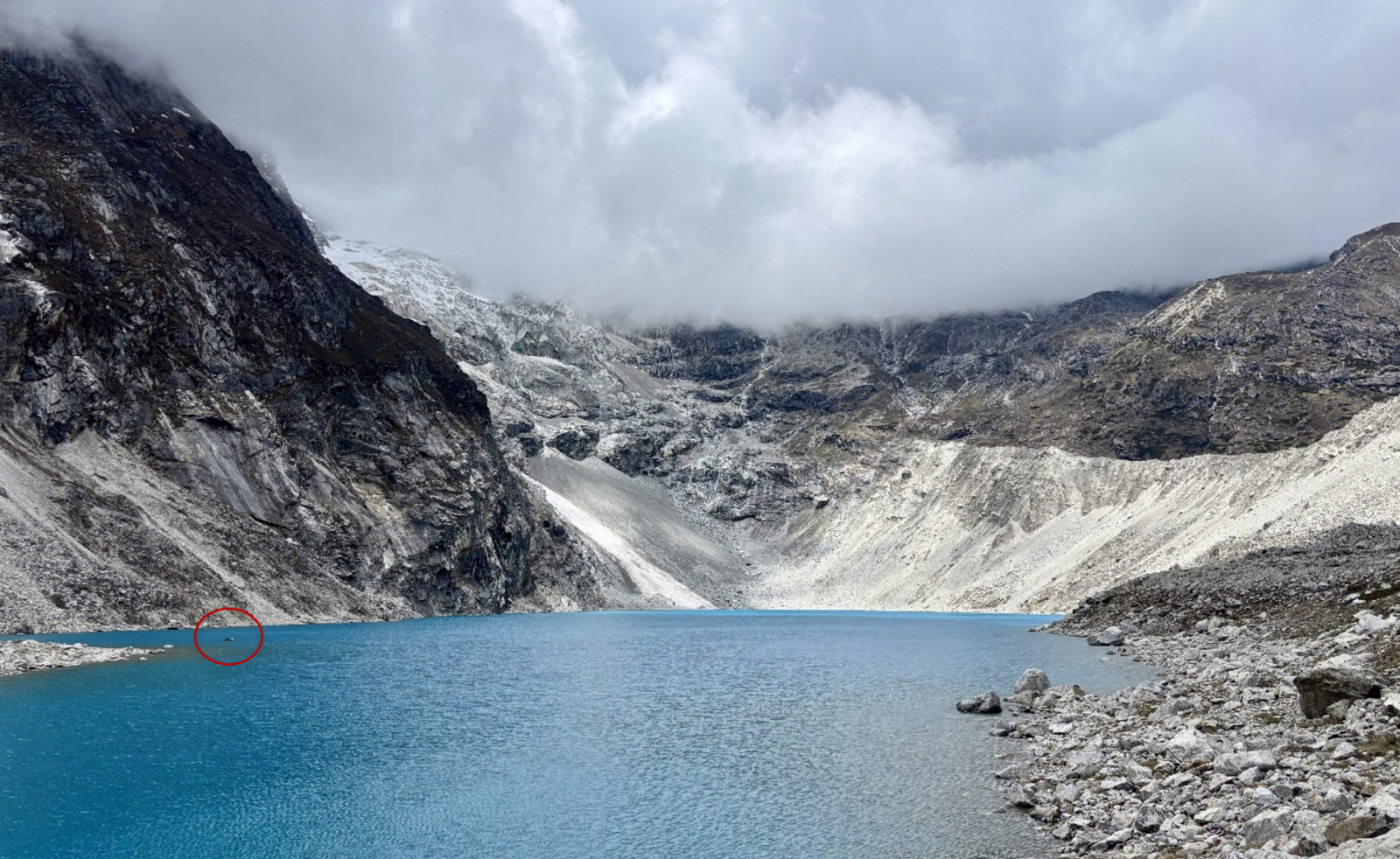
Figure 5. Dig Tsho lake, Nepal. Red circle shows the location of the sonar-mounted kayak performing bathymetry surveys by Scott Watson. [Credit: Lauren D. Rawlins]
Slowly, slowly
An important aspect of the field trekking was shaped by the need to acclimatise to the increasing altitude. The route was carefully planned with rest days and gradual ascents to allow our bodies to adjust to the elevation. After all, with survey sites regularly hitting altitudes of 4500+ m, and the mountain passes of Renjo La and Cho La reaching upwards of 5400 m a.s.l, this was no easy task – it was both physically and mentally demanding.
A few days into fieldwork, I learned one of the most valuable Nepali phrases (actually, more the mantra), from my wonderful guide Mahesh: “slowly, slowly”. Alongside trekking and working in this remote, beautiful landscape, the altitude was a whole different ball game. At first, I thought the phrase was simply encouraging me to take my time. However, it didn’t take long to realise that “slowly, slowly” was essential. Despite the acclimatisation schedule, there were days when my brain and body struggled. Headaches occasionally crept in, appetite reduced, and even relatively gentle uphill sections left me out of breath, with progress often becoming a case of stop, start. Mentally, I found this particularly frustrating, having to accept that the mountains would dictate my pace, not me.
Nowhere was that lesson clearer than on the two high mountain passes of Renjo La (5,360 m a.s.l.) and Cho La (5,420 m a.s.l.). On a map, they looked like little more than lines connecting neighbouring valleys. On foot, they were anything but. Renjo La rewarded hours of climbing with spectacular views across Ngozumpa Glacier and the turquoise Gokyo lakes (Figure 6). A few days later, Cho La brought another demanding crossing on the 24 km trek to the village of Lobuche. Here, overlooking Khumbu Glacier from the moraine ridge, the remnants of Everest Base Camp could be seen upvalley (Figure 7). By then, Mahesh’s mantra of “slowly, slowly” had become second nature.
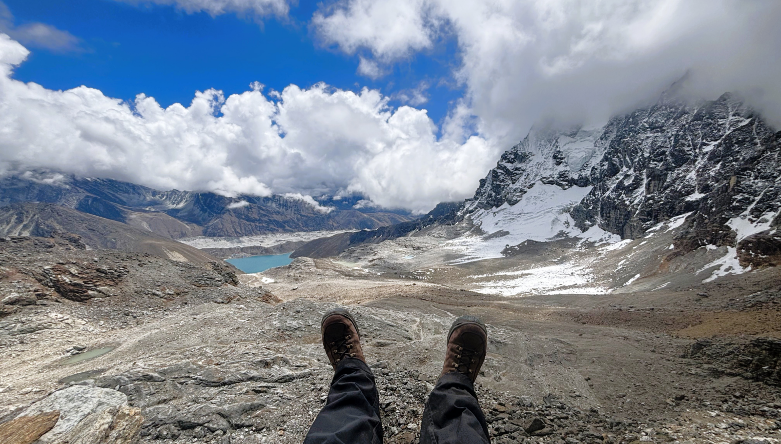
Figure 6. The view from the top of Renjo La Pass at 5360 m a.s.l. with Ngozumpa Glacier and Gokyo lake below. [Credit: Lauren D. Rawlins]
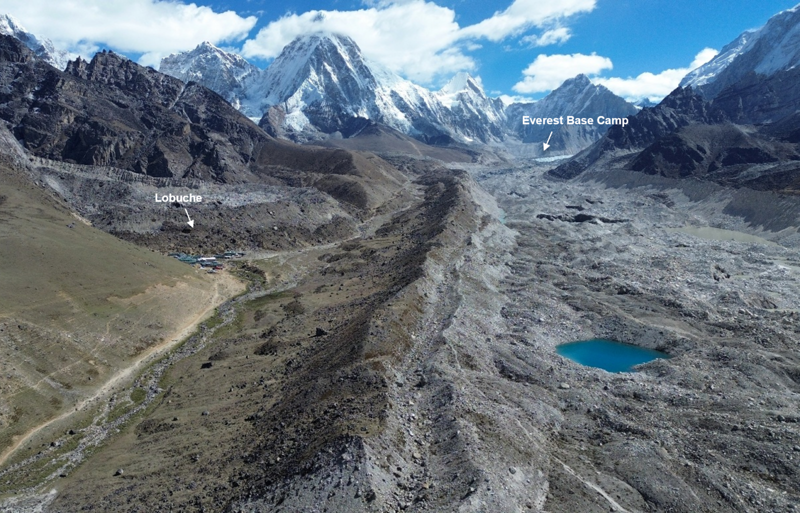
Figure 7. Drone image of Lobuche village (left), Khumbu glacier (right) and, in the distance, the location of Everest Base Camp (5,364 m a.s.l) [Credit: Lauren D. Rawlins]
Looking back (and forwards…)
By the end of the field campaign, we had crossed much of the Khumbu (Everest) region. We surveyed 30+ lakes, collected thousands of drone images, and covered more than 200 km through some of the world’s most spectacular mountain landscapes. Data on these lakes are now being transformed into detailed maps and 3D models, which alongside satellite observations, will help improve our understanding of glacial lake evolution, better estimate lake volumes and improve flood hazard modelling in the Himalayas.
As a whole, I learned a tremendous amount about this remarkable landscape and country and was fortunate to meet some truly incredible Nepalis along the way, including our wonderful trekking team, without whom none of the fieldwork would have been possible. I also learned a great deal about myself. From navigating the challenges of altitude and unpredictable weather to trekking across glaciers and high mountain passes, the experience pushed me well beyond my comfort zone and left me with memories that will stay with me forever.
Fortunately, this is not the end of the fieldwork story. In May and June 2026, we, the GLO team, returned to Nepal, this time to the Annapurna-Manaslu region, to continue surveying glacial lakes and downstream valleys (Figure 8). Another set of lakes, plenty more data collected and another chapter in understanding how this mountain landscape is changing.
Perhaps a story for another day…
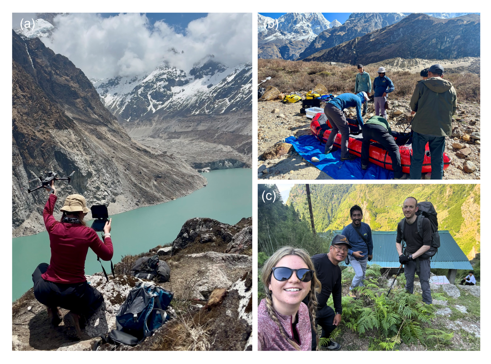
Figure 8. Snapshots of the GLO team in the Annapurna-Manaslu region, Nepal, in May-June 2026. (a) Drone launch by Lauren D. Rawlins at Thulagi lake; (b) Sonar-mounted kayak preparations; (c) The GLO team – Lauren D. Rawlins, Mahesh Magar, Rajendra Shrestha and C.Scott Watson [Credit: Lauren D. Rawlins]
You can watch a short outreach video of our fieldwork so far here!
With thanks to: Scott Watson (GLO PI); Rajendra Shrestha (NDRI); Mahesh Magar (Guide); Kaji Lama (Guide); Nepali chefs and porters; Himalayan Research Expeditions (HRE); Civil Aviation Authority Nepal; Department of National Parks and Wildlife Conservation.
References and further reading
-
ICIMOD (2019) Glacial lake outburst flood video https://www.youtube.com/watch?v=awLGxl5JmjY
-
Khadka, N., Liu, W., Shrestha, M., Watson, C.S., Acharya, S., Chen, X. and Gouli, M.R., 2025. Multidisciplinary perspectives in understanding Himalayan glacial lakes in a climate challenged world. Information Geography, 1(1), p.100002.
-
Shugar, D. H., Burr, A., Haritashya, U. K., Kargel, J. S., Watson, C. S., Kennedy, M. C., Bevington, A. R., Betts, R. A., Harrison, S., and Strattman, K.: Rapid worldwide growth of glacial lakes since 1990, Nat Clim Change, 10, 939–945, https://doi.org/10.1038/s41558-020-0855-4, 2020
-
Zhang, T., Wang, W., and An, B.: Heterogeneous changes in global glacial lakes under coupled climate warming and glacier thinning, Commun. Earth Environ., 5, 374, https://doi.org/10.1038/s43247-024-01544-y, 2024a