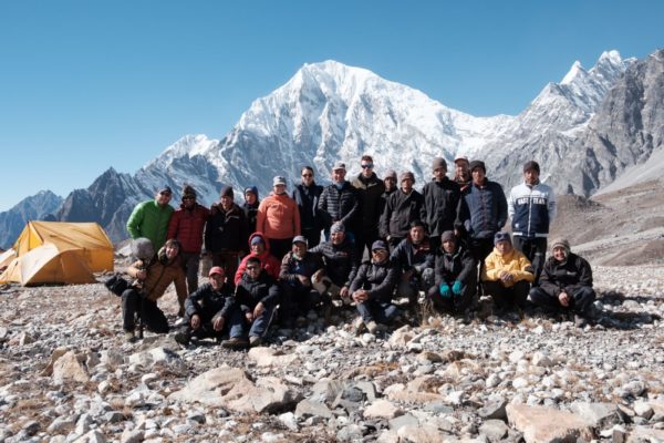
The Himalayas are Big. But how Big is the fieldwork experience? What is behind all the mountain field data and beautiful mountain pictures? 40 preparation emails, 110 km of hiking, 170 kg of gear and 25 people in the team. We try to put some numbers on the experience we had during the Langtang, Nepal Himalaya expedition in November 2022.
Behind the scenes
Remote mountain fieldwork can be quite an adventure, and it requires a lot of preparation. When it comes to the logistics of high-mountain fieldwork, our research group at Utrecht University has experience – or at least part of our group has. For the two of us, this was the first time in the Himalayas. Despite having fieldwork experience in other parts of the world, the immensity of the Himalayan landscape, and how it complicates fieldwork, was eye-opening.
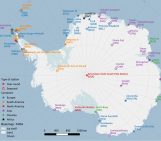
Last November, we had the chance to learn first-hand how much goes on to make mountain fieldwork happen when we headed to the Langtang valley, in the Nepal Himalayas. The valley is about 100 km north of Kathmandu, close to the border with China, and is a popular trekking destination. Together with our group from Utrecht University, two filmmakers joined to document the research process.
We were there to collect data for our own individual projects, but also to continue the monitoring efforts of the area: downloading weather and water data, replacing broken instruments and making notes of what needs to be done next time. With mountain science in such a remote setting, collaboration is key. The monitoring efforts are carried out with colleagues from the International Centre for Integrated Mountain Development (ICIMOD), Swiss Federal Institute for Forest, Snow and Landscape Research (WSL) and many others. At the moment, there are 218 sensors, measuring different components of the water cycle, at 62 locations in the Langtang valley, that are running on 10-minute to 1-hour temporal resolution. Most of the data, which in the Langtang valley has been collected since 2012, was published 2 years ago (Steiner et al., 2021).
In this blog post, we put some numbers on our fieldwork experience in the Himalayas. Hopefully, this provides some context on what goes on to obtain high-quality field data from high mountains and hopefully express our appreciation for it. Keep in mind that some of the numbers (especially related to hiking) can deviate a little bit per team member.
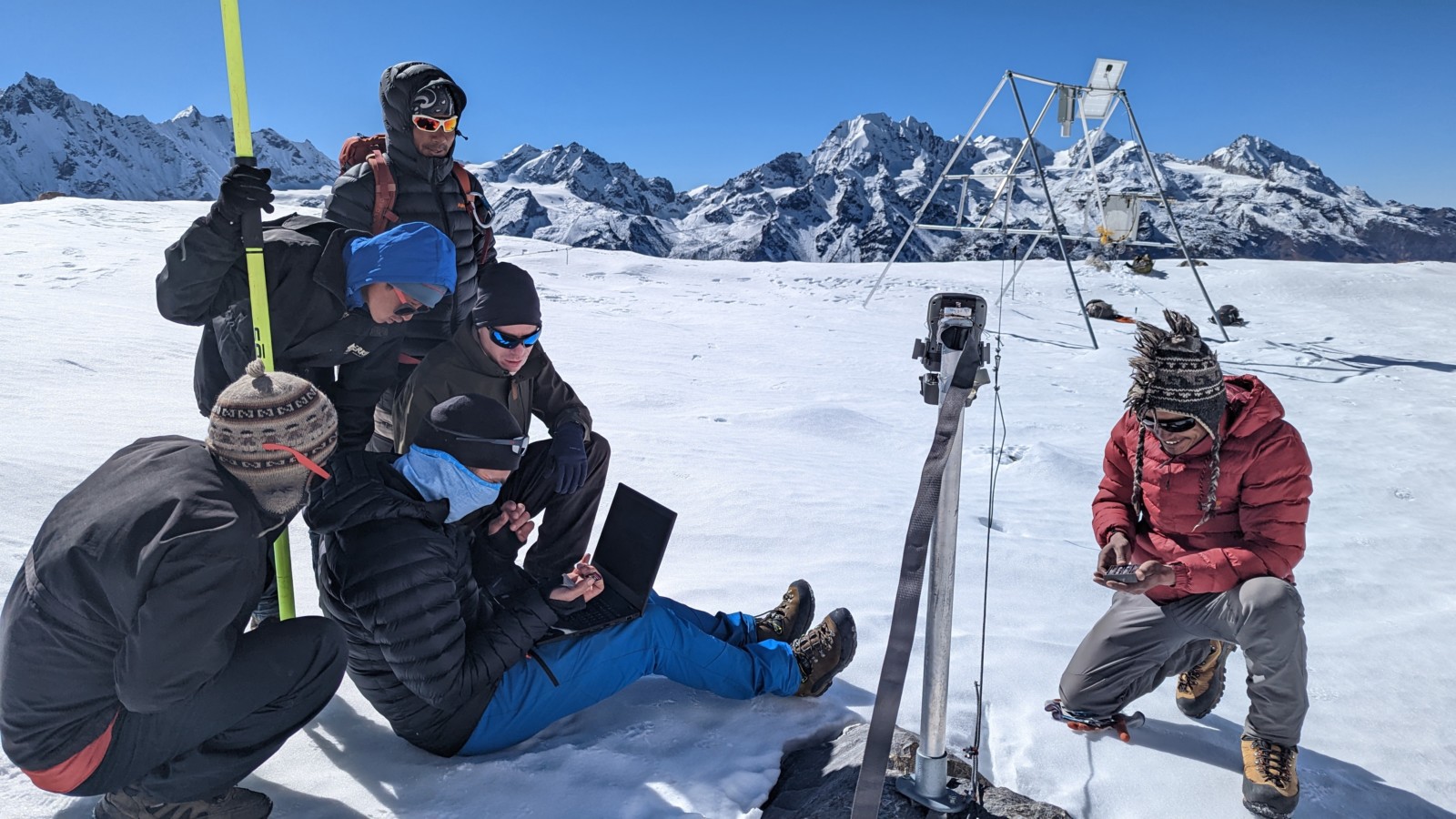
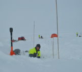
Downloading data from the weather station at Yala glacier. [Credit: Caroline Aubry-Wake]
Preparations
8 months in advance – start of the preparations
5 meetings with the research team and filmmaking team
40 e-mails with the trekking agency
8 hours of meetings with the trekking agency
Double-checking endless gear lists, testing the instruments, writing protocols, making a detailed research plan, and doing last-minute equipment shopping only covers a fraction of what needs to be prepared. Organizing the logistics of the trip, such as accommodation and transport, is very time-consuming. Our team works with a trekking agency, which handles all the non-scientific aspects of the trip, including obtaining permits and supporting us once we are in the mountains. That way, we can focus on the science. We try to hire the same support team every year, and they are an essential part of our crew!
Equipment
170 kg total weight of all gear
15 kg of personal clothes and gear in a duffel bag
180 lithium AA batteries for different sensors and time-lapse cameras
7 time-lapse cameras for debris flow monitoring
60 sampling bottles for water
2 laptops
Spread across 5 teammates, we brought about 70 kg of luggage from Utrecht to Nepal. That included personal luggage (15 kg/person), replacement batteries for existing weather stations and sensors, 15 kg of metal mounting systems for new time-lapse cameras and temperature loggers, bottles for water sampling, electrical conductivity meter, field notebooks, spare parts and other little things. To avoid transporting equipment back and forth between Nepal and Utrecht, the team has 3 big boxes of equipment stored in a village in the valley: drill, screwdrivers, tie wraps, etc. On top of all the science equipment, the film crew had about 100 kg of cameras, microphones and batteries with them. Besides the stuff we brought with us from Utrecht, we also had all the support equipment managed by the trekking agency: tents, cooking shelter and cooking gear, stoves, crampons, harnesses, helmets, etc.
Travel
6940 km distance from our office in Utrecht to our field site
13 hours 15 minutes of travel time from Amsterdam Airport to Kathmandu
110 km and 9 hours drive from Kathmandu to Langtang National Park
5:45 hours time difference
Langtang is a famous trekking destination in Nepal due to its proximity to the capital city. It still took us approximately 9 hours of driving to get from Kathmandu to Sherpa gaon – the starting point of our trek. That included some data downloads and maintenance of one automatic weather station and about a 2-hour spent at the checkpoint to enter the national park, while the police checked our permits and our bags. The park, like nearly all parks in Nepal, is patrolled by the national army that checks visitors for the transport of illegal goods and smuggling of wildlife. So, it is important to allocate time and pack everything to ease these checks.
Travels and logistics while in the field
110.3 km hiked
4927 m total elevation ascent
19.7 km longest hike in a day
5100 m asl highest elevation
The Himalayas are BIG. It takes a lot of time to reach all our instruments. The distances feel even larger due to the high altitude, as we all operate at reduced speed due to the lower oxygen levels. Out of the 14 days that we spent outside of Kathmandu, we had 9 days staying in teahouses (or lodges, as they are often called), and 5 nights of camping. We stayed at 6 different locations: 4 teahouses and 2 camps. We had 1 day in Kathmandu prior to heading out in the field, 8 hiking days where we hiked from one location to another, and 4.5 days where we returned to the “basecamp”. We also had 1.5 rest days in Kyanjing village to get used to being at a high elevation. Well, some of us had. The hiking times varied between team members depending, how used the person is to being in the high-altitude environment, skills and general fitness.
Crew
25 people (2 women in the team)
- 5 scientists
- 3 guides
- 2 cooks
- 13 porters
- 2 filmmakers
The high mountain fieldwork project can not be done by scientists alone. Our team included researchers, guides, a cooking crew and porters who helped us with the logistics: setting up camps, preparing meals, carrying gear, and also with the scientific tasks such as with the installations of the sensors and taking samples. At altitude, even the simplest task (like drilling a hole) took us a lot of energy, and our support team was crucial in insuring the science got done well and in a timely manner. In addition, 2 filmmakers joined to make a short documentary about our research. And in addition, 1 person back in the office acted as an emergency contact, also updating the field crew on the weather forecast via satellite phone.
Monitoring and research
In total, we visited:
- 26 instrumented locations
- 7 tipping buckets (for precipitation measurements)
- 5 soil moisture sensors
- 7 automatic weather stations of varying complexity
- 24 water sampling sites
And we installed:
- 7 new time-lapse cameras (in addition to already existing ones)
- 5 new sub-surface temperature sensors
Over the years, monitoring instruments at Langtang have been removed or re-installed, and new instruments added to fit our research needs. Between the turnover of researchers going into the field and the pandemic years that limited field visits, tracking the location and condition of instruments has been no small feat. But with good metadata and a lot of thinking, we managed to visit all 26 locations. Most equipment/sensors still worked, but some had not survived the past year. Some just needed cleaning and changing of batteries to continue their data collection. In addition to the existing monitoring instruments, we also had some new measurements. We collected water samples to investigate surface water-groundwater interactions in the valley. We deployed multiple time-lapse cameras and installed sub-surface rock temperature sensors to look into debris flows, sediment movement and production and permafrost creep. We scoped out locations for installations we aim to do the next time we visit.
When in the field
8 dal bhat lunches and dinners
12 lemon tea breaks
~11 painkillers consumed to reduce the elevation headaches
3 showers
3 layers of down jackets during dinners at campsites
Many pairs of hiking socks
Being in the Himalayas gave us a glimpse of the culture in the region while confronting us with everyday luxuries we take for granted. We ate a lot of the local staple food of dal bhat (rice with lentil soup and vegetable sides), and became very fond of the hot lemon drinks and the garlic soups (recommended for acclimatization). We got to know our guides and porters and learned about their families and careers. When staying in lodges that our research group has visited for many years already, it often felt like old friends catching up with heartwarming welcomes. This was juxtaposed with the not-heartwarming parts of fieldwork: limited showers, low temperatures, smelly socks and the occasional altitude headaches (that we monitored carefully to stay safe and avoid elevation sickness).
Post-processing
Reflecting on field trips like these provides a deep appreciation for the people and the process that goes into obtaining every new data point. Against the background of global-scale modelling efforts, small-scale observations and process studies like ours might seem insignificant. However, fieldwork remains a crucial component of our understanding of the Earth system, providing the best basis for validating and downscaling models or remote sensing products, especially in remote areas like the HMA. After all, to properly understand large-scale systems one must always start small, revealing the complexity of small-scale processes. Fieldwork is also a necessary reminder of the holistic view we need to take of the mountains as a system – a view that is sometimes easy to forget in the hours spent working with these data in front of a computer. The mountains are rapidly changing. Between glacier retreat, shifting precipitation and warming temperature, the risk of natural hazards and the changing water supply is influencing both the population within these mountains, but also the population downstream. Fieldwork, despite its challenges, must thus continue to help us quantify, understand and mitigate the impacts on the mountains and its people.
Further reading
Steiner, Jakob F., Tika R. Gurung, Sharad P. Joshi, Inka Koch, Tuomo Saloranta, Joseph Shea, Arun B. Shrestha, Emmy Stigter, and Walter W. Immerzeel. “Multi‐year observations of the high mountain water cycle in the Langtang catchment, Central Himalaya.” Hydrological Processes 35, no. 5 (2021). https://doi.org/10.1002/hyp.14189
Previous blog about the EverDrill project in the Himalayas
Edited by Giovanni Baccolo and Loeka Jongejans
 Dr. Caroline Aubry-Wake is a postdoctoral fellow in the Mountain Hydrology group at Utrecht University, the Netherlands. She investigates how water moves in high mountain regions using fieldwork data and hydrological simulations, with her project looking into cryosphere-groundwater interactions in the Langtang basin, in the Nepal Himalayas. Caroline tweets as @CryoCaro. Contact: caroline.aubrywake@gmail.com
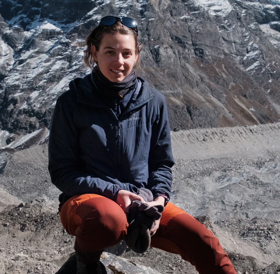 Varvara Bazilova is a PhD researcher in the Mountain Hydrology group at Utrecht University, the Netherlands. She uses machine learning and physical modeling to understand mountain hazards, such as debris flows, across High Mountain Asia, and to investigate how this will change in the future. You can find Varvara on twitter as @ varyabazilova. Contact: v.bazilova@uu.nl