People usually perceive space and time, comparing them to their own life Words such as “forever” and “until the end” appear in fiction But how can we imagine the space and time of the mountain glaciers whose existence goes beyond our usual perception? And why is it so important for us now? With this post, researcher Alexandra Rogozhina shares her thoughts on these suggestive topics.
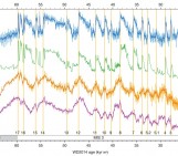
Mostly, when we hear about the loss of glaciers, it is regarding climate change. Undoubtedly, glaciers are the most sensitive indicators of climate change. They make these changes visible to us. Most often information about ice loss is presented in the form of graphics and diagrams. Or sometimes only with calculations and numbers. But we can’t imagine the real picture of the process and the scale of the reduction of the glaciers. Thus, it’s also impossible to link these changes to things we are familiar with and present it to people outside of science or mathematics.
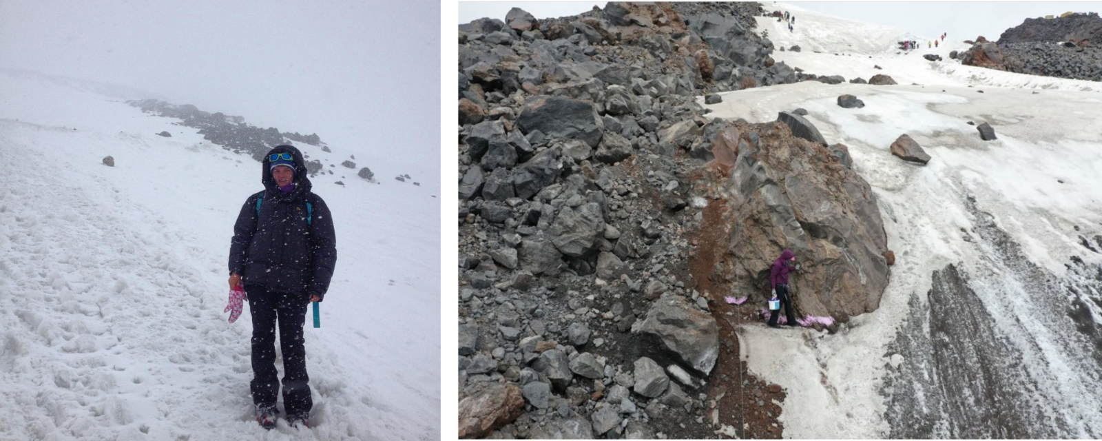
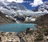
Garabashi glacier, Elbrus mountain, 2013 & 2020. [Credits: Alexandra Rogozhina]
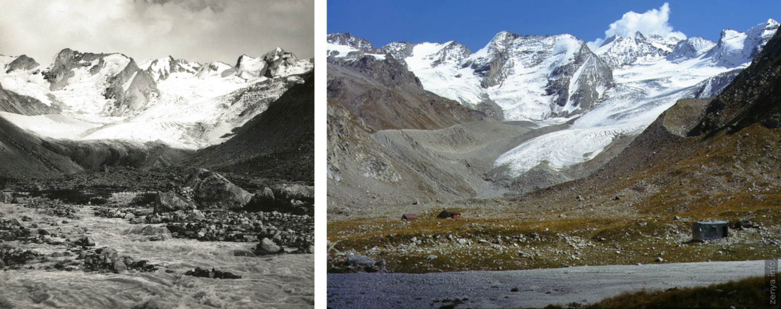
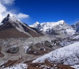
Djhankhyat glacier, Elbrus mountain region, 1967 & 2000. [Credits: Alexandra Rogozhina & IGRAS/RGO]
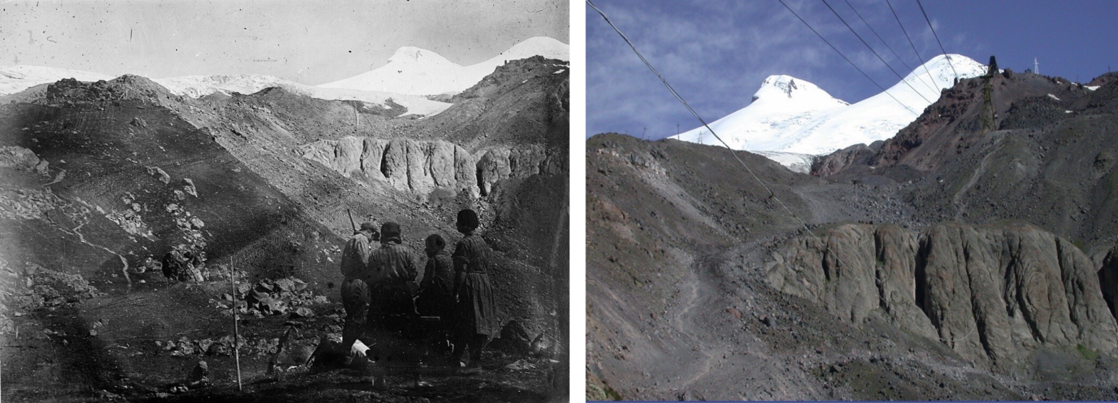
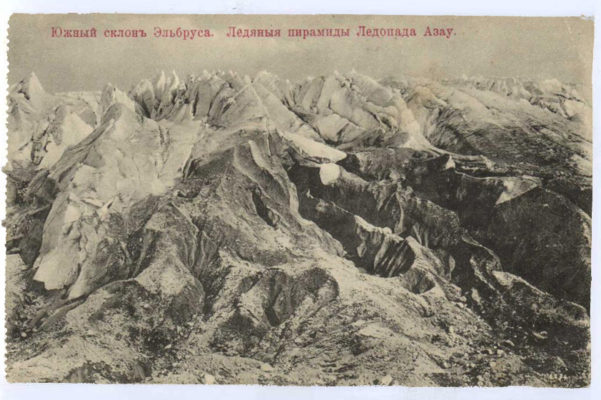
Rocks in a place of Azay glacier ice fall in 1932 & 2020. [Credits: Alexandra Rogozhina & IGRAS/RGO]
Repeat photography
Usually, in science articles we can see two photos of the same glacier in the late 19th century and today. We can see the difference of 100 years as a result of climate change. But I wanted to show the process, and how this change happened over time. It was very difficult and tedious work to find the images of the same glacier from the same angles. It doesn’t have to be a photo image. It might also be a life drawing, engraving, lithography, daguerreotype image, postcard, stereo photo pair, card, newspaper article and any other type of image. The main idea is that presenting these images in a row for a certain glacier can provide us with the information about its past and tell us its real life story.
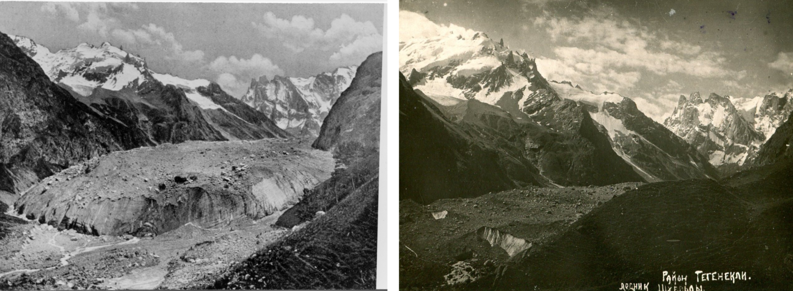
Shelda glacier, Elbrus mountain region, 1886 & 1934. [Credits: Alexandra Rogozhina & IGRAS/RGO]
Lifelines
Sometimes I get sad when I look at the glaciers’ lifelines carved into the rock like the lifelines on a palm of a human. Trimlines are the typical marks left by the glaciers on the borders of the valley. These lines show us where the glacier was located in the past, but it is still hard to understand what happened with them 150 years ago, because the time and space of a human life is very different to that of a living glacier. This difference is shown by rows of historical images of mountain glaciers.
Now I am beginning to collect the Alpine glacier images and I’m open for offers and collaborations, if you are interested, please reach out!
An animation showing the evolution of Terskol glacier in the last 150 years (Elbrus mountain). [Credits: Alexandra Rogozhina & IGRAS/RGO]
Edited by Jenny Turton, Hayat Nasirova and Giovanni Baccolo
 Alexandra Rozoghina is an indipendent researcher, she is working on the construction of a photographic archive of the Caucasus glaciers. She can be contacted one her IG account