Through the scientific excursion part of the University Centre in Svalbard (UNIS) course ‘Arctic Late Quaternary Glacial and Marine Environmental History’, a few lucky grad students got to visit Nordaustlandet, northeastern Svalbard. This is the story of our research adventure in this beautiful, remote part of the Arctic.
On a bright and early morning in late August, a group of 16 students, 4 professors, an engineer and a safety and logistics expert (arguably the most important person!), set foot to the Longyearbyen harbour. Here, we find our home for the week: Stålbas, a former seal hunting vessel. The 58m long ship, built in 1955, is now used as a research vessel and for whale counting. The group, a mix of 13 different nationalities and PhD and master students from various backgrounds, has just finished an intense week of lectures on topics relating to the upcoming fieldwork focussing on the marine and glacial history of the north of Svalbard. Our destination is about 26 hours away, so once on board everyone settles in with seasickness tablets and a little patience, while we set sail for Oxfordhalvøya, Nordaustlandet, Svalbard (see the map below!).
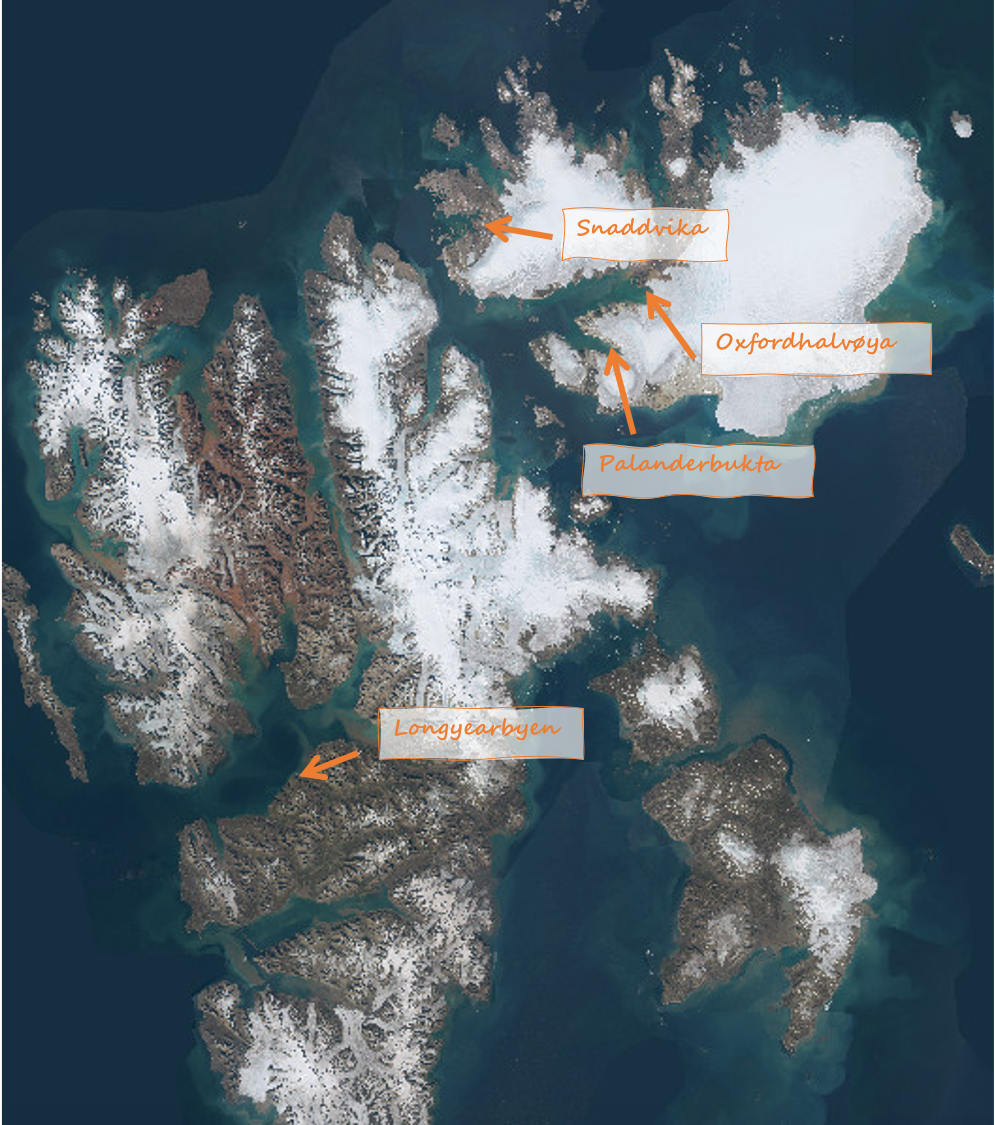
Map of Nordaustlandet, Svalbard. Figure source: Toposvalbard.no.
After a day or so of whale watching, puffin gazing, eating and trying to sleep while being rocked back and forth, we arrive at Oxfordhalvøya. A brief reconnaissance trip to scout out the area is first point of order: in what kind of landscape will we spend these next few days? After being brought to shore in a dinghy, we get our bearings and prepare for four days of work in four rotating groups. The objective is to put together a field map of the area on a range of topics:
- Raised beaches: the mapping of raised beaches and the collection of shell and whale bone samples for radiocarbon dating. From these data, local sea level curves can be constructed.
- Geomorphology and sedimentology: the mapping of landforms and sections, and the collection of sediment samples, in order to understand the story the landscape tells us about former glaciation.
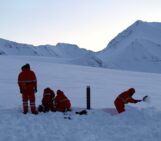
- Lake coring: the coring of threshold lakes, in this area Kløverbladvatna, with a piston corer and gravity corer, to take back to the lab for analysis.
- CTD (conductivity, temperature, depth) probing: taking measurements in the fjord, lagoon and at the glacier front, telling us more about salinity at various depths.
After preparation and a good (quiet, as we’re finally anchored) night’s sleep, the first two days go off without a hitch. Dressed ready for all kinds of weather, the groups come back to the ship with whale bone, many shell and sediment samples, some successful cores and cold hands and noses. Everyone is elated that sampling is going so well, but also mildly disappointed that the only polar bear we’ve seen so far was in the form of a skeleton at the lake shore. But, as the professors keep reminding us, the Arctic is unpredictable.
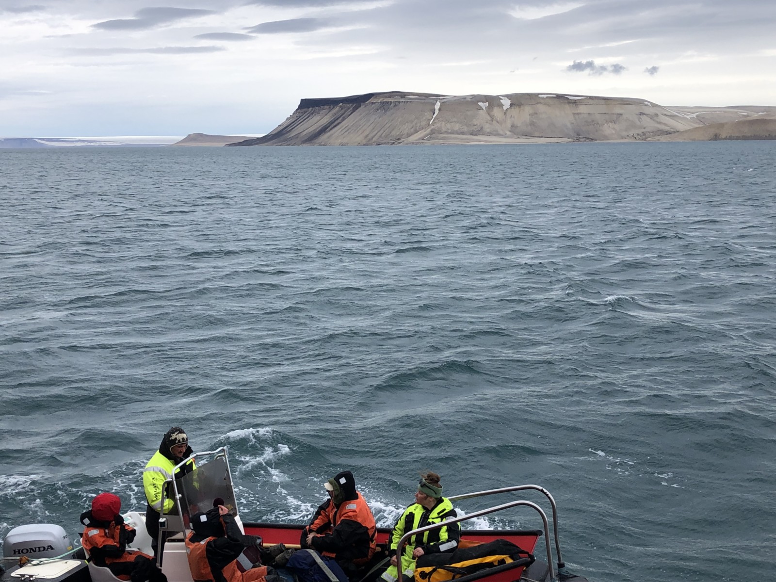
A group setting off to shore. Photo credit: Larissa van der Laan.
We find out exactly how unpredictable the next morning, as we set off to the lake carrying equipment. Arriving at the shore, scanning the surroundings, nothing seems amiss. But then suddenly behind us we hear: “BEAAAR! BEAR! BEAR!”. And we look to our right, where he is hanging out by the lake: a big, mud-covered polar bear. More brown than white, but still terrifying and beautiful at the same time. And, unfortunately, very curious. Our talented safety expert has trained us well though: back to shore, no running, pile up backpacks, and get as many people into the dinghy as we can. Still, we need to get one of the groups back into walkie talkie range, and back onto the ship. It takes four flare gun shots to keep the bear at a safe distance, as he is eager to see why there are humans on his normally uninhabited island. Luckily for us, he seems well fed, so he is curious rather than aggressive. Once everyone is back on board, there is a collective sigh of relief though: all are safe, including the bear.
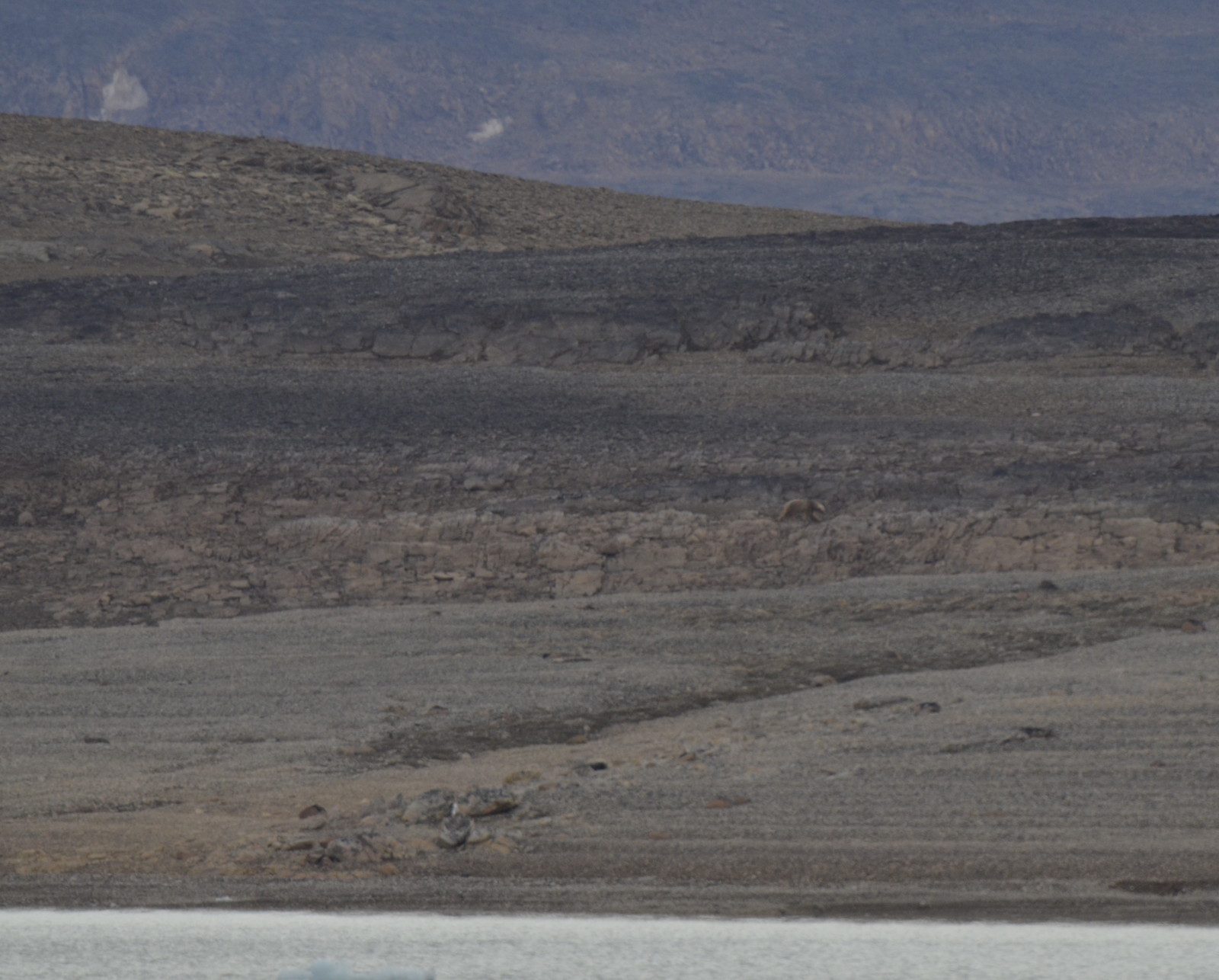
Can you spot the (brown) polar bear? This is the best photo we have of him. Photo credit: Agust Gustavsson.
For safety reasons though, this does mean we need a plan B, as we cannot go on shore here anymore. So, we head further south, where we are greeted by a storm in Palanderbuktan. After a brief reconnaissance trip here, the weather forces us to abandon our plan B as well. Wind and fog make it difficult to ensure safety on land, as well as making travel by dinghy quite dangerous. Our plan C takes us further to the north, where we spend the last day of our fieldwork collecting data around the Snaddvika area, celebrating that we’re working at 80°N.

Another bear, this time seen from the safety of the ship. Photo credit: Agust Gustavsson.
While making our way back to Longyearbyen, where we’ll spend two weeks working on group- and personal projects to analyze and interpret the data, we have a chance to look back at our fieldwork experience. The hot tub on deck is the perfect place for a discussion of our adventures (though not all field work has such luxury facilities!). PhD student Katrin Hättig, based at the Royal Netherlands Institute for Sea Research (NIOZ) in the Netherlands, gives a beautiful summary of her experience, which everyone agrees with: “The cruise was unique, with special people, in a very special environment. I enjoyed the interdisciplinary and open minded group! It was awesome to discover new areas, and discuss the samples and research together. The most important lesson I learned is: it’s essential to know your field area and safety measures. And especially — in the Arctic — to have a back-up plan!”
Further Svalbard reading in the Cryoblog:
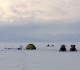
- Camping on the Svalbard coast
- The bi-polar behaviour of surge-type glaciers – Heidi Sevestre
- The Norwegian Polar Institute
- Image of the Week — Arctic porthole, Arctic portal
Edited by Andrew Smedley and Marie Cavitte
 Larissa van der Laan is a PhD Student at the Leibniz University Hannover, Germany and artist, aiming to communicate climate science (among other things) through art. Her research is within the project GLISSADE, focusing on glacier mass balance modelling on seasonal and decadal scales, using the Open Global Glacier Model (OGGM). Find her artistic and scientific musings on Instagram @anda.designstore and on twitter under @larissavdlaan. Contact Email: vdlaan@iww.uni-hannover.de.