To study how the ocean behaves in the glacial fjords of Antarctica and Greenland, we normally have to go there on big icebreaker campaigns. Or we rely on modelling results, especially so to determine what happens when the wind or ocean properties change. But there is also a third option that we tend to forget about: we can recreate the ocean in a lab. This is exactly what our Bergen-Gothenburg tea ...[Read More]
Image of the Week – Karthaus Summer School 2017
Glaciologists often undertake fieldwork in remote and difficult to access locations, which perhaps explains why they happily travel to similar locations to attend meetings and workshops. The Karthaus Summer School, which focuses on Ice Sheets and Glaciers in the Climate System, is no exception. The idyllic village of Karthaus, located in the narrow Schnalstal valley in Südtirol (Italy), has been h ...[Read More]
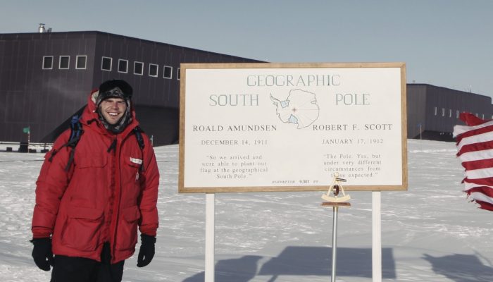
Mapping the bottom of the world — an Interview with Brad Herried, Antarctic Cartographer
Brad Herried, Antarctic cartographer at South Pole. [Credit: Brad Herried].
Mapping Earth’s most remote continent presents a number of unique challenges. Antarctic cartographers and scientists are using some of the most advanced mapping technologies available to get a clearer picture of the continent. We asked Brad Herried, a Cartographer and Web Developer at the Polar Geospatial Center at the University of Minnesota, a few questions about what it’s like to do this unique ...[Read More]
Image of the Week – The true size of Greenland
Greenland is a critical part of the world, which is regularly covered on this blog, because it hosts the second largest ice body on Earth – the Greenland Ice Sheet. This ice sheet, along with its small peripheral ice caps, contributes by 43% to current sea-level rise. However, despite being the world’s largest island Greenland, appears disproportionately large on the most common world maps (Fig. 2 ...[Read More]
Image of the Week: Petermann Glacier
Our image of the week shows the area around the calving front of Petermann Glacier through the spring, summer, and autumn of 2016. Petermann Glacier, in northern Greenland, is one of the largest glaciers of the Greenland Ice Sheet. It terminates in the huge Petermann Fjord, more than 10 km wide, surrounded by 1000 m cliffs and plunging to more than 1100 m below sea level at its deepest point. In 2 ...[Read More]
Image of the Week – Powering up the ground in the search for ice
In an earlier post, we talked briefly about below-ground ice and the consequences of its disappearing. However, to estimate the consequences of disappearing ground ice, one has to know that there actually is ice in the area of study. How much ice is there – and where is it? As the name suggests, below-ground ice is not so easy to spot with the naked eye. Using geophysical methods, however, ...[Read More]
Image of the Week – ROVing in the deep…
Robotics has revolutionised ocean observation, allowing for regular high resolution measurements even in remote locations or harsh conditions. But the ice-covered regions remain undersampled, especially the ice-ocean interface, as it is still too risky and complex to pilot instruments in this area. This is why it is exactly the area of interest of the paper from which our Image of the week is take ...[Read More]
Image of the Week – Bioalbedo: algae darken the Greenland Ice Sheet
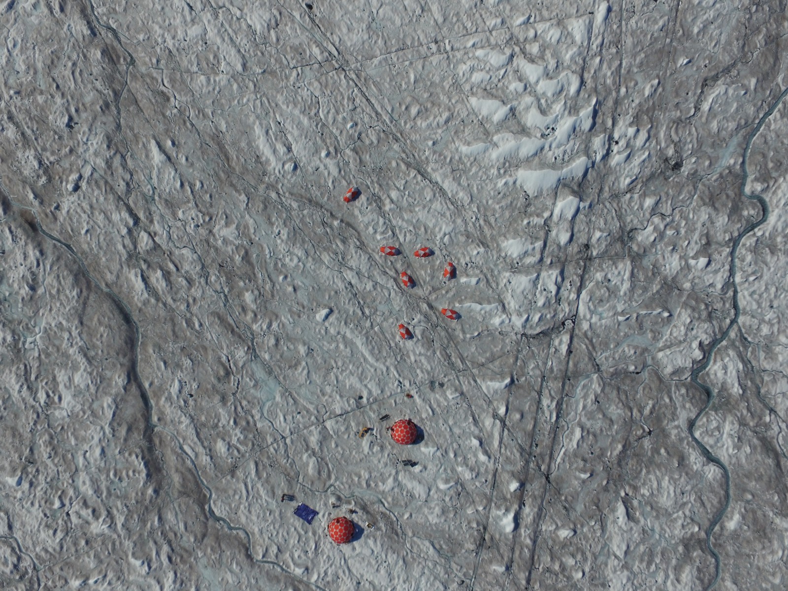
Fig 1: This aerial image shows the surprisingly dark grey-brown colour of the Greenland Ice Sheet surface, around the ‘Black and Bloom’ camp. [Credit: 'Black and Bloom']
Most of the energy that drives glacier melting comes directly from sunlight, with the amount of melting critically dependent on the amount of solar energy absorbed compared to that reflected back into the atmosphere. The amount of solar energy that is reflected by a surface without being absorbed is called the albedo. A low albedo surface absorbs more of the energy that hits it compared to a high ...[Read More]
Image of the week – Learning from our past!
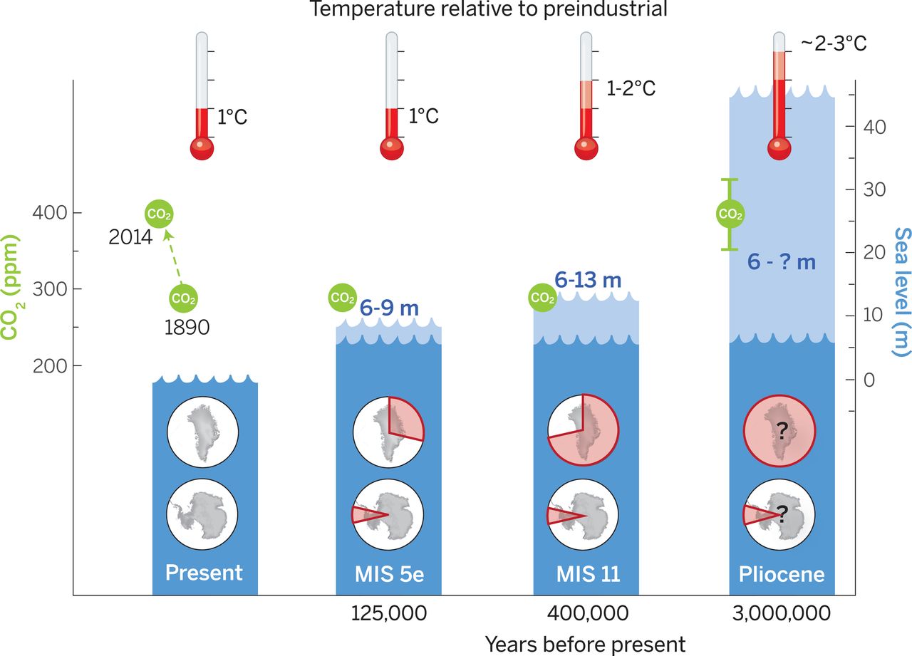
Figure 1: Peak global mean temperature, atmospheric CO2, maximum global mean sea level (GMSL) and source(s) of meltwater over the past 3 million years. The light blue area on each bar indicates the uncertainty associated with the maximum global mean sea level , and the pie charts denote the fraction (not location) of ice retreat in Greenland and Antarctica [Credit: Dutton et al. (2015)].
Understanding the climate evolution of our planet is not an easy task, but it is essential to understand the past if we are to predict the future! Historic climate cycles provide us with a glimpse into a period of time when the Earth was warmer than it was today. Our image of the week looks at these warmer periods of time to see what they can tell us about the future! For example, during the Plioc ...[Read More]
Image of the week – Getting glaciers noticed!
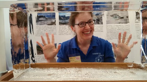
Public engagement and outreach in science is a big deal right now. In cryospheric science the need to inform the public about our research is vital to enable more people to understand how climate change is affecting water resources and sea level rise globally. There is also no better way to enthuse people about science than to involve them in it. However, bringing the cryosphere to the public is a ...[Read More]