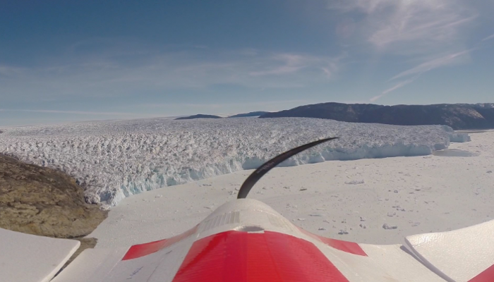
In the summer of 2014, our group at Aberystwyth University and the University of Cambridge decided to pursue an ambitious but exciting field campaign in West Greenland. The aim was to survey Store Glacier once a day using a fixed-wing unmanned aerial vehicle (UAV) (see photo above for a view from the UAV on its way back from a mission with Store Glacier, West Greenland in the background). The UAV is equipped with a digital camera, which takes photos every two seconds during its dangerous 40 km sortie over the glacier. These photos can be stitched together using multi-view stereophotogrammetry to produce high-resolution orthoimages and digital elevation models of the glacier. We hope to use the data to provide insights into the process of calving and the interplay between the glacier and sea-ice mélange that forms during the winter and breaks up in late spring.
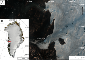
A) Landsat 8 true colour image of Store Glacier in August 2014 with the location of camp site. B) MODIS mosaic image of Greenland (Kargel et al., 2012, The Cryosphere) with location of Store Glacier which is situated in Uummannaq Bay.
The field campaign started on 7th May 2014 when my colleague, Nick Toberg, and I were dropped off by a helicopter on a peninsula by side of Store Glacier. This site was to be our home for the next 10 weeks and as we watched the helicopter disappear down the fjord, there were not two lonelier men on Earth. Temperatures dropped quickly to -20 degrees as the sun set behind the mountains so it was important to set up camp and prepare for a chilly first night. We were well provided for, with a large mess/science dome tent, individual sleeping tents, generators, a stove, kerosene heaters and a table and camping chairs. By the 9th May we were ready to start flying missions over Store Glacier.
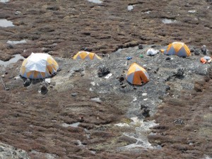
The camp with sleeping tents and mess/science tent. Generators and solar panels were used to charge laptops and UAV LiPo batteries.
A typical day would consist of a lazy breakfast, followed by some reading or hiking during the morning. We would then have lunch and aim to fly the UAV at 3pm. Setting up the UAV took a few minutes and a typical survey would take 30 minutes. At the start of the field campaign, these 30 minutes would seem like a lifetime and we would usually be too worried and agitated to think of anything but the plane. I would pace up and down trying to remember whether I had checked a certain part or become increasingly nervous about the wind speed, which always seemed to increase as the plane started its mission. As time passed and more data was collected, we became more and more relaxed. We got to a point where, once the UAV was launched, we would go straight back into the mess tent and read our books. Then once, we heard the plane over our heads, we would head out and land it.
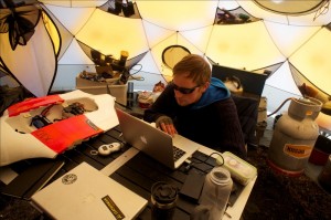
Inside the mess tent. Downloading the GPS, attitude and the locations of the camera triggers from the flight controller.
Once the plane was safely landed (see video below), which was difficult on the short, boulder-strewn runway, the photos would be downloaded from the SD card and the log files from the flight controller (see photo above). We would then check for damage and repair anything that needed fixing. Cooking and washing up duties were rotated every evening and we would watch a film (usually something starring Nick Cage) after dinner. After the film, we would head to our individual sleeping tents. There was something magical about brushing your teeth overlooking Store Glacier below, the Greenland Ice Sheet to the east and the beautiful fjord and rugged mountains to the west.
In total we completed 55 surveys of Store Glacier from early May to late July. Nick and I are still friends and are now processing the data. We hope to be able to provide some exciting results soon.
Johnny Ryan is a PhD student working at Aberystwyth University in Wales and is supervised by Prof. Alun Hubbard. He is interested in understanding the dynamics of the Greenland Ice Sheet and its fast flowing tidewater outlet glaciers. The primary tool Johnny uses for his research is a fixed-wing unmanned aerial vehicle (UAV) which can be used to survey the cryosphere at fine temporal and spatial scales. Currently he is using data collected by UAVs combined with timelapse camera imagery, meterological stations and tide gauges to investigate processes that control calving and the break-up of the ice melangé at Store Glacier. Johnny tweets as @glaciology_uavs .

![Image of the Week – Seven weeks in Antarctica [and how to study its surface mass balance]](https://blogs.egu.eu/divisions/cr/files/2019/02/Vue_globale-161x141.jpg)
Nanna B. Karlsson
Results from Johnny’s study is now published in The Cryosphere:
http://www.the-cryosphere.net/9/1/2015/tc-9-1-2015.html
Pingback: Cryospheric Sciences | Image of the Week: Greenland Glacier Seen from a Drone
Pingback: Cryospheric Sciences | Image of the Week – On the tip of Petermann’s (ice) tongue
Pingback: Cryospheric Sciences | Cryo Adventures – Droning on glaciers and ice caps in Kyrgyzstan