In 2008 the NEEM Deep Ice Core Project was initiated by 14 partner countries in Northwestern Greenland (camp position 77.45°N 51.06°W) with the aim to drill from the very top of the Greenland ice cap to its base; obtaining ice from as far back as the last interglacial period- the Eemian – some 130,000 years old.
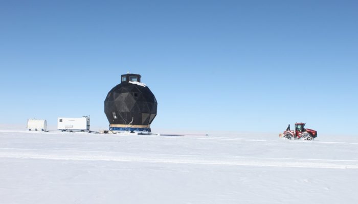
At the start of the 2008 field season, the NEEM camp consisted of a single heavy-duty tent, some vehicles, and a skiway. Over the summer months, the facilities could host up to 30 researchers at a time. Extra heavy duty tents were built to accommodate everyone comfortably. However to further ease the work of the many researchers who contributed to the project over several years and to create a common space, ‘the dome’ was build. Spread over three stories, the round black building included a kitchen and eating space on the ground floor, a working and relaxing area on the first floor for and a top floor for observing weather conditions before incoming flights.
After three summers of drilling through the icecap, bedrock was reached in 2010 and the Eemian ice was secured.
The 2011 season was spent on surface programs and some drilling into bedrock. Finally, in 2012 the deep ice core drilling project NEEM was terminated and camp was dismantelled. Most of the heavy equipment was left on the NEEM site with supplies and equipment stored inside the main dome, in two garages, and on seven heavy sleds. The large dome was put on skis with the intention of moving it to the next drilling site, though exactly where was yet to be determined and funds also needed to be secured.
In 2015, a group of 12 people, including myself, travelled back to the NEEM site. We packed down the the garages and stored them on sledges, we removed 3 years’ worth of accumulated snow (~1.5 m) from the sledges packed in 2012 and from the 45 ton main dome, and finally made the whole lot ready for moving. Using specialist snowploughs (known as a PistenBully, sponsored by NSF ) we relocated to our new drilling site, EastGRIP at the North East Greenland Ice Stream (NEGIS).
The trip began on Monday 18th May in the afternoon. Progress was slow. By 20.30 the traverse consisting of 8 vehicles had traveled 24 km along the ice flow divide towards the south-east, towing an incredible 143 tonnes worth of equipment, not including the weight of the vehicles themselves.
After an arduous eight day traverse, on 26th May the convoy made the last 53 km of the journey and arrived at EastGRIP in the afternoon. On arrival, the team only had 3000 litres of fuel left, which would have only supported the traverse for one more day. The total route travelled was 449 km.
The focus of the work at the new ice core camp at EastGRIP is different to that of the NEEM project. While the overall aim is to also drill to the bottom of the Greenland ice sheet, this time the goal is to understand the fast flowing ice at NEGIS.
Ice streams, such as NEGIS, are responsible for draining a significant fraction of the ice from the Greenland Ice Sheet. By drilling to the bottom of the ice sheet the project hopes to gain new and fundamental information on ice stream dynamics, thereby improving the understanding of how ice streams will contribute to future sea-level change. The drilled core will also provide a new record of past climatic conditions from the northeastern part of the Greenland Ice Sheet which will be analysed at numerous laboratories worldwide. Similar to NEEM the project has many international partners and is managed by the Centre for Ice and Climate, Denmark with air support carried out by US ski-equipped Hercules aircraft managed through the US Office of Polar Programs, National Science Foundation.
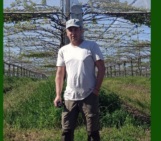
By Helle Astrid Kjær, researcher at the Niels Bohr Institute, University of Copenhagen
Imaggeo is the EGU’s online open access geosciences image repository. All geoscientists (and others) can submit their photographs and videos to this repository and, since it is open access, these images can be used for free by scientists for their presentations or publications, by educators and the general public, and some images can even be used freely for commercial purposes. Photographers also retain full rights of use, as Imaggeo images are licensed and distributed by the EGU under a Creative Commons licence. Submit your photos at http://imaggeo.egu.eu/upload/