
How many times have you turned your head up to the sky and spotted familiar shapes in the clouds? Viewing structures from afar can reveal interesting, common and, sometimes, funny patterns. Satellite images are often used to map geological terrains. They offer a bird’s eye view of the planet and the opportunity to see broad scale structures, the scale of which would be impossible to grasp from the ...[Read More]
Imaggeo on Mondays: The place where water runs through rocks
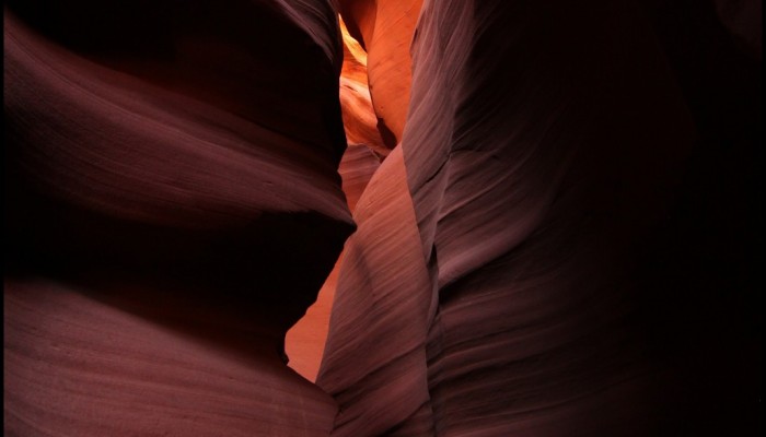
Antelope Canyon, located in Arizona, USA, was formed by erosion of the Navajo Sandstone, primarily due to flash flooding and secondarily due to other sub-aerial processes (think of physical weathering processes such as freeze-thaw weathering exfoliation and salt crystallisation). Rainwater runs into the extensive basin above the slot canyon sections, picking up speed and sand as it rushes into the ...[Read More]
Imaggeo on Mondays: Sunset over the Labrador Sea
Ruby skies and calm waters are the backdrop for this week’s Imaggeo image – one of the ten finalist images in this year’s EGU Photo contest. “I took the picture while on a scientific cruise in West Greenland in 2013,” explains Christof Pearce, a postdoctoral researcher at Stockholm University. “We spent most of the time inside the fjord systems around the Greenland capital, Nuuk, but this specific ...[Read More]
Imaggeo on Mondays: Escullos
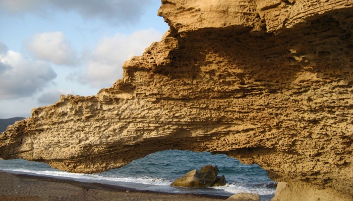
This picture shows a Quaternary aeolianite fossil dune at the Escullos beach, in the Nature Reserve of Cabo de Gata (Almeria, Spain). Originally a soft accumulation of sand grains, shaped by the wind into large mounds and ridges, the dunes eventually turn into rock. As the sediments compact under their own pressure and expel any moisture and fluids retained within them, they become lithified and b ...[Read More]
Imaggeo on Mondays: Painted Hills after the storm.
The geological record preserved at John Day Fossil beds, in Oregon, USA, is very special. Rarely can you study a continuous succession through changing climates quite like you can at this National Park in the USA. It is a treasure trove of some 60,000 plant and animal fossil specimens that were preserved over a period of 40 million years during the Cenozoic era (which began 66 million years ago). ...[Read More]
The known unknowns: Climate, Life, and the Solid Earth (Part V)
After four fascinating instalments in the known unknowns series we have (sadly) come to the final post. Since the series began in September we have explored the top questions that still remain unanswered when it comes to understanding the inner workings of the planet as well as how the interplay of a number of systems that occur at the Earth’s surface give rise to its varied landscapes. The series ...[Read More]
The known unknowns – the outstanding 49 questions in Earth Sciences (Part IV)
We are coming to the end of the known unknowns series and so far we have explored issues which mainly affect the inner workings of our planet. Today we’ll take a look at the surface expression of the geological processes which shape the Earth. Topography significantly affects our daily life and is formed via an interplay between primarily tectonics and climate, but it also affected by biological, ...[Read More]
The known unknowns – the outstanding 49 questions in Earth sciences (Part III)
We continue exploring the biggest conundrums in Earth sciences in this third post of the known unknowns. In the two previous instalments of the series we’ve discovered what the major questions still to be answered about the early days of planet Earth and its inner workings are. We now move onto the planet’s surface. The advent of plate tectonic theory, arguably one of the biggest advancements in t ...[Read More]
Imaggeo on Mondays: Fossil dunes
Desert winds continually rework the sands on their surface, shifting grains up the stoss side of a dune to pile the sand higher… until the pile gets too steep and collapses under its own weight. This slipping of material along the front of the dune, allows it to move forward and migrate. The movement of the sand grains up and over the crest of the dunes is recorded in the internal structure of the ...[Read More]
Imaggeo on Mondays: Shaken, not stirred – sediment shows signs of past earthquakes
Nore Praet, a PhD student from Ghent University in Belgium, brings us this week’s Imaggeo on Mondays. She sets the scene for an investigation into past earthquakes and explains how peering through a lake’s icy surface and its murky waters, and into the sediment below can help scientists find out more about the impact of earthquakes in the future… Early this year, I set off with a group of scientis ...[Read More]