How many times have you turned your head up to the sky and spotted familiar shapes in the clouds? Viewing structures from afar can reveal interesting, common and, sometimes, funny patterns. Satellite images are often used to map geological terrains. They offer a bird’s eye view of the planet and the opportunity to see broad scale structures, the scale of which would be impossible to grasp from the ...[Read More]
Imaggeo on Mondays: The place where water runs through rocks
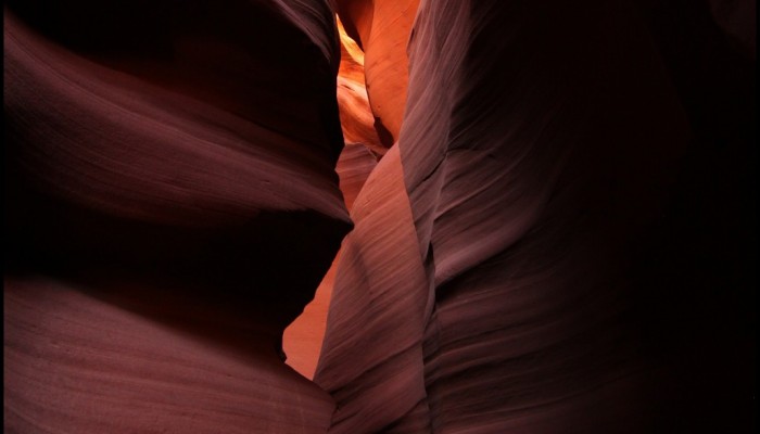
Waved rocks of Antelope slot canyon. Credit: Frederik Tack (distributed via imaggeo.egu.eu)
Antelope Canyon, located in Arizona, USA, was formed by erosion of the Navajo Sandstone, primarily due to flash flooding and secondarily due to other sub-aerial processes (think of physical weathering processes such as freeze-thaw weathering exfoliation and salt crystallisation). Rainwater runs into the extensive basin above the slot canyon sections, picking up speed and sand as it rushes into the ...[Read More]
Imaggeo on Mondays: Sunset over the Labrador Sea
Ruby skies and calm waters are the backdrop for this week’s Imaggeo image – one of the ten finalist images in this year’s EGU Photo contest. “I took the picture while on a scientific cruise in West Greenland in 2013,” explains Christof Pearce, a postdoctoral researcher at Stockholm University. “We spent most of the time inside the fjord systems around the Greenland capital, Nuuk, but this specific ...[Read More]
Imaggeo on Mondays: Escullos
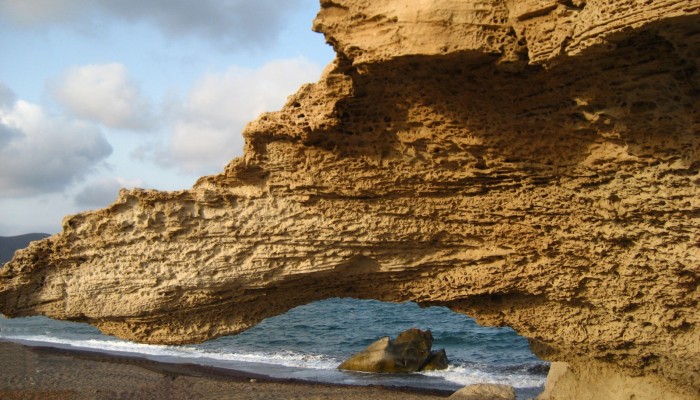
Escullos. Credit: Alicia Morugán (distributed via imaggeo.egu.eu)
This picture shows a Quaternary aeolianite fossil dune at the Escullos beach, in the Nature Reserve of Cabo de Gata (Almeria, Spain). Originally a soft accumulation of sand grains, shaped by the wind into large mounds and ridges, the dunes eventually turn into rock. As the sediments compact under their own pressure and expel any moisture and fluids retained within them, they become lithified and b ...[Read More]