Brekkuselslækur, a small river, carves its way across Iceland’s ancient volcanic landscape. At Hengifoss, Iceland’s third-highest waterfall, it tumbles fiercely down thick, dark layers of lavas erupted from volcanoes some 18 to 2.58 million years ago, during a period of geological time known as the Tertiary. Eruptions are rarely continuous; during hiatuses in the extrusion of lavas, ash is able to ...[Read More]
Imaggeo on Mondays: A lava layer cake
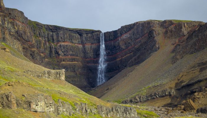
A lava layer cake flowing . Credit: Timothée Duguet (distributed via imaggeo.egu.eu)