GeoLog

Imaggeo

Imaggeo On Monday: The evolution of a cloud during a day

Imaggeo On Monday: The evolution of a cloud during a day

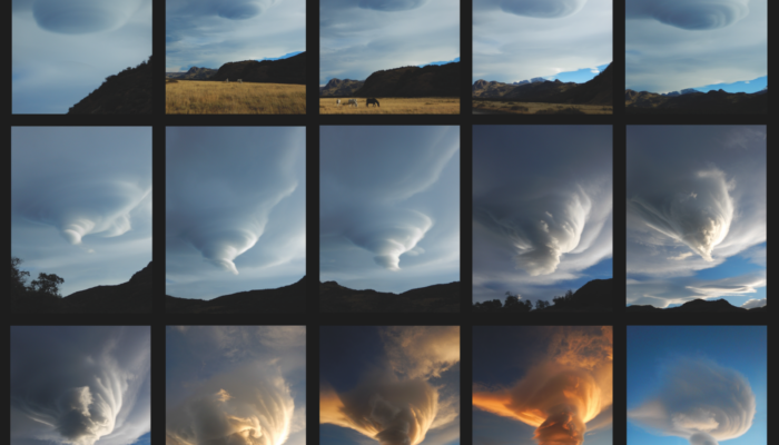
A cloud in the lee of the Patagonian Andes observed during an entire day. The shape of the cloud changed from lenticular to whirl- and funnel-shaped. Description by Christoph Mayr, after the description on imaggeo.egu.eu.   Konstantinos Kourtidis also added a comment to the image, explaining more about how lenticular clouds like these can form: “That’s a great photo sequence. The ...[Read More]

Imaggeo On Monday: Solar eclipse of November 3, 2013, observed from a geostationary orbit

Imaggeo On Monday: Solar eclipse of November 3, 2013, observed from a geostationary orbit

The solar eclipse of November 3, 2013, as observed from the MSG satellite, in geostationary orbit 36000km above the equator. The eclipsed area, where the shadow of the full Moon reached the Earth’s surface, moved over the Atlantic Ocean and Africa. This eclipse was classified as a hybrid eclipse because it started out as an annular eclipse and became a total eclipse over equatorial Africa. W ...[Read More]

Imaggeo On Monday: Alps highest peak meets folded sea floor

Imaggeo On Monday: Alps highest peak meets folded sea floor

During the late Jurassic, this dolostone was formerly at the sea floor, but after millions years of tectonic movements and natural forces, these rocks now appear at 3000m! Mont Blanc, the highest peak of the Alps is less than 20km away, and is visible in the background. Thank to the Alpine collision, this former sea floor was thrusted over gneiss and granite to make both geologists and mountaineer ...[Read More]

Imaggeo On Monday: Onsala Twin Telescopes

Imaggeo On Monday: Onsala Twin Telescopes

“The Onsala Twin Telescopes are part of the global geodetic Very Long Baseline Interferometry (VLBI) network. Radio telescopes all around the globe are observing extra-galactic radio sources simultaneously to determine Earth orientation parameters, source positions and station coordinates, as well as velocities. Geodetic Very Long Baseline Interferometry is used to maintain the International ...[Read More]