In the midst of summer when the sun does not set at high latitudes one can sometimes catch a glimpse of the mesosphere shortly after sunset or before sunrise. These thin veils, known as noctilucent clouds, are the highest known cloud-like structures forming at about 80km above the surface. At this height, they are still lit by the sun and can be seen from lower latitudes many hundreds of kilometer ...[Read More]
Imaggeo On Monday: Catching a glimpse of the Mesosphere
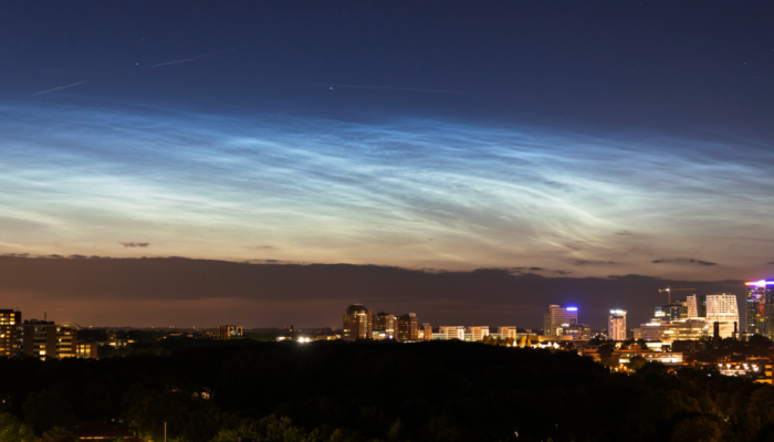
Catching a glimpse of the Mesosphere. Credit: Michiel Baatsen (distributed via imaggeo.egu.eu)