In this month’s Geosciences Column, Amanda Gläser-Bligh writes about SAR (synthetic aperture radar) satellites and how they can be used to map glacier lakes and mitigate related flood hazards.
Glaciers are a natural storage system and provide a perennial source of fresh water to the surrounding low-lying areas, which can be used for drinking water, irrigation, or even hydroelectricity. But when glaciers melt rapidly and form lakes before unstable moraines, the possibility of glacial lake outburst floods increases, causing concern for nearby population centers.
Due to the ever-changing nature of glacial lakes, Dr Tazio Strozzi and his team have developed a method to monitor these changes as they happen to limit the catastrophic potential from the lake outbursts. Their ideas are presented in the paper, “Glacial lake mapping with very high resolution satellite SAR data” recently published in the EGU open-access journal, Natural Hazards and Earth System Sciences.
Most glacial lakes are located in areas that are difficult to monitor terrestrially. An easier approach is to monitor changing surface conditions from space. To get the level of detail needed for developing lakes in remote regions, synthetic aperture radar (SAR) satellites are employed. These satellites can produce images at a 2-m interval – enough to determine the boundaries of a lake when a trained person examines the pictures. And SAR is not dependent on the weather, whereas other optical methods have trouble creating images through cloud cover or at night.
The orbit of a single SAR satellite moves in a coil-like motion, longitudinally around the planet and can take anywhere between 11 and 46 days to come back to a specific location, depending on the satellite. But since there are a good number of available operating SAR satellites, their efforts can be combined so that more frequent observation of an area can occur; image data on a single lake-forming region can therefore be gathered within hours. Such areas could be potentially dangerous, time-consuming, and expensive for a geological team to approach, showing the advantages of using satellite imagery.
There are some limitations, though. Smaller lakes are difficult to map with SAR. Computers are also not able to analyze the data alone, as backscattering and noise often makes it difficult to determine if an area is composed of water, ice, or wet snow cover. Specialized software is employed to analyze the images, which are often combined with digital elevation models (3D representations of terrains) to add geocoding information, but a human eye is necessary to make the final judgment call about the details of the lake border on the map.

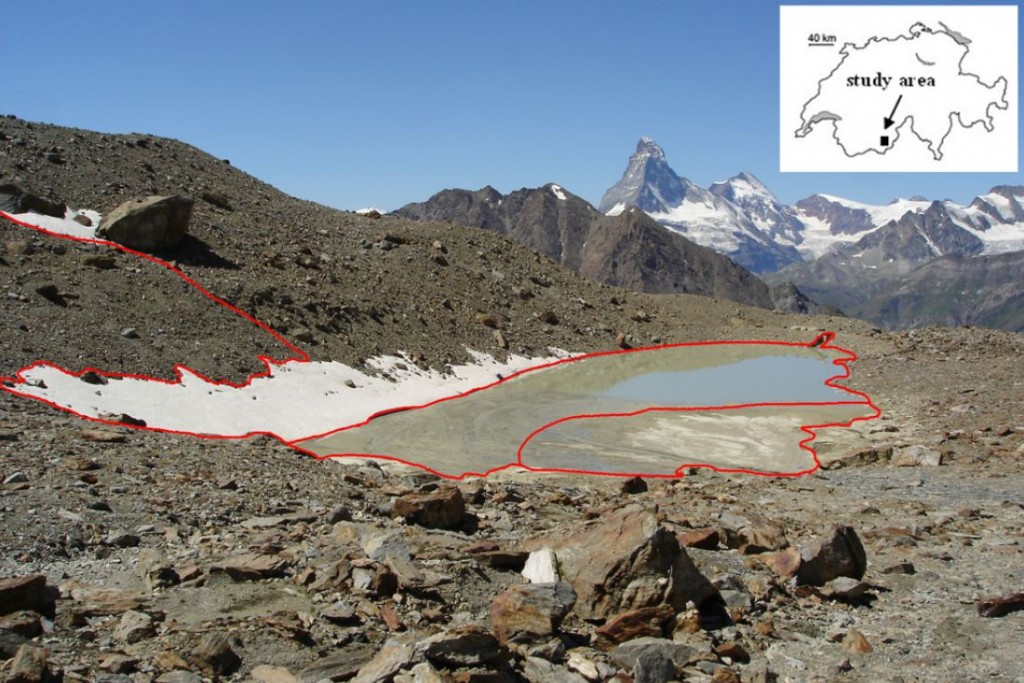
Photograph of the Weingarten glacier lake in Switzerland with GPS path in red. (From: Strozzi et al., 2012)
Dr. Strozzi and his team looked at three glacial areas (in Switzerland, Tajikistan, and Nepal) to determine the changing nature of glacial lakes and to test the SAR technology. In Switzerland and Nepal, teams travelled to the lake sites to make on-the-ground comparisons to the SAR satellite images. The results show that the SAR imaging is of high enough quality to make assessments in changes in lake shapes. And when used in conjunction with other optical and land-based information sources, can be used as a hazard predictor in glacial regions.
In addition to flood prevention, the results can also be uploaded into Google Earth, which accepts changes to mapped features to keep information as actual as possible. This contributes to a genuine visual guide to the planet, while at the same time keeping people safe from the hazards lurking from above.
By Amanda Gläser-Bligh, geologist and member of ELEEP, Emerging Leaders in Environmental and Energy Policy Network

Pingback: GeoLog | Glacial lake outburst floods: What we know about this destructive ice hazard