“Hurricane Season 2010” by Maximilian Reuter, distributed by EGU under a Creative Commons licence.
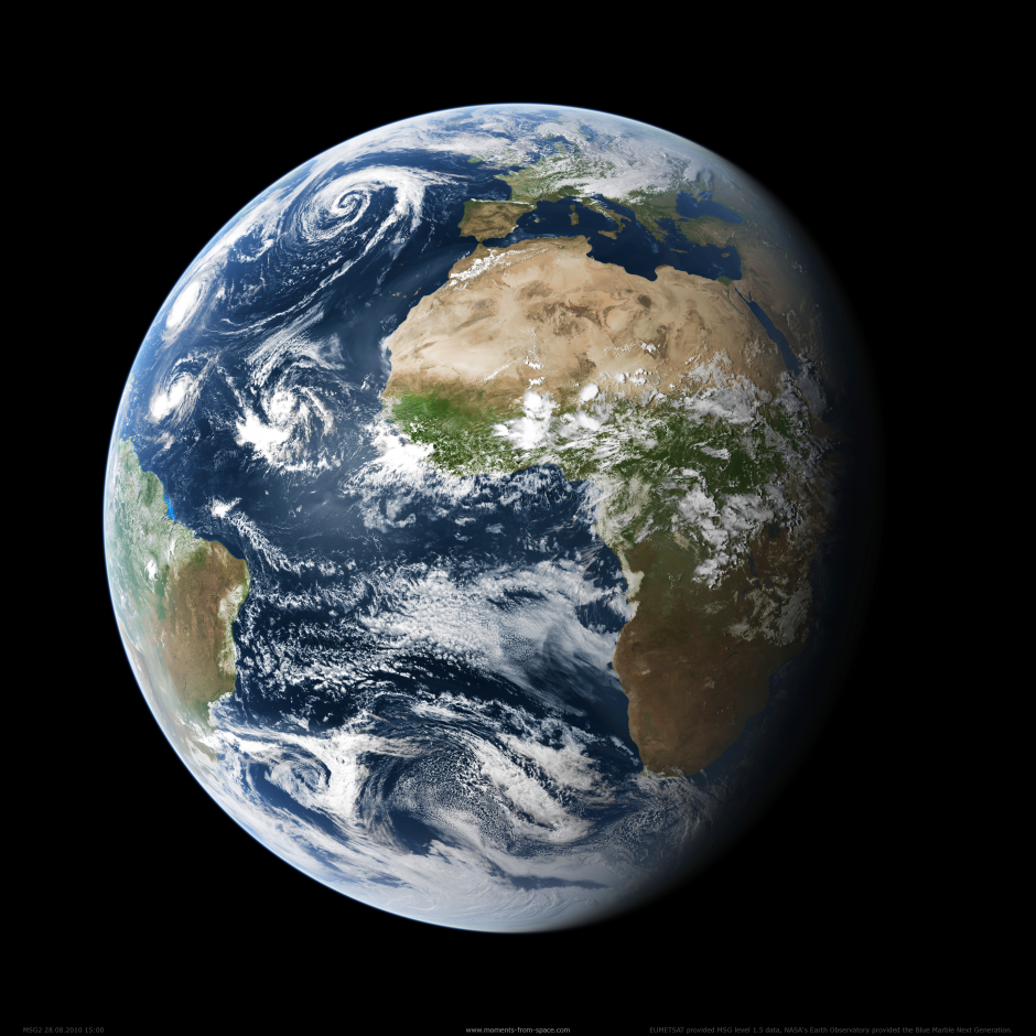
From space, planet Earth resembles a glassy blue marble, a term that was first used to describe a photograph of the Earth taken by the Apollo 17 crew on their way to the moon in 1972. Aside from providing stunning views of our planet, images of the Earth taken from above can also be used for meteorological observations. This beautiful photograph, taken by the Meteosat Second Generation (MSG) satellite, is a case in point.
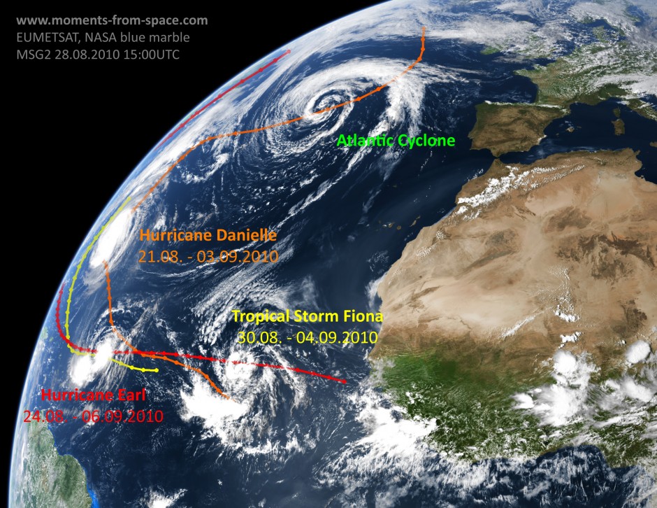
Maximilian Reuter, who submitted the picture to the Imaggeo database describes it in detail. “This image shows a snapshot of the hurricane season 2010. It was taken on August 28 that year from the MSG satellite in a geostationary orbit 36,000 km above the equator at 0°E. La Niña conditions favoured lower wind shear over the Atlantic Basin. This allowed storm clouds to grow and organise. Atlantic hurricanes often follow a typical path from Africa across the Atlantic to the east cost of the US. Along this way one can see the Category 4 hurricanes Earl and Danielle as well as the developing tropical storm Fiona. Often the remnants of hurricanes become North Atlantic low-pressure systems which are moving towards Europe.”
Reuter, a researcher at the Institute of Environmental Physics, University of Bremen, also provided a labelled image where the hurricane tracks are highlighted. The image, seen below, is part of the Moments from Space collection. Details on the generation of Moments from Space true-colour images have been published in the International Journal of Remote Sensing.
Imaggeo is the online open access geosciences image repository of the European Geosciences Union. Every geoscientist who is an amateur photographer (but also other people) can submit their images to this repository. Being open access, it can be used by scientists for their presentations or publications as well as by the press. If you submit your images to imaggeo, you retain full rights of use, since they are licenced and distributed by EGU under a Creative Commons licence.

