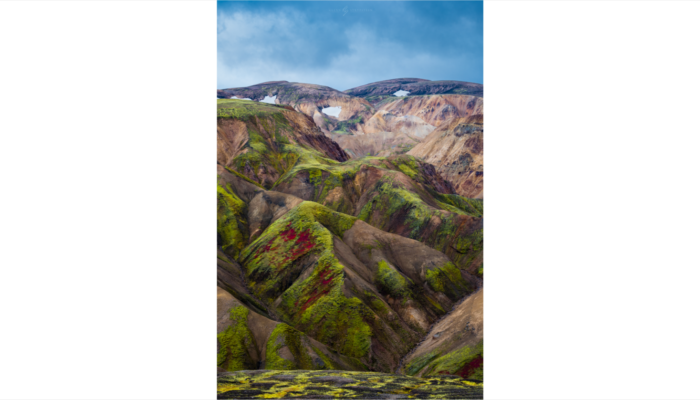
Landmannalaugar is a unique and beautiful area in Iceland, nestled in the highlands of the country. It is known for its stunning scenery, including green-covered mountains, vast lava fields, and natural hot springs. This area served as the end destination of my hiking adventure where I crossed Iceland from north to south, and it’s easy to see why.
Aside from its natural beauty, Landmannalaugar is also known for its unique geoscience content. The area is home to one of the most active volcanic systems in Iceland, with the most recent eruption occurring in 2015. This volcanic activity has given rise to a wide range of geological formations, including colorful rhyolite mountains and geothermal features like hot springs and steam vents.
Photo and caption by Glenn Strypsteen, shared on imaggeo.egu.eu.
Imaggeo is the EGU’s online open access geosciences image repository. All geoscientists (and others) can submit their photographs and videos to this repository and, since it is open access, these images can be used for free by scientists for their presentations or publications, by educators and the general public, and some images can even be used freely for commercial purposes. Photographers also retain full rights of use, as Imaggeo images are licensed and distributed by the EGU under a Creative Commons licence. Submit your photos at http://imaggeo.egu.eu/upload/.


